Sheridan in Sheridan County, Wyoming — The American West (Mountains)
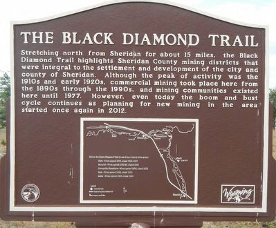
The Black Diamond Trail
Erected by Wyoming State Parks & Cultural Resources.
Topics. This historical marker is listed in these topic lists: Industry & Commerce • Settlements & Settlers.
Location. 44° 48.372′ N, 106° 56.46′ W. Marker is in Sheridan, Wyoming, in Sheridan County. Marker can be reached from Sibley Circle near East 5th Street. Touch for map. Marker is at or near this postal address: 850 Sibley Circle, Sheridan WY 82801, United States of America. Touch for directions.
Other nearby markers. At least 8 other markers are within 2 miles of this marker, measured as the crow flies. The Black Diamonds of Sheridan County (here, next to this marker); The Sheridan Railway Company (about 400 feet away, measured in a direct line); Big Horns (approx. 0.3 miles away); A Place of Shelter (approx. 0.3 miles away); Class 0-5-A Mohawk Locomotive (approx. 0.6 miles away); Historic Sheridan Inn (approx. 0.6 miles away); First Cabin in Sheridan (approx. 0.9 miles away); General George Crook (approx. 1.2 miles away). Touch for a list and map of all markers in Sheridan.
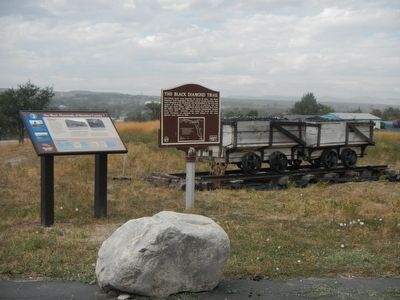
More about this marker. This marker is located at the Sheridan County Museum at the western edge of the parking lot. Request a Black Diamonds Trail brochure at the museum or visitors center.

Photographed By Barry Swackhamer, September 15, 2015
2. The Black Diamond Trail Marker (detail)
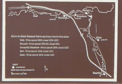
Follow the Black Diamond Trail to see these historic mine areas:
Dietz - Mines opened 1892, closed 1919-1923
Monarch - Mines opened 1903-04, closed 1953
Carneyville/Kleeburn - Mines opened 1904, closed 1923
Kool - Mines opened 1906, closed 1922
Acme - Mines opened 1909, closed 1940
Legend: ♦︎ Interpretive Site
Dietz - Mines opened 1892, closed 1919-1923
Monarch - Mines opened 1903-04, closed 1953
Carneyville/Kleeburn - Mines opened 1904, closed 1923
Kool - Mines opened 1906, closed 1922
Acme - Mines opened 1909, closed 1940
Legend: ♦︎ Interpretive Site
Credits. This page was last revised on June 16, 2016. It was originally submitted on December 11, 2015, by Barry Swackhamer of Brentwood, California. This page has been viewed 294 times since then and 13 times this year. Photos: 1, 2, 3. submitted on December 11, 2015, by Barry Swackhamer of Brentwood, California.

