Casper in Natrona County, Wyoming — The American West (Mountains)
Casper: "The Oil Capital of the Rockies"

Photographed By Barry Swackhamer, September 18, 2015
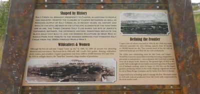
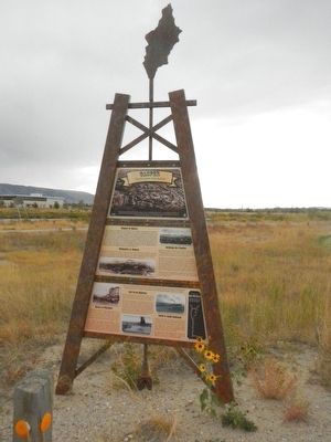
1. Casper: "The Oil Capital of the Rockies" Marker, top panel
Caption: The sleepy, dusty cowtown of Casper grew big and strong on the black gold of Salt Creek, which helped build the city and fuel its boom and bust economy for a century. Salt Creek oil brought infrastructure and refineries to Casper as well as investors and residents from all over the world.
Salt Creek oil brought prosperity to Casper, in addition to people and industry. Despite the closure of Casper refineries as well as reduced output of Salt Creek oil in recent years, oil history and wealth can still be seen in the cityscape: elements of the tank farm are in use, the Three Crowns Golf Club marks the site of Amoco's expansive refinery, the extensive historic downtown reflects the black gold that built it, and the Derrick Sculpture (by Bart Rea) at Amoco Park plays tribute to the wooden derricks that forested Salt Creek from the 1890s through World War II.
Although the first oil well near Casper "came up dry" in 1888 oil success was attracting attention and newcomers. The boom hit in 1908 with Salt Creek's first gusher, drawing wildcatters, stock traders, and swindlers. Casper's population rose from 2,000 to 20,000 between 1912 and 1918. By 1920 its red light district, the "Sand Bar" boasted a large number of prostitutes.
Casper's first oil refinery was built in 1894. By the 1920s four more refineries expanded the city's refining capacity from 50 barrels to 100,000 barrels per day. They covered much of the city with an industrial landscape and filled the sky with smokestacks.
The 1920s were exhilarating years for Salt Creek and Casper. World War I was over, automobile ownership was rising, and gasoline - previously a waste product - was in demand. Salt Creek kert revealing more oil at deeper levels. Known as "the greatest light oil field in the world," Salt Creek's light oil was readily converted to gasoline at Standard Oil of Indiana's cracking plant in Casper. In 1922 this was the largest gasoline-producing refinery in the world, shipping a significant amount by rail to Baton Rouge, Louisiana, and by tanker from there to Europe.
Casper built acres of holding tanks to manage the flow. The boom ended in 1929 with reduced production from Salt Creek wells compounded by the stock market crash.
bottom panel:
Oil could be efficiently moved through pipelines; however, people, equipment, and supplies still needed transportation between Casper and Salt Creek.
Through the early 20th century, string teams of 12-18 horses pulled trains of wagons loaded with wooden barrels of oil from the Salt Creek area to Casper. To cross hills, each wagon was hauled separately and rehitched. The trip took several days one way - up to two weeks in bad weather. when the dirt road turned to "gumbo mud."
In 1911 Midwest Oil Company tied the oilfield to the city with a pipeline. Many pipelines followed, including one for water. Built at this site in 1920, the pump house pumped fresh water from the North Platte River via pipeline to Salt Creek. In 1924 the first oil pipeline was built between central Wyoming and other states, allowing Salt Creek oil to compete nationally.
Motorized transportation arrived in 1912 with a motor truck, which made the 45-mile trip between Salt Creek and Casper in only 18 hours. Horses were soon history.
The next big improvement in transportation arrived in 1920 when the alternately muddy and dusty Salt Creek Trail between Casper and the oilfield was partially paved with concrete, elevating its name to Salt Creek Highway. A half-way house 20 miles from Casper welcomed weary travelers, truckers, and freighters with good meals and spirits. Sections of this road remain today as the terminus in Casper and at the entrance to Teapot Dome.
During its short life, the North & South Railroad symbolized hope and prosperity for Salt Creek residents and added to the growing sophistication of the boom towns. Built in 1922-23, this line joined Casper to the oilfield towns of Midwest, Lavoye, Salt Creek, Snyder, and Illco. At Illco

Photographed By Barry Swackhamer, September 18, 2015
3. Casper: "The Oil Capital of the Rockies" Marker, bottom panel
Captions: (top left) String team leaving Casper for Salt Creek with casing and supplies, 1910.; (bottom center) Laying Salt Creek Highway, 1920.; (top right) North and South Railroad crossing Salt Creek. (far right) Follow the Black Gold Bway (map).
Built during Salt Creek's biggest boom, the railroad succumbed to the Great Depression in 1935. The roadbed is still visible across Salt Creek Oilfield.
Erected by Wyoming State Parks & Cultural Resources.
Topics. This historical marker is listed in these topic lists: Industry & Commerce • Settlements & Settlers.
Location. 42° 50.73′ N, 106° 20.994′ W. Marker is in Casper, Wyoming, in Natrona County. Marker is on West 1st Street (Yellowstone Highway) (U.S. 20) near South Poplar Avenue (Wyoming Highway 220), on the left when traveling east. Touch for map. Marker is at or near this postal address: 1775 1st Street, Casper WY 82604, United States of America. Touch for directions.
Other nearby markers. At least 8 other markers are within 2 miles of this marker, measured as the crow flies. Cable Tool Drilling Rig (approx. 0.6 miles away); Wyoming's Oil & Gas (approx. 0.6 miles away); Site of Fort Casper (approx. 1.2 miles away); Old Pioneer Military Cemetery (approx. 1.2 miles away); Platte Bridge Cemetery (approx. 1.2 miles away); The Mormon Ferry (approx. 1.2 miles away); The Road to Zion (approx. 1.2 miles away); The Upper Crossing (approx. 1.2 miles away). Touch for a list and map of all markers in Casper.
More about this marker.
This marker is located near the Tate Pumphouse Trail Center on the Platte River Parkway.
Credits. This page was last revised on June 16, 2016. It was originally submitted on January 4, 2016, by Barry Swackhamer of Brentwood, California. This page has been viewed 485 times since then and 23 times this year. Photos: 1, 2, 3, 4. submitted on January 4, 2016, by Barry Swackhamer of Brentwood, California.

