Montego Bay, St James Parish, Jamaica — Caribbean Region of the Americas (Greater Antilles of the West Indies)
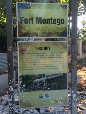
Fort Montego History
The fort was originally built in 1750; it was then known as Fort Frederick, later as Fort George. Fort Montego designed by European engineers, was built by enslaved Jamaicans to guard the town of Montego Bay.
Built in the shape of a polygon, the traditional shape of forts, it had a battery armed with cannons and a barracks to house 100 men. It also had an armoury for weapons and ammunition as well as a small hospital with 40 beds. It was last manned in 1832.
Erected by Jamaica National Heritage Trust.
Topics. This historical marker is listed in this topic list: Forts and Castles. A significant historical year for this entry is 1750.
Location. 18° 28.709′ N, 77° 55.563′ W. Marker is in Montego Bay, St James Parish. Marker can be reached from Fort Street close to Gloucester Avenue. Touch for map. Touch for directions.
Other nearby markers. At least 8 other markers are within walking distance of this marker. Fort Montego Cannons (within shouting distance of this marker); Montego Bay History (within shouting distance of this marker); Fort Montego Armoury (within shouting distance of this marker); Old Hospital Park (approx. half a kilometer away); The Cage (approx. 0.6 kilometers away); Sam Sharpe (approx. 0.6 kilometers away); Montego Bay Civic Centre (approx. 0.6 kilometers away); Jamaica's Independence and Royal Visit (approx. 0.6 kilometers away). Touch for a list and map of all markers in Montego Bay.

Photographed By J. Makali Bruton, November 21, 2015
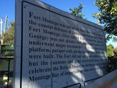
2. Fort Montego History additional marker
This older, additional marker just a few steps to the north reads: Fort Montego was one of the many forts built as part of the coastal defense of Jamaica during the early 1700s. Fort Montego (also called Fort Frederick or Fort George) was not always well maintained and in 1779 underwent major reconstruction. It was then that the platform, parapet wall, paving and new powder magazine were built. The Fort did not see much military action, but the cannons and guns were fired more often to celebrate the British Monarchs birthdays, or the visit to Montego Bay of important persons such as the Governor.
Credits. This page was last revised on July 7, 2022. It was originally submitted on January 27, 2016, by J. Makali Bruton of Accra, Ghana. This page has been viewed 449 times since then and 38 times this year. Photos: 1, 2, 3. submitted on January 27, 2016, by J. Makali Bruton of Accra, Ghana.

