Fairmeadow in Palo Alto in Santa Clara County, California — The American West (Pacific Coastal)
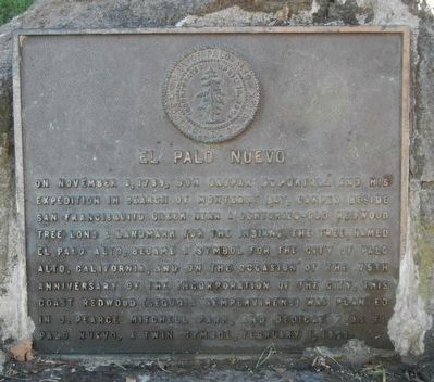
El Palo Nuevo
Erected 1969.
Topics and series. This historical marker is listed in these topic lists: Exploration • Horticulture & Forestry. In addition, it is included in the Portolá Expedition series list. A significant historical date for this entry is November 8, 1789.
Location. 37° 25.215′ N, 122° 6.87′ W. Marker is in Palo Alto, California, in Santa Clara County. It is in Fairmeadow. Marker can be reached from East Charleston Road near Middlefield Road, on the right when traveling west. Touch for map. Marker is at or near this postal address: 455 East Charleston Road, Palo Alto CA 94306, United States of America. Touch for directions.
Other nearby markers. At least 8 other markers are within 2 miles of this marker, measured as the crow flies. J. Pearce Mitchell Park (approx. 0.2 miles away); Semiconductor Planar Process and Integrated Circuit (approx. 0.6 miles away); First Commercially Practicable Integrated Circuit (approx. 0.6 miles away); Homesite of Sarah Wallis (approx. 0.9 miles away); Birthplace of Silicon Valley (approx. 1.1 miles away); Mayfield Fire Bell (approx. 1.1 miles away); Juana Briones Park (approx. 1.1 miles away); Juana Briones. This is her park. (approx. 1.1 miles away). Touch for a list and map of all markers in Palo Alto.
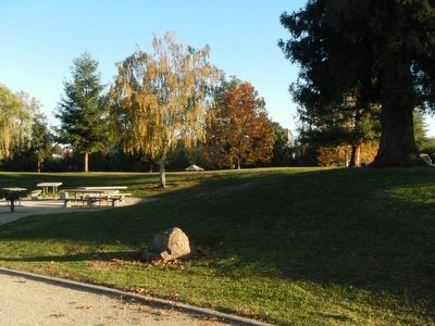
More about this marker. This marker is located at the southern end of J. Pearce Mitchell Park near the picnic tables.
Credits. This page was last revised on February 7, 2023. It was originally submitted on February 4, 2016, by Barry Swackhamer of Brentwood, California. This page has been viewed 549 times since then and 29 times this year. Photos: 1, 2. submitted on February 4, 2016, by Barry Swackhamer of Brentwood, California.

