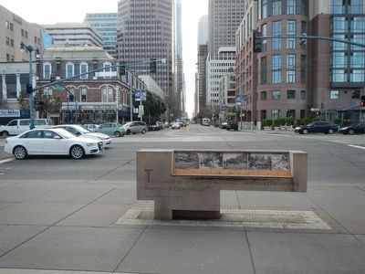
Embarcadero in San Francisco City and County, California — The American West (Pacific Coastal)
Getting Around
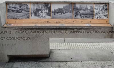
(text on the horizontal surface)
Getting Around San Francisco, 1860's & 1870's
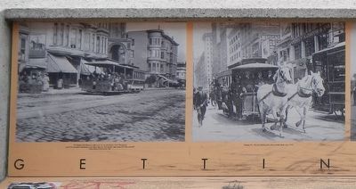
Mostly surrounded by water with hills that remain a dare, San Franciscans have embraced the challenge of getting around. Step off the transcontinental railroad and onto the Oakland ferry to greet San Francisco from the water. From the Ferry Depot take a cable car up California, or a horse car down Market, or climb into a hack for hire to arrive in style, luggage stowed above. Horse-cars - looking like future cable cars - were pulled by teams along fast tracks laid on city streets, only avoiding hills. Blacksmith Henry Casebolt invented a horse-car carriage that could pivot in a circle on wheels that remained in place. On lines not blessed with ballon cars, horse-car crews recruited passengers to get out and push their car onto a turntable and rehitch the horses. For every ten citizens, somewhere in the city a horse was hard at work, pulling a wheeled vehicle. The 1880 census counted 233,959 San Franciscans; estimated 23,00 horses.
Hallidie's Cable Car Conquers Hills, 1873
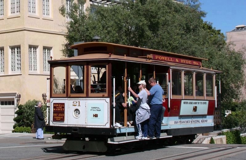
A canny Scot, Andrew S. Hallidie made a comfortable living from manufacturing steel cables; made of six strands of nineteen steel wires each. His aerial tramways carried gold and silver bearing ore down from Sierra mines. But Hallidie had in mind a way to run horse-cars without horses. He saw an endless wire cable to be concealed underground, to which cars could be attached, like ore buckets on a tramway. In 1873, on a foggy August 1st, a 5:00 a.m. (too early for passerbys to be injured if his grip failed), Hallidie left his backers gathered at the top of Jones and Clay, to test drive the first cable car. It descended down Clay Street into the dense damp fog. Backers strained to hear the crash below, instead they heard the now familiar humming sound from the cable car slot, as Hallidie ascended, triumphant from the mist. His newfangled idea worked; 25 brave souls rode the world's first cable car up a steep city hill.
Horse-car Cable Car Street Car 1890-1910
By 1890 eight cable car systems reached North Beach, the Presidio, and Seal Rock. Lucius Beebe put it best: "Horse cars, cable cars and steam trains operated over an amazement of geographic locales. crossing, meeting, receding, shuttling, connecting and converging upon one another like dancers. They wove back and forth across each other's lines like the warp and woof of a gigantic fabric: the clangor of their coming and going, ascending and descending; rattling over cobbles, Belgian
Photographed By Barry Swackhamer, December 18, 2014
2. Getting Around Marker (detail)
Captions: (left) "If it pleases Providence to make a car run up and down a slit in the ground... and if for two-pence half-penny I can ride in that car, why should I seek reasons for that miracle?" - Rudyard Kipling in San Francisco, 1889; (right) Hanging On: The Last Satisfying Run Down Market Street, June 1913.
The 20th Century Arrives with a Great Shake
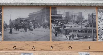
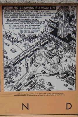
When the great 1906 earthquake destroyed four lines of cable car tracks down Market to the Ferry Building, electric cars moved in. Bigger, faster, and cheaper to install, the electric street car took over the first half of the 20th century. The busy street car loop in front of the Ferry Building carried more people more places - still only a nickel. Cable car slots ran down Clay Street to the waterfront; the lone Sutter Street horse-car trotted the ferry loop until 1913; interurban cars headed south to San Mateo. In 1918 ferryboat commuters had a cast-iron walkway bridge to make a safe last minute sprint over Embarcadero traffic. When automobiles threatened this lively scene in 1925, the dip-down tunnel took them under the busy loop and out the other side. It was cheap - fun - and it worked.
Erected by San Francisco Art Commission for the Waterfront Transportation Projects.
Topics. This historical marker is listed in this topic list: Railroads & Streetcars. A significant historical date for this entry is August 1, 1880.
Location. 37°
Photographed By Barry Swackhamer, December 18, 2014
3. Getting Around Marker (detail)
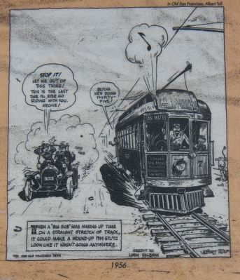
Captions: (left) Electric Street Cars Arrive at the Ferry Building with the 20th Century.; (right) By 1930, the continuous circuit of street cars met every one of 43 ferries on the Bay. Only Charing Cross Station in London saw more foot traffic.
Other nearby markers. At least 8 other markers are within walking distance of this marker. Audiffred Building (within shouting distance of this marker); Splendid Survivor (within shouting distance of this marker); In Memory of Howard Sperry and Nick Bordoise (about 300 feet away, measured in a direct line); The Big Strike (about 400 feet away); Stephan C. Leonoudakis (about 600 feet away); Port Time (about 600 feet away); Signs of History (about 600 feet away); Ferry Building (about 700 feet away). Touch for a list and map of all markers in San Francisco.
Also see . . . Wikipedia entry for San Francisco’s Cable Car System. “In 1878, Leland Stanford opened his California Street Cable Railroad (Cal Cable). This company's first line was on California Street and is the oldest cable car line still in operation. In 1880, the Geary Street, Park & Ocean Railway began operation. The Presidio and Ferries Railway followed two years later, and was the first cable company to include curves on its routes. The curves were ‘let-go’ curves, where the car drops the
Photographed By Barry Swackhamer, December 18, 2014
4. Working Drawing of a Way of Life: Getting Around Marker (detail)
Caption: Al Tolf's Drawing of How It All Worked in the 1930's: Find the tunnel for motor-cars; the cast iron foot bridge for commuters; the interurban cars to the Penisula (sic); the tracks for the State Belt Line Freight Train.
Credits. This page was last revised on February 7, 2023. It was originally submitted on March 4, 2016, by Barry Swackhamer of Brentwood, California. This page has been viewed 798 times since then and 26 times this year. It was the Marker of the Week August 5, 2018. Photos: 1, 2, 3, 4, 5, 6. submitted on March 4, 2016, by Barry Swackhamer of Brentwood, California. 7. submitted on August 5, 2018, by J. J. Prats of Powell, Ohio.
