Walnut Creek in Contra Costa County, California — The American West (Pacific Coastal)
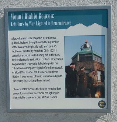
Mount Diablo Beacon:
Left Dark by War, Lighted in Remembrance
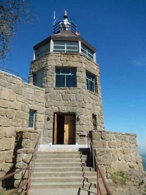
Obsolete after the war, the beacon remained dark except for an annual December 7th lighting in memorial to those who died at Pearl Harbor.
Erected by California State Department of Parks and Recreation.
Topics and series. This historical marker is listed in this topic list: Air & Space. In addition, it is included in the Civilian Conservation Corps (CCC) series list.
Location. 37° 52.909′ N, 121° 54.858′ W. Marker is in Walnut Creek, California, in Contra Costa County. Marker can be reached from Summit Road. Touch for map. Marker is in this post office area: Walnut Creek CA 94598, United States of America. Touch for directions.
Other nearby markers. At least 8 other markers are within 3 miles of this marker, measured as the crow flies. Mount Diablo (a few steps from this marker); Mt Diablo State Park (within shouting distance of this marker); What Are Those Towers For? (approx. ¼ mile away); Mount Diablo State Park (approx. ¼ mile away); Turritella Snail Bed (approx. 2.3 miles away); Sentinel Rock Overlook (approx. 2.4 miles away); Indian Grinding Holes (approx. 2.4 miles away); Blackhawk Ranch Quarry (approx. 2.4 miles away). Touch for a list and map of all markers in Walnut Creek.
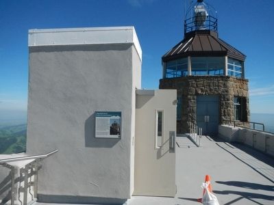
More about this marker. This marker is located on the roof of the Mt. Diablo Summit Museum roof in Mt. Diablo State Park.
Credits. This page was last revised on April 13, 2022. It was originally submitted on April 5, 2016, by Barry Swackhamer of Brentwood, California. This page has been viewed 701 times since then and 33 times this year. Photos: 1, 2, 3. submitted on April 5, 2016, by Barry Swackhamer of Brentwood, California. 4. submitted on April 6, 2022, by Joseph Alvarado of Livermore, California.


