Reno in Washoe County, Nevada — The American Mountains (Southwest)
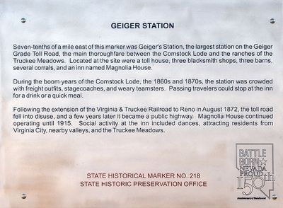
Geiger Station
During the boom years of the Comstock Lode, the 1860s and 1870s, the station was crowded with freight outfits, stagecoaches, and weary teamsters. Passing travelers could stop off at the inn for a drink or a quick meal.
Following the extension of the Virginia & Truckee Railroad to Reno in August 1872, the toll road fell into disuse, and a few years later it became a public highway. Magnolia House continued operating until 1915. Social activity at the inn included dances, attracting residents from Virginia City, nearby valleys, and the Truckee Meadows.
Erected by Nevada Historic Preservation Office. (Marker Number 218.)
Topics. This historical marker is listed in this topic list: Settlements & Settlers. A significant historical year for this entry is 1860.
Location. 39° 22.549′ N, 119° 42.952′ W. Marker is in Reno, Nevada, in Washoe County. Marker is at the intersection of Toll Road and Ravazza Road, on the left when traveling east on Toll Road. Touch for map. Marker is in this post office area: Reno NV 89521, United States of America. Touch for directions.
Other nearby markers. At least 8 other markers are within 6 miles of this marker, measured as the crow flies. Steamboat Springs (approx. 1.4 miles away); Old Geiger Grade (approx. 2.6 miles away); Lousetown (approx. 4.1 miles away); Huffaker's (approx. 5.4 miles away); The Comstock Lode (approx. 5˝ miles away); Hebrew Cemetery 1862 (approx. 5˝ miles away); Veterans Day November 11th 1995 (approx. 5˝ miles away); Silver Terrace Cemeteries (approx. 5˝ miles away). Touch for a list and map of all markers in Reno.
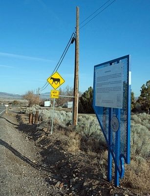
More about this marker. A highway sign picturing a riderless horse is a warning to motorists that wild horses are sometimes in the area.
Credits. This page was last revised on June 16, 2016. It was originally submitted on April 23, 2016, by Alvis Hendley of San Francisco, California. This page has been viewed 438 times since then and 21 times this year. Photos: 1, 2. submitted on April 23, 2016, by Alvis Hendley of San Francisco, California. • Syd Whittle was the editor who published this page.

