Kanab in Kane County, Utah — The American Mountains (Southwest)
Kanab Public Square
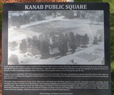
Young returned in September of 1870 with surveyor Jesse Fox, “To lay out the town”. The town consisted of one square mile, with a block in the center set aside for public buildings and designated Kanab’s public square. The other blocks were divided into 4 lots each, and numbered. The head of each family then drew for a lot.
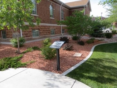
The Public Square (bordered by Center Street, Main Street, 100 North and 100 West) served as a center for community activities including: church meetings, education, recreation and entertainment. Four important buildings were erected on the Square: the Tithing Office, Academy, Ward Hall, and the pioneer Chapel. This aerial view shows the Public Square as it looked in 1950: the Chapel (southeast corner of the Square) is at the lower center; the Ward Hall (southwest corner) is at the left; both the Academy (northeast corner) and the Tithing Office (northwest corner) were gone. Plaques at each corner denote the buildings. Additional information is available at the Kanab Heritage Museum.
Erected 2012 by Kanab Heritage and Historic Preservation Board.
Topics. This historical marker is listed in this topic list: Settlements & Settlers. A significant historical month for this entry is September 1870.
Location. 37° 2.902′ N, 112° 31.728′ W. Marker is in Kanab, Utah, in Kane County. Marker is at the intersection of West Center Street and North Main Street, on the right when traveling west on West Center Street. Marker is on the northwest corner. Touch for map. Marker is in this post office area: Kanab UT 84741, United States of America. Touch for directions.
Other nearby markers. At least 8 other markers are within walking distance of this marker. The Kanab Chapel (here, next to this marker); The Academy Bell (here, next to this marker); Ted Markland (within shouting distance of this marker); Bob Hoy (within shouting distance of this marker); Don Collier (within shouting distance of this marker); Linda Darnell (within shouting distance of this marker); Ken Curtis (within shouting distance of this marker); Sidney Poitier (within shouting distance of this marker). Touch for a list and map of all markers in Kanab.
Credits. This page was last revised on June 16, 2016. It was originally submitted on May 29, 2016, by Bill Kirchner of Tucson, Arizona. This page has been viewed 276 times since then and 16 times this year. Photos: 1, 2. submitted on May 29, 2016, by Bill Kirchner of Tucson, Arizona.

