Near Blanding in San Juan County, Utah — The American Mountains (Southwest)
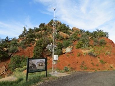
Salvation Knoll
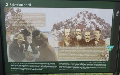
December 24, 1879 “... we had cooked the last food we had, consisting of a slap jack baked in a frying pan and about one inch thick.”
December 25, 1879 “ it was Christmas day 1879, which found us on the side of the Elk Mountain without food, in the midst of a piercing cold...It surely looked like our bones would bleach not far from that point...” George B. Hobbs
photo of four men
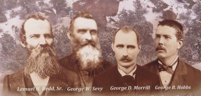
Lemuel H Redd Sr., George W Sevy, George D. Morrill, George B. Hobbs
The scouts, lost, weary, cold, and without food, climbed a small knoll to the southwest in a desperate attempt to determine where they were.
“This was surely Salvation Knoll, for on looking to northeast across a spur of the Elk Mountain I discovered the Blue Mountains, about 10 miles away. This was the land mark we had been looking for for several days...From this point we could locate ourselves, but knowing we were a long distance yet from Fort Montezuma we lost no time in starting and following a canyon to the east.” George B. Hobbs, Christmas morning 1879
Photos of the scouts were taken later in their lives. Their ages at the time of the expedition were from left to right: 43, 47, 22, and 23.
As the Hole-in-the-Rock pioneers labored on a road through the Colorado River gorge, four scouts were sent ahead to search for a feasible route between the Colorado River and Montezuma Fort. Their anticipated eight-day expedition turned into an ordeal of 23 days as they plotted a route through some of the most difficult terrain in North America.
January 10, 1880 “Brother Sevy and party returned last night all well but tired out. They have had a hard trip and great credit is due them for pluck and determination they have shown under the very adverse circumstances which surrounded them. They were lost 4 or 5 days in deep snow and blinding snow storms, were out of provisions...traveled 136 miles.” Platt D. Lyman
Erected by BLM, Monticello Field Office.
Topics. This historical marker is listed in this topic list: Exploration. A significant historical date for this entry is January 10, 1880.
Location. 37° 33.879′ N, 109° 49.118′ W. Marker is near Blanding, Utah, in San Juan County. Marker is on Utah Route 95 at milepost 97, on the left when traveling west. Touch for map. Marker is in this post office area: Blanding UT 84511, United States of America. Touch for directions.
Other nearby markers. At least 5 other markers are within 11 miles of this marker, measured as the crow flies. Mule Canyon Ruin (approx. 4½ miles away); Utah's First National Monument (approx. 9.2 miles away); Bears Ears (approx. 10 miles away); Sipapu Bridge
(approx. 10.7 miles away); Owachomo Bridge (approx. 10.8 miles away).
Credits. This page was last revised on June 10, 2022. It was originally submitted on June 12, 2016, by Bill Kirchner of Tucson, Arizona. This page has been viewed 701 times since then and 43 times this year. Last updated on June 9, 2022, by McGhiever of Minneapolis, Minnesota. Photos: 1, 2, 3. submitted on June 12, 2016, by Bill Kirchner of Tucson, Arizona. • J. Makali Bruton was the editor who published this page.


