Indian Head in Charles County, Maryland — The American Northeast (Mid-Atlantic)
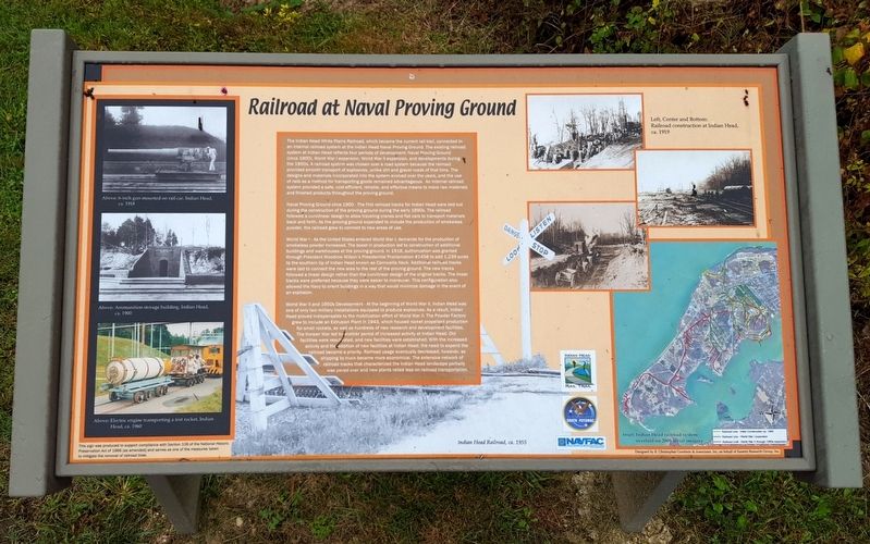
Railroad at Naval Proving Ground
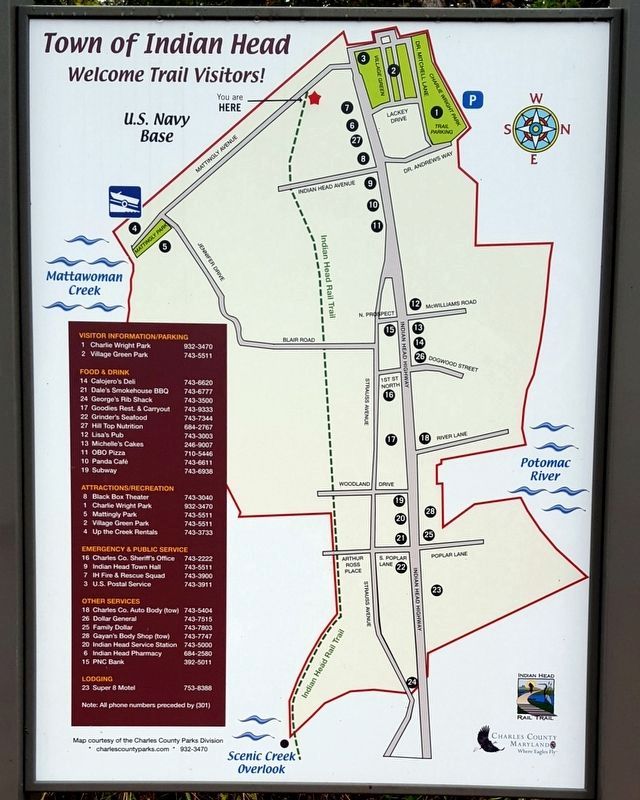
— Indian Head Rail Trail —
The Indian Head White Plains Railroad, which became the current rail trail, connected to an internal railroad system at the Indian Head Naval Proving Ground. The existing railroad system at Indian Head reflects four periods: of development: Naval Proving Ground (circa 1900), World War I expansion, World War II expansion, and developments during the 1950s. A railroad system was chosen over a road system because the railroad provided smooth transport of explosives, unlike dirt and gravel roads of that time. The designs and materials incorporated into the system evolved over the years, and the use of rails as a method for transporting goods remained advantageous. An internal railroad system provided a safe, cost-efficient, reliable, and effective means to move raw materials and finished products throughout the proving ground.
Naval Proving Ground circa 1900 - The first railroad tracks for Indian Head were laid out during construction of the proving ground during the early 1890s. The railroad followed a curvilinear design to allow traveling cranes and flat cars to transport materials back and forth. As the proving ground expanded to include the production of smokeless powder, the railroad grew to connect to new areas of use.
World War I - As the United States entered World War I, demands for the production of smokeless powder increased. The boost in production led to construction of additional buildings and warehouses at the proving ground. In 1918, authorization was granted through President Woodrow Wilson's Presidential Proclamation #1458 to add 1,239 acres to the southern tip of Indian Head known as Cornwallis Neck. Additional railroad tracks were laid to connect the new area to the rest of the proving ground. The new tracks followed a linear design rather than the curvilinear design of the original tracks. The linear tracks were preferred because they were easier to maneuver. This configuration also allowed the Navy to orient buildings in a way that would minimize damage in the event of an explosion.
World War II and 1950s Development - At the beginning of World War II, Indian Head was one of two military installations equipped to produce explosives. As a result, Indian Head proved indispensable to the mobilization effort of World War ll. The Powder Factory grew to include an Extrusion Plant in 1943, which housed rocket propellant production for small rockets, as well as hundreds of new research and development facilities. The Korean War led to another period of increased activity at Indian Head. Old facilities were reactivated, and new facilities were established. With the increased activity and the addition of new facilities at Indian Head, the need to expand the railroad became a priority. Railroad usage eventually decreased, however, as shipping by truck became more economical. The extensive network of railroad tracks that characterized the Indian Head landscape partially was paved over and new plants relied less on railroad transportation.
(captions)
Above: 6-inch gun mounted on rail car, Indian Head, ca. 1918
Above: Ammunition storage building, Indian Head, ca. 1900
Above: Electric engine transporting a test rocket, Indian Head, ca. 1960
Indian Head Railroad, ca. 1955
Left, Center and Bottom: Railroad construction at Indian Head, ca. 1919
Inset: Indian Head railroad system overlaid on 2009 aerial imagery.
This sign was produced to support compliance with Section 106 of the National Historic Preservation Act of 1966 (as amended) and serves as one of the measures taken to mitigate the removal of railroad lines.
Topics and series. This historical marker is listed in these topic lists: Railroads & Streetcars • War, World I • War, World II. In addition, it is included in the Former U.S. Presidents: #28 Woodrow Wilson series list.
Location. 38° 35.822′ N, 77° 10.076′ W. Marker is in Indian Head, Maryland, in Charles County. Marker can be reached from Mattingly Avenue, 0.2 miles south of Indian Head Highway (Maryland Route 210), on the left when traveling south. Touch for map. Marker is in this post office area: Indian Head MD 20640, United States of America. Touch for directions.
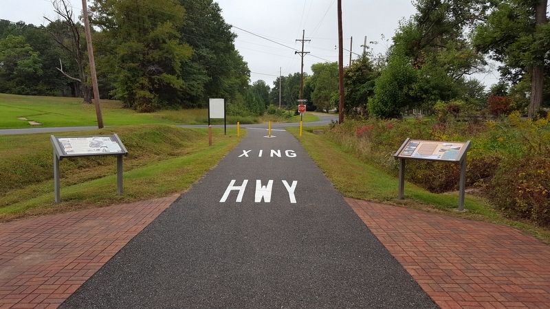
Other nearby markers. At least 8 other markers are within 3 miles of this marker, measured as the crow flies. Navy Railroad (a few steps from this marker); In Honor and Memory (approx. 0.2 miles away); Saint Charles of Cornwallis Neck (approx. 1.8 miles away); Christian Temple Manor (approx. 2.8 miles away); John Smith Explores the Chesapeake (approx. 2.8 miles away); Join the Adventure (approx. 2.8 miles away); Rich Resources (approx. 2.8 miles away); Explore your Chesapeake (approx. 2.9 miles away). Touch for a list and map of all markers in Indian Head.
Also see . . . Indian Head Rail Trail. Town of Indian Head website entry (Submitted on February 16, 2022, by Larry Gertner of New York, New York.)
Credits. This page was last revised on January 10, 2024. It was originally submitted on October 9, 2016, by Bernard Fisher of Richmond, Virginia. This page has been viewed 377 times since then and 21 times this year. Photos: 1, 2, 3, 4. submitted on October 9, 2016, by Bernard Fisher of Richmond, Virginia.


