Pelham Bay Park in the Bronx in Bronx County, New York — The American Northeast (Mid-Atlantic)
Gloverís Rock
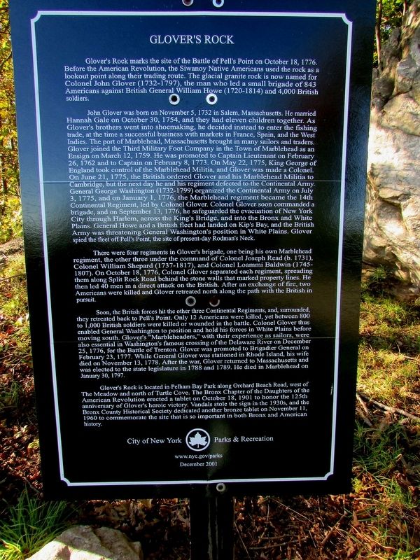
Gloverís Rock marks the site of the Battle of Pellís Point on October 18, 1776. Before the American Revolution, the Siwanoy Native Americans used the rock as a lookout point along their trading route. The glacial granite rock is now named for Colonel John Glover (1732-1797), the man who led a small brigade of 843 Americans against British General William Howe (1720-1814) and 4,000 British soldiers.
John Glover was born on November 5, 1732 in Salem, Massachusetts. He married Hannah Gale on October 30, 1754, and they had eleven children together. As Gloverís brothers went into shoemaking, he decided instead to enter the fishing trade, at the time a successful business with markets in France, Spain, and the West Indies. The port of Marblehead, Massachusetts brought in many sailors and traders. Glover joined the Third Military Foot Company in the Town of Marblehead as an Ensign on March 12, 1759. He was promoted to Captain Lieutenant on February 26, 1762 and to Captain on February 8, 1773. On May 22, 1775, King George of England took control of the Marblehead Militia, and Glover was made a Colonel. On June 21, 1775, the British ordered Glover and his Marblehead Militia to Cambridge, but the next day he and his regiment defected to the Continental Army. General George Washington (1732-1799) organized the Continental Army on July 3, 1775, and on January 1, 1776, the Marblehead regiment became the 14th Continental Regiment, led by Colonel Glover. Colonel Glover soon commanded a brigade, and on September 13, 1776, he safeguarded the evacuation of New York City through Harlem, across the Kingís Bridge, and into the Bronx and White Plains. General Howe and a British fleet had landed on Kipís Bay, and the British Army was threatening General Washingtonís position in White Plains. Glover spied the fleet off Pellís Point, the site of present-day Rodmanís Neck.
There were four regiments in Gloverís brigade, one being his own Marblehead regiment, the other three under the command of Colonel Joseph Read (b. 1731), Colonel William Shepard (1737-1817), and Colonel Loammi Baldwin (1745-1807). On October 18, 1776, Colonel Glover separated each regiment, spreading them along Split Rock Road behind the stone walls that marked property lines. He then led 40 men in a direct attack on the British. After an exchange of fire, two Americans were killed and Glover retreated north along the path with the British in pursuit.
Soon, the British forces hit the other three Continental Regiments, and, surrounded, they retreated back to Pellís Point. Only 12 Americans were killed, yet between 800 to 1,000 British soldiers were killed or wounded in the battle. Colonel Glover thus enabled General Washington to position and hold his forces in White Plains before moving south. Gloverís ďMarbleheaders,Ē with their experience as sailors, were also essential in Washingtonís famous crossing of the Delaware River on December 25, 1776, for the Battle of Trenton. Glover was promoted to Brigadier General on February 23, 1777. While General Glover was stationed in Rhode Island, his wife died on November 13, 1778. After the war, Glover returned to Massachusetts and was elected to the state legislature in 1788 and 1789. He died in Marblehead on January 30, 1797.
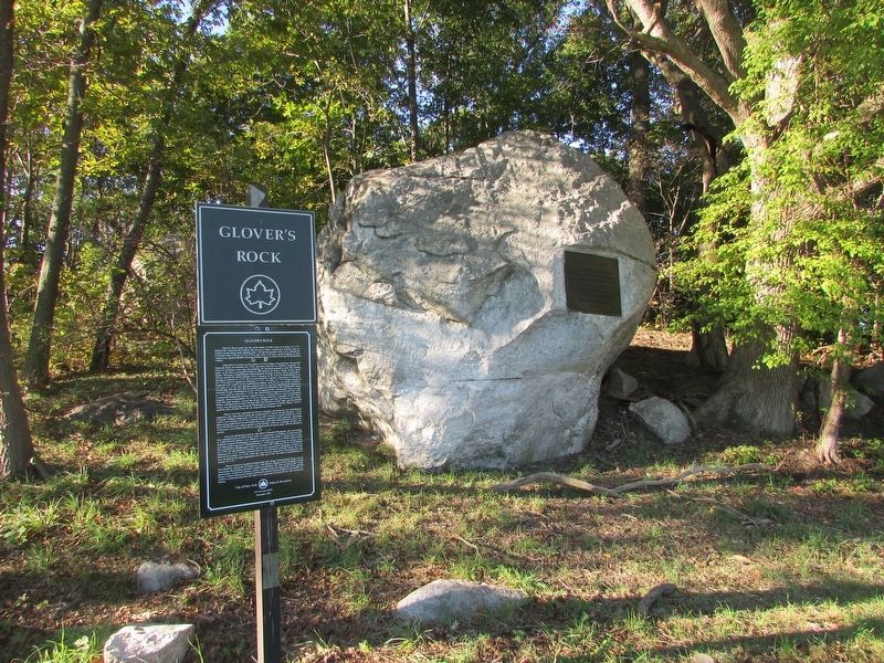
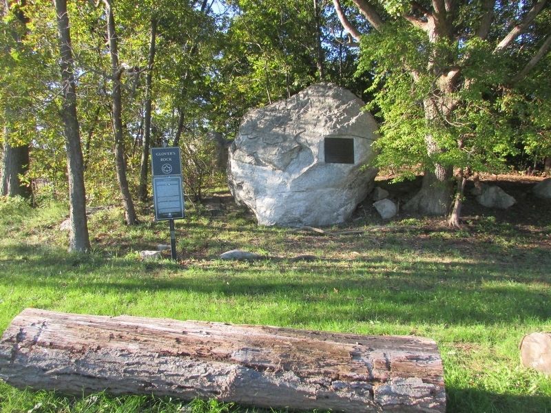
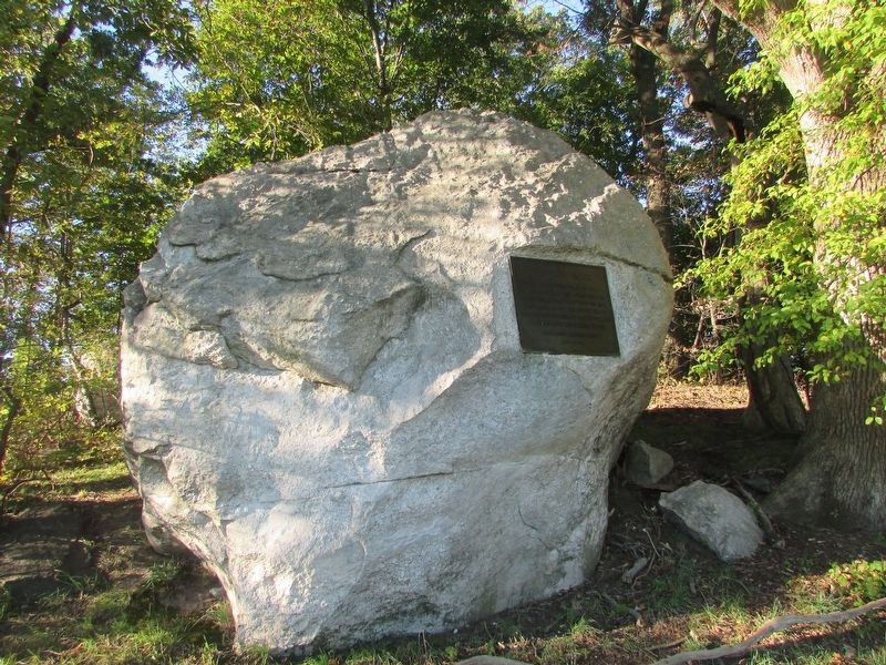
Gloverís Rock is located in Pelham Bay Park along Orchard Beach Road, west of The Meadow and north of Turtle Cove. The Bronx Chapter of the Daughters of the American Revolution erected a tablet on October 18, 1901 to honor the 125th anniversary of Gloverís heroic victory. Vandals stole the sign in the 1930s, and the Bronx County Historical Society dedicated another bronze tablet on November 11, 1960 to commemorate the site that is so important in both Bronx and American history.
Erected 2001 by City of New York Parks & Recreation.
Topics and series. This historical marker is listed in this topic list: War, US Revolutionary. In addition, it is included in the Former U.S. Presidents: #01 George Washington, and the NYC Parks series lists. A significant historical date for this entry is October 18, 1776.
Location. 40° 51.906′ N, 73° 48.18′ W. Marker is in Bronx, New York, in Bronx County. It is in Pelham Bay Park. Marker is on Orchard Beach Road, 0.2 miles west of Park Drive, on the right when traveling east. Touch for map. Marker is in this post office area: Bronx NY 10464, United States of America. Touch for directions.
Other nearby markers. At least 8 other markers are within 2 miles of this marker, measured as the crow flies. A different marker also named Gloverís Rock (a few steps from this marker); Bartow Ė Pell Mansion (approx. half a mile away); Bartow Pell Mansion (approx. half a mile away); Pellís Treaty Oak (approx. 0.6 miles away); World War II Memorial (approx. 0.9 miles away); Vietnam War Veterans (approx. 0.9 miles away); Korean War Veterans (approx. 0.9 miles away); Bronx Victory Memorial (approx. 1.3 miles away). Touch for a list and map of all markers in Bronx.
Also see . . . The Battle of Pellís Point. The American Revolutionary War website. (Submitted on October 11, 2016, by Bill Coughlin of Woodland Park, New Jersey.)
Credits. This page was last revised on March 8, 2023. It was originally submitted on October 11, 2016, by Bill Coughlin of Woodland Park, New Jersey. This page has been viewed 935 times since then and 111 times this year. Photos: 1, 2, 3, 4. submitted on October 11, 2016, by Bill Coughlin of Woodland Park, New Jersey.


