Near Dixon in Taos County, New Mexico — The American Mountains (Southwest)
Rio Grande Gaging Station
U.S. Geological Survey
— Established 1889 —
Inscription.
U.S. Geological Survey
Topics and series. This historical marker is listed in these topic lists: Industry & Commerce • Natural Resources. In addition, it is included in the ASCE Civil Engineering Landmarks series list.
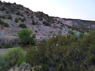
Location. 36° 11.045′ N, 105° 58.78′ W. Marker is near Dixon, New Mexico, in Taos County. Marker is on State Road 68, on the left when traveling south. 1.98 miles south of Embudo Station, 1.2 miles north of Velarde. Touch for map. Marker is in this post office area: Dixon NM 87527, United States of America. Touch for directions.
Other nearby markers. At least 8 other markers are within 13 miles of this marker, measured as the crow flies. Velarde (approx. 0.9 miles away); Embudo Stream-Gaging Station (approx. 3.4 miles away); Historic Los Luceros (approx. 5.8 miles away); Santa Cruz (approx. 9 miles away); San Gabriel (approx. 10.3 miles away); Esther Martinez - P’oe Tsáwäˀ (1912-2006) (approx. 10.3 miles away); Shrine of Our Lady of Lourdes (approx. 10.3 miles away); Pilar (approx. 12.1 miles away).
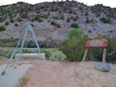
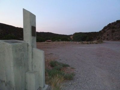
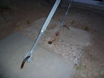
More about this marker. The wooden marker is about to fall down the east bank of the Rio Grande River. The concrete centenary marker near the highway replaces it.
Regarding Rio Grande Gaging Station. The humble, nondescript wooden sign, posts rotted at ground level, about to slide into the Rio Grande and the matter-of-fact concrete pylons and brass plaques replacing it near the highway do not tell the historical story of this Middle Rio Grande river stream gage. This first federal water measuring station, established at the urging of John Wesley Powell, became the training ground for the USGS' first dozen hydrologists. The water science begun here has grown to our nation's water quantity and quality measurement network. This network grows, adopting to changes in water science technology and reporting methods, making the information available to any person on the planet reading English, or connected to the Internet. When the water's rising near your home, you can find out what's going on in near real-time because of the science begun and the Embudo Station water gage. My thanks to John Philbin, my gage-watching educator.
Also see . . .
1. U.S. Geological Survey Water Resources of the United States. Click on the U.S. map on the left side of the page and zoom into the water gages in your state or locale. Most of these gaging stations are feeding satellite data feeds, tracking water levels in near real-time. You can subscribe to Water Alerts to get water level alerts on your personal digital notification device. (Submitted on July 14, 2011, by Chris English of Phoenix, Arizona.)
2. USGS 08279500 Rio Grande at Embudo, NM. The modern online readout from the Rio Grande Embudo Station gage (Submitted on July 14, 2011.)
3. About the (USGS) Hydrologic Instrumentation Facility. This link has a very brief history of the United States Geological Survey, its mission, and discussion about the Embudo Station water gage and its importance in training the nation's first dozen hydrologists. (Submitted on July 16, 2011, by Chris English of Phoenix, Arizona.)
4. The first USGS gaging station was established on the Rio Grande near Embudo, New Mexico in 1889. This links to a presentation converted to a web page. It's a first historical mention of the Embudo Station gage, linking to another slide discussing the importance of the Embudo Station gage, John Wesley Powell's involvement, irrigation in the West, and a picture of the first dozen hydrologist trainees of the United States of America. (Submitted on July 16, 2011, by Chris English of Phoenix, Arizona.)
Additional keywords. Civil Engineering
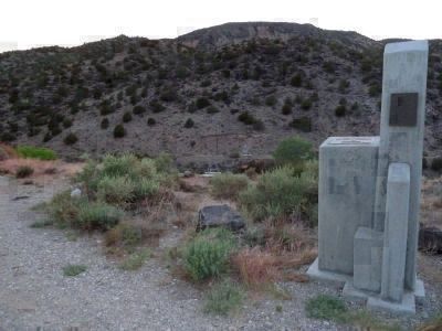
Photographed By Thomas Chris English, June 7, 2011
3. Embudo Stream Gaging Station Marker
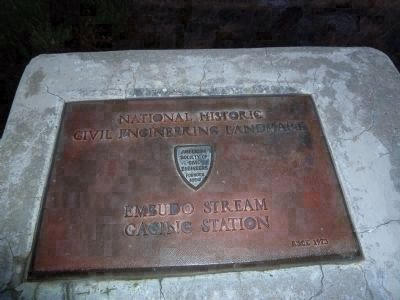
Foreground: The 1973 American Society of Civil Engineers monument with an 1979 U.S. Geological Survey and State of New Mexico plaque added in 1979. The cable gaging station A-frame, anchor, footer and backstays are seen in the background.
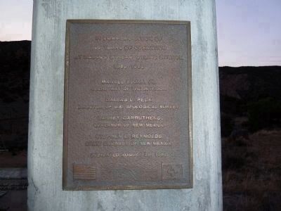
Photographed By Thomas Chris English, June 7, 2011
5. Embudo Stream Gaging Station Marker, Centenary Plaque
New Mexico Governor, New Mexico State Civil Engineer and United States Geological Survey plaque reading:
"In commemoration of 100 years of operation at Embudo Stream-gaging station 1889-1989. Dallas L. Peck, Director of U.S. Geological Survey, Garry Carruthers, Governor of New Mexico, Stephen E. Reynolds,Civil Engineer of New Mexico. August 28, 1989
Credits. This page was last revised on January 10, 2021. It was originally submitted on June 27, 2011, by Chris English of Phoenix, Arizona. This page has been viewed 1,417 times since then and 54 times this year. Last updated on July 27, 2011, by Chris English of Phoenix, Arizona. Photos: 1. submitted on July 12, 2011, by Chris English of Phoenix, Arizona. 2, 3, 4, 5. submitted on June 27, 2011, by Chris English of Phoenix, Arizona. 6, 7, 8, 9, 10. submitted on July 13, 2011, by Chris English of Phoenix, Arizona. 11. submitted on June 27, 2011, by Chris English of Phoenix, Arizona. • Syd Whittle was the editor who published this page.

