Asunción Mita, Jutiapa, Guatemala — Central America
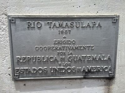
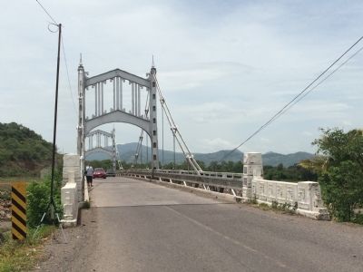
Tamasulapa River Bridge
1937
Erigido
Cooperativamente
por la
Republica de Guatemala
y los
Estados Unidos de America
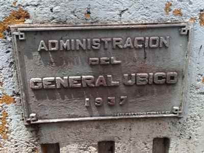
1937
Erected cooperatively by the Republic of Guatemala and the United States of America
Erected 1937.
Topics. This historical marker is listed in this topic list: Bridges & Viaducts. A significant historical year for this entry is 1937.
Location. 14° 18.216′ N, 89° 43.048′ W. Marker is in Asunción Mita, Jutiapa. Marker is on Panamerican Highway, on the left when traveling east. Touch for map. Marker is in this post office area: Asunción Mita, Jutiapa 22005, Guatemala. Touch for directions.
Other nearby markers. At least 1 other marker is within 13 kilometers of this marker, measured as the crow flies. Amatal River Bridge (approx. 12.9 kilometers away).
Also see . . . 1946 Pan-American Highway to El Salvador - Guatemala. Excerpt from Thayer Soule's travelogue, "The Road to Panama", archived in the Human Studies Film Archives, Smithsonian Institution. The clip shows about 11 seconds worth of the bridge (1:05-1:16), and includes a shot of the marker. (Submitted on July 12, 2015, by J. Makali Bruton of Accra, Ghana.)
Credits. This page was last revised on March 2, 2018. It was originally submitted on July 12, 2015, by J. Makali Bruton of Accra, Ghana. This page has been viewed 645 times since then and 21 times this year. Photos: 1, 2, 3. submitted on July 12, 2015, by J. Makali Bruton of Accra, Ghana. • Andrew Ruppenstein was the editor who published this page.


