Appalachia in Wise County, Virginia — The American South (Mid-Atlantic)
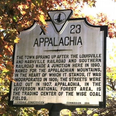
Appalachia
Erected 1941 by Virginia Conservation Commission. (Marker Number X-23.)
Topics and series. This historical marker is listed in these topic lists: Political Subdivisions • Railroads & Streetcars. In addition, it is included in the Virginia Department of Historic Resources (DHR) series list. A significant historical year for this entry is 1890.
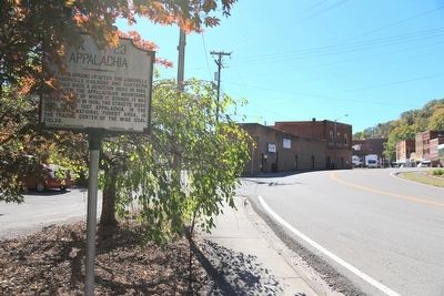
Location. 36° 54.344′ N, 82° 46.895′ W. Marker is in Appalachia, Virginia, in Wise County. Marker is on Callahan Avenue (Virginia Route 78) east of West Main Street (Business U.S. 23), on the right when traveling east. It is well hidden in the trees in a small triangle park between Route 78 and the railroad tracks. Touch for map. Marker is in this post office area: Appalachia VA 24216, United States of America. Touch for directions.
Other nearby markers. At least 8 other markers are within 7 miles of this marker, measured as the crow flies. Big Stone Gap (approx. 2.6 miles away); Origins of Big Stone Gap (approx. 2.6 miles away); Carl Martin (approx. 2.7 miles away); a different marker also named Big Stone Gap (approx. 2.8 miles away); Christ Episcopal Church (approx. 2.9 miles away); Southwest Virginia Museum (approx. 2.9 miles away); Benge’s Gap (approx. 6.2 miles away); Highest Point in Kentucky (approx. 6.2 miles away in Kentucky).
More about this marker. Appalachia was on the Louisville and Nashville’s Cumberland Valley Division which ran from L&N’s main line to Atlanta at Corbin Kentucky to Norton Virginia via Cumberland Gap. It was on the Southern Railway’s branch line between Bristol Tennessee/Virginia and St. Charles Virginia. After the town was founded, a third railroad, the Interstate Railroad, built through Appalachia. Interstate was only 22 miles long and never left the county.
Credits. This page was last revised on June 16, 2016. It was originally submitted on November 23, 2015, by J. J. Prats of Powell, Ohio. This page has been viewed 525 times since then and 51 times this year. Photos: 1, 2, 3. submitted on November 23, 2015, by J. J. Prats of Powell, Ohio.


