Elk Point in Union County, South Dakota — The American Midwest (Upper Plains)
Return to "Elk Sign" Campsite
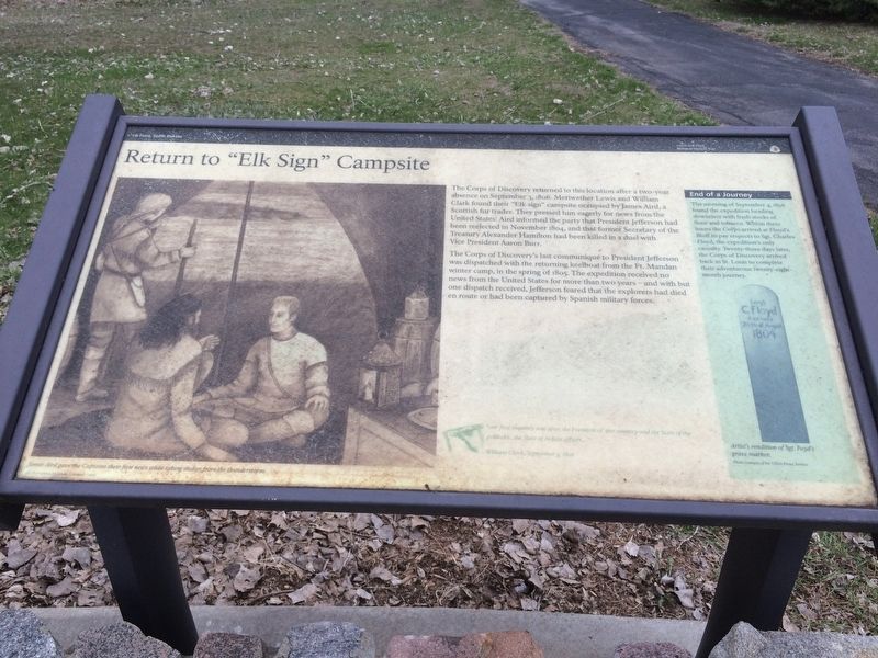
The Corps of Discovery returned to this location after a two-year absence on September 3, 1806. Meriwether Lewis and William Clark found their "Elk sign" campsite occupied by James Aird, a Scottish fur trader. They pressed him eagerly for news from the United States. Aird informed the party that President Jefferson had been reelected in November 1804, and that former Secretary of the Treasury Alexander Hamilton had been killed in a duel with Vice President Aaron Burr.
The Corps of Discovery's last communique to President Jefferson was dispatched with the returning keelboat from the Ft. Mandan winter camp, in the spring of 1805. The expedition received no news from the United States for more than two years - and with but one dispatch received, Jefferson feared that the explorers ad died en route or had been captured by Spanish military forces.
Picture Title
James Aird gave the Captains their first news while taking shelter from the thunderstorm.
End of a Journey
The morning of September 4, 1806 found the expedition heading downriver with fresh stocks of flour and tobacco. Within three hours the Corps arrived at Floyd's Bluff to pay respects the Sgt. Charles Floyd, the expedition's only casualty. Twenty-three days later the Corps of Discovery arrived back in St. Louis to compete their adventurous twenty-eight-month journey.
Journal Entry>
"our first enquirey was after the President of our country and the State of politicks.. The State of Indian affairs…
William Clark, September 3, 1806
Erected 2001 by Lewis and Clark National Historic Trail.
Topics and series. This historical marker is listed in this topic list: Exploration. In addition, it is included in the Former U.S. Presidents: #03 Thomas Jefferson, and the Lewis & Clark Expedition series lists. A significant historical date for this entry is September 3, 1806.
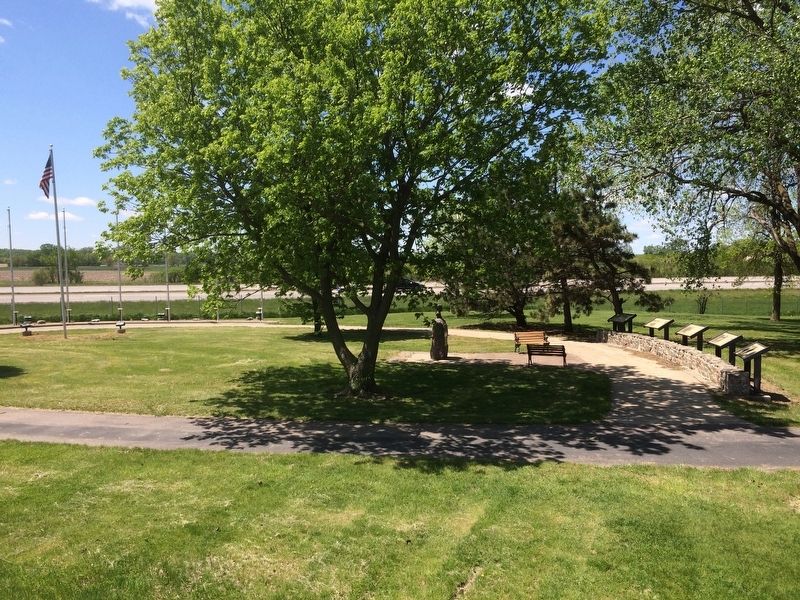
Location. 42° 40.999′ N, 96° 41.606′ W. Marker is in Elk Point, South Dakota, in Union County. Marker can be reached from S. Harrison St., ¼ mile W. Jefferson St.. This marker is located with others to recognize the Lewis and Clark expedition camped here in this park. Touch for map. Marker is in this post office area: Elk Point SD 57025, United States of America. Touch for directions.
Other nearby markers. At least 8 other markers are within 5 miles of this marker, measured as the crow flies. Entering an Uncertain Land (here, next to this marker); A Land of Plenty (here, next to this marker); U.S. Democracy Crosses the Mississippi River (here, next to this marker); The Lewis and Clark Expedition (a few steps from this marker); Lewis & Clark Campsite / Eli Wixson Farm Site (about 300 feet away, measured in a direct line); Elk Point (approx. 0.4 miles away); First Election in Northwestern United States (approx. 0.6 miles away); Grasshopper Cross (approx. 4.2 miles away). Touch for a list and map of all markers in Elk Point.
Related markers. Click here for a list of markers that are related to this marker. To better understand the relationship, study each marker in the order shown.
Credits. This page was last revised on January 19, 2017. It was originally submitted on January 17, 2017, by Ruth VanSteenwyk of Aberdeen, South Dakota. This page has been viewed 463 times since then and 16 times this year. Photos: 1, 2, 3. submitted on January 17, 2017, by Ruth VanSteenwyk of Aberdeen, South Dakota. • Bill Pfingsten was the editor who published this page.


