Scranton in Lackawanna County, Pennsylvania — The American Northeast (Mid-Atlantic)
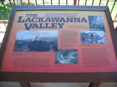
The Lackawanna Valley
"This is a marvelous place. Only two years ago it was a wilderness... But the eye of speculation and improvement was on it, and a furnace was erected between the hills and upon the stream. The mines for coal to be used in this establishment, are within a biscuit toss of the doors of the furnace, and the ore is obtained on the opposite hill. The lime stone is less easily obtained..."
Wilkes-Barre Advocate, September 4, 1844
Ore was first mined from the hill across Roaring Brook. However, this ore was difficult to extract and mines were opened on the south sided of Moosic Mountain. Coal was poor in quality; so new mines were opened on nearby mountains. Mules brought the coal and ore to the furnace.
Anthracite fueled iron furnaces require a blast of hot air to smelt the iron ore. A dam and waterwheel were constructed on Roaring Brook to provide power to the bellows blowing air into the furnace. The blast furnaces were built on the side of a hill so they could be loaded from the top. The ore, coal, and limestone were dumped into an opening in the chimney. The slag, or waste, and the molten iron were tapped from openings at the base of the furnace. Slag and ash from the furnaces were used to fill in the marsh, in today's downtown Scranton.
Topics. This historical marker is listed in this topic list: Industry & Commerce. A significant historical date for this entry is September 4, 1844.
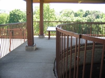
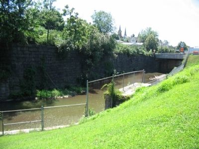
Location. 41° 24.237′ N, 75° 39.756′ W. Marker is in Scranton, Pennsylvania, in Lackawanna County. Marker can be reached from the intersection of Cedar Avenue and Mattes Avenue, on the right when traveling north. Located at the Scranton's Iron Furnace Park. Touch for map. Marker is in this post office area: Scranton PA 18505, United States of America. Touch for directions.
Other nearby markers. At least 8 other markers are within walking distance of this marker. Settlement (here, next to this marker); Making Steel (a few steps from this marker); City of Scranton (a few steps from this marker); Rolling and Puddling (a few steps from this marker); Casting Iron (within shouting distance of this marker); Supplying the Blast (within shouting distance of this marker); Scranton Iron Furnaces (within shouting distance of this marker); The Blast Furnaces (about 300 feet away, measured in a direct line). Touch for a list and map of all markers in Scranton.
More about this marker. On the left is "View of the Lackawanna Coal and Iron Company Furnaces" by George Clough, 1859. In the center, a photo from a coal mine shows a "Driver and Mule." On the right is a drawing from Harpers Weekly from February 22, 1873, captioned "Down
among the coal miners - going down the slope." Also on the right is a photo of the blast furnaces when in operation.
Credits. This page was last revised on June 16, 2016. It was originally submitted on August 21, 2008, by Craig Swain of Leesburg, Virginia. This page has been viewed 956 times since then and 45 times this year. Photos: 1, 2, 3. submitted on August 21, 2008, by Craig Swain of Leesburg, Virginia.


