Scranton in Lackawanna County, Pennsylvania — The American Northeast (Mid-Atlantic)
Settlement
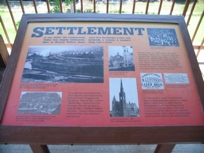
To house the ironworkers and their families, the Lackawanna Iron and Coal Company built houses on "Shanty Hill," today's "South Side," across from the furnaces. The first group to work at LI&C - German, Welsh, and Irish - lived in these houses, and built their own churches and schools.
Between 1880 and 1900, eastern European immigrants came to the ironworks, settling in "Shanty Hill" and in other areas of Scranton. When LI&S closed in 1901, many workers followed the company to Lackawanna, New York. Others went to work in the coal mines, buying their rented homes in "Shanty Hill" from the company. The ethnic groups remain, continuing their ancestors' traditions.
As "Shanty Hill" residents prospered, new buildings replaced some of the earlier, simpler structures. In 1888, German Presbyterians built the Hickory Street Presbyterian church and in 1905, Irish Catholics built the Church of the Nativity. Larger houses and a variety of businesses were built throughout the neighborhood.
Topics. This historical marker is listed in this topic list: Industry & Commerce. A significant historical year for this entry is 1880.
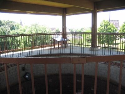
Location. 41° 24.238′ N, 75° 39.758′ W. Marker is in Scranton, Pennsylvania, in Lackawanna County. Marker can be reached from the intersection of Cedar Avenue and Mattes Avenue, on the right when traveling north. Located at the Scranton's Iron Furnace Park. Touch for map. Marker is in this post office area: Scranton PA 18505, United States of America. Touch for directions.
Other nearby markers. At least 8 other markers are within walking distance of this marker. The Lackawanna Valley (here, next to this marker); Making Steel (a few steps from this marker); Rolling and Puddling (a few steps from this marker); City of Scranton (a few steps from this marker); Casting Iron (a few steps from this marker); Supplying the Blast (within shouting distance of this marker); Scranton Iron Furnaces (within shouting distance of this marker); The Blast Furnaces (about 300 feet away, measured in a direct line). Touch for a list and map of all markers in Scranton.
More about this marker. In the upper left is a photo showing "Shanty Hill," also called "Nativity" is seen to the right, with the rolling mill number one to the left, C. 1895. Below it is a drawing of the valley before the mills, "Ebenezer Slocum founded this settlement in 1787. Slocum built the first forge on Roaring Brook." In the center are photos of the Church of the Nativity and Hickory Street Church. In the upper right is a photo of the LI&G Workers from 1884. Below that photo are examples
of advertisements for beer and baked goods from the newspapers of the time.
Credits. This page was last revised on June 16, 2016. It was originally submitted on August 21, 2008, by Craig Swain of Leesburg, Virginia. This page has been viewed 1,895 times since then and 33 times this year. Photos: 1, 2. submitted on August 21, 2008, by Craig Swain of Leesburg, Virginia.

