Würzburg, Bavaria, Germany — Central Europe
Former Synagogue
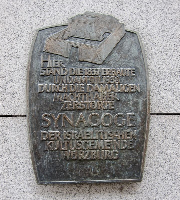
stand die 1837 erbaute
und am 9.11.1938
durch die damaligen
Machthaber
zerstörte
Synagoge
der israelitischen
Kultusgemeinde
Würzburg
Here stood the Synagogue of the Jewish Community of Würzburg, built in 1837 and destroyed by those in power at the time, on November 9, 1938.
Topics and series. This historical marker is listed in these topic lists: Churches & Religion • War, World II. In addition, it is included in the The Holocaust series list. A significant historical year for this entry is 1837.
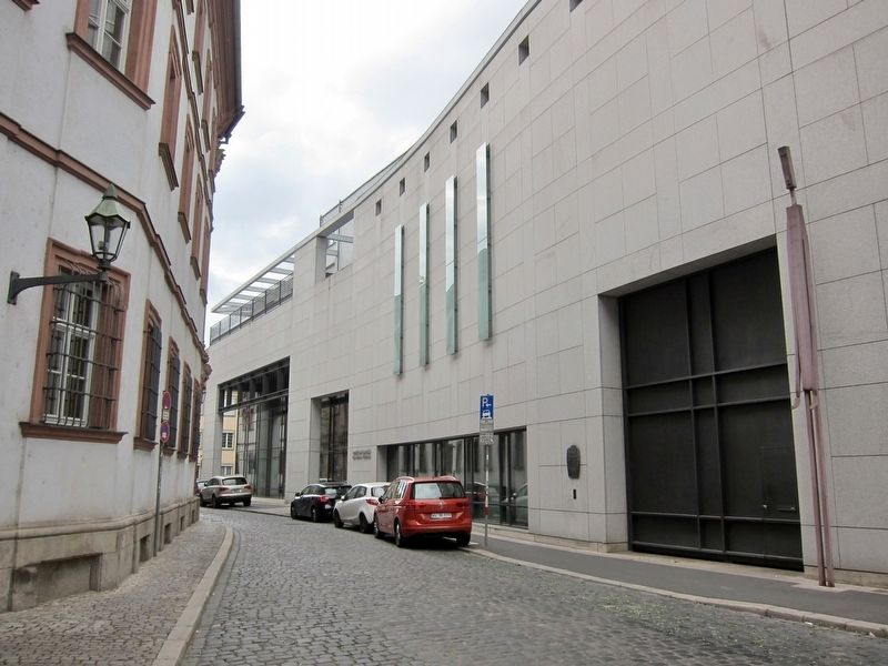
Location. 49° 47.448′ N, 9° 56.057′ E. Marker is in Würzburg, Bayern (Bavaria). Marker is at the intersection of Domerschulstraße and Bibrastrasse, on the right when traveling west on Domerschulstraße. Touch for map. Marker is at or near this postal address: Domerschulstraße 17, Würzburg BY 97070, Germany. Touch for directions.
Other nearby markers. At least 8 other markers are within walking distance of this marker. Priesterseminar / Seminary (within shouting distance of this marker); Hof Groß von Trockau / Gross von Trockau Manor (within shouting distance of this marker); Johann Peter Alexander Wagner (about 90 meters away, measured in a direct line); Johann Lukas Schönlein (about 120 meters away); Frühgotische Doppeltoranlage / Early Gothic Double-Gate Structure (about 120 meters away); Rabbiner Seligmann Bär Bamberger (about 120 meters away); Antonius Neidhardt Graf von Gneisenau / Field Marshal Antonius Neidhardt, Count of Gneisenau (about 150 meters away); Die Erste Sternwart der Universität Würzburg / The First Observatory of the University of Würzburg (about 150 meters away). Touch for a list and map of all markers in Würzburg.
Regarding Former Synagogue. The date of destruction, November 9, 1938, is Kristallnacht - the Night of Broken Glass, on which the Nazis unleashed a violent wave of destruction against the Jews throughout Germany, Austria, and the Sudetenland.
Although the contents of the Synagogue were destroyed on Kristallnacht, and the Jewish community of more than 2,000 was by 1943 destroyed through forced deportations to concentration camps, the Synagogue itself was not destroyed until the Allied bombing of the city on March 16, 1945.
Also see . . .
1. Würzburg During the Holocaust: Kristallnacht. Yad Veshem website entry:
The Jews of Würzburg suffered a heavy blow on Kristallnacht, between the 9th and the 10th of November, 1938. Nearly 1,000 SA militiamen raided Jewish residences throughout the city, robbing their valuables
and destroying their contents. Jewish shops were looted and destroyed. Though the synagogue in Würzburg was not set on fire, as it was too close to neighboring buildings, its contents were gutted and burnt. The Torah scrolls disappeared, and later a few charred scrolls resurfaced in the yard of a local resident. The contents of the small synagogue were similarly destroyed. (Submitted on July 18, 2017.)
2. Hauptsynagoge. WürzburgWiki website entry (in German) (Submitted on July 18, 2017.)
Additional keywords. Holocaust Gedenktafel
Credits. This page was last revised on September 28, 2023. It was originally submitted on July 18, 2017, by Andrew Ruppenstein of Lamorinda, California. This page has been viewed 188 times since then and 7 times this year. Photos: 1, 2. submitted on July 18, 2017, by Andrew Ruppenstein of Lamorinda, California.

