Soda Springs in Caribou County, Idaho — The American West (Mountains)
Conda Mine - A phosphate fortune unearthed
Inscription.
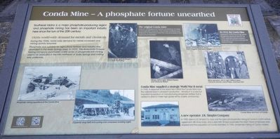
Southeast Idaho is a major phosphate-producing region and phosphate mining has been an important industry here since the turn of the 20th century.
During the 1920s, world-wide demand for metals increased and mining activity boomed.
Phosphate rock suitable for agricultural fertilizer and industry was abundant in the Soda Springs area. In 1919, the Anaconda Copper Mining Company purchased 3,500 acres of phosphate-rich mining claims for $650,000 in the hills northeast of Soda Springs and mining was underway.
In 1940, in response to the World War II effort the Conda Mine took the national lead in vanadium production. Vanadium is a rare but important by-product of manufacturing phosphate fertilizer that is added to steel to make high-grade armor, bullets, and bombs.
In 1959, Idaho's J.R. Simply Co. took over the open-pit phosphate mining at Conda in a joint venture agreement with Anaconda, and a year later Simplot purchased the plant. Fewer employees were required and the population at Conda dwindled. In 1984, phosphate mining at Conda ceased.
Topics. This historical marker is listed in these topic lists: Industry & Commerce • Natural Resources. A significant historical year for this entry is 1919.
Location. 42° 39.29′ N, 111° 36.159′ W. Marker is in Soda Springs, Idaho, in Caribou County. Marker is on East 2nd Street South (U.S. 30) near South Main Street, on the right when traveling west. Touch for map. Marker is at or near this postal address: 31 East 2nd Street South, Soda Springs ID 83276, United States of America. Touch for directions.
Other nearby markers. At least 8 other markers are within walking distance of this marker. Memories of Conda - a company community (here, next to this marker); Coach History (a few steps from this marker); Hooper Spring (within shouting distance of this marker); General Patrick Edward Connor (within shouting distance of this marker); Dr. Ellis Kackley (within shouting distance of this marker); The Dinkey Engine (about 600 feet away, measured in a direct line); Brigham Young Summer Home (approx. 0.2 miles away); A Grand Vision (approx. 0.2 miles away). Touch for a list and map of all markers in Soda Springs.
More about this marker. This marker is located in Corrigan (City) Park.
Also see . . . History of the Conda Operation: Underground to Strip Mining - AAPG Datapage. The Anaconda Copper
Mining Company ac- quired the claims in 1919 and 1920, and began underground development in the later year. A railroad spur from Soda Springs was constructed, a townsite was laid out, and a surface crushing plant was installed. The rock subsequently mined was shipped to Anaconda, Montana for manufacture of phosphate fertilizers. (Submitted on August 7, 2017, by Barry Swackhamer of Brentwood, California.)
Credits. This page was last revised on August 8, 2017. It was originally submitted on August 7, 2017, by Barry Swackhamer of Brentwood, California. This page has been viewed 623 times since then and 65 times this year. Photos: 1, 2. submitted on August 7, 2017, by Barry Swackhamer of Brentwood, California.

