Hapeville in Fulton County, Georgia — The American South (South Atlantic)
Hapeville, Georgia
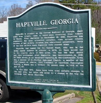
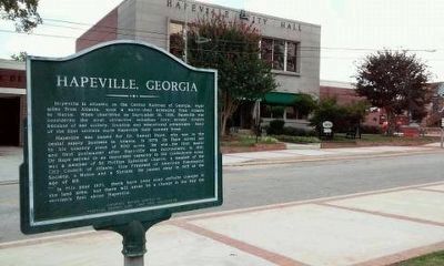
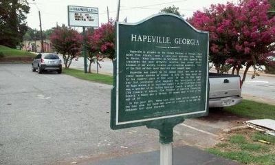
Hapeville was named for Dr. Samuel Hape, who was in the dental supply business in Atlanta. In 1879, Dr. Hape moved out to his country place of 500 acres. He was the first mayor and first postmaster after Hapeville was incorporated in 1891. Dr. Hape served in an important capacity in the Confederate Army, was a member of St. Phillips Episcopal Church, a member of the City Council of Atlanta, Vice President of American Pomological Society, a Mason and a Shriner. He passed away in 1915 at the age of 85.
In this year 1971, there have been some definite changes in the land area, but there will never be a change in the way the residents feel about Hapeville.
Erected 1971 by Hapeville Woman's Club, First Civic Organization.
Topics. This historical marker is listed in these topic lists: Political Subdivisions • Settlements & Settlers. A significant historical month for this entry is September 1861.
Location. 33° 39.58′ N, 84° 24.505′ W. Marker is in Hapeville, Georgia, in Fulton County. Marker is at the intersection of North Fulton Avenue and King Arnold Street, on the left when traveling north on North Fulton Avenue. Touch for map. Marker is in this post office area: Atlanta GA 30354, United States of America. Touch for directions.
Other nearby markers. At least 8 other markers are within 2 miles of this marker, measured as the crow flies. Historic Christ Church, Hapeville (about 700 feet away, measured in a direct line); Chick-fil-A (approx. 0.3 miles away); Delta Air Lines (approx. ¾ mile away); Mt. Zion Methodist Church (approx. 1.2 miles away); Rough and Ready Tavern (approx. 1.4 miles away); Jonesboro Threatened (approx. 1.4 miles away); Rough and Ready (approx. 1.4 miles away); Transfer Point (approx. 1.4 miles away). Touch for a list and map of all markers in Hapeville.
Credits. This page was last revised on June 16, 2016. It was originally submitted on August 31, 2008, by David Seibert of Sandy Springs, Georgia. This page has been viewed 1,648 times since then and 45 times this year. Photos: 1. submitted on August 31, 2008, by David Seibert of Sandy Springs, Georgia. 2, 3. submitted on August 11, 2015, by J. Makali Bruton of Accra, Ghana. • Craig Swain was the editor who published this page.


