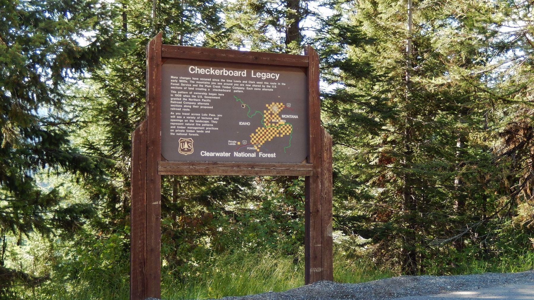
Near Lolo Hot Springs in Idaho County, Idaho — The American West (Mountains)
Checkerboard Legacy
This pattern of ownership began here in 1908 when the U.S. Government granted the Northern Pacific Railroad Company alternate sections along their proposed railroad route.
As you travel across Lolo Pass, you will see a variety of textures and openings on the landscape. They represent natural fire patterns and timber management practices on private timber lands and the national forests.
Erected by Forest Service, U.S. Department of Agriculture.
Topics. This historical marker is listed in this topic list: Horticulture & Forestry.
Location. 46° 35.745′ N, 114° 36.002′ W. Marker is near Lolo Hot Springs, Idaho, in Idaho County. Marker is on U.S. 12, 3 miles west of Elk Meadows Road, on the left when traveling east. Marker is located in a pull-out on the west side of US Highway 12, about 3 miles west of Lolo Pass Summit and the Montana state line. Touch for map. Marker is in this post office area: Lolo MT 59847, United States of America. Touch for directions.
Other nearby markers. At least 8 other markers are within 11 miles of this marker, measured as the crow flies. Lolo Trail Crossing (within shouting distance of this marker); Nez Perce Trail (approx. 2.9 miles away); Lewis and Clark (approx. 2.9 miles away); Lolo Summit (approx. 2.9 miles away); Lewis and Clark Route (approx. 3.6 miles away); a different marker also named Lewis and Clark Route (approx. 8.2 miles away); Whitehouse Pond (approx. 10.4 miles away); "...Across the Endless Sea of Mountains..." (approx. 10˝ miles away).
More about this marker. Large wooden marker in good condition
Credits. This page was last revised on November 11, 2017. It was originally submitted on November 8, 2017, by Cosmos Mariner of Cape Canaveral, Florida. This page has been viewed 536 times since then and 44 times this year. Photos: 1, 2. submitted on November 8, 2017, by Cosmos Mariner of Cape Canaveral, Florida. • Andrew Ruppenstein was the editor who published this page.

