Kailua-Kona in Hawaii County, Hawaii — Hawaiian Island Archipelago (Pacific Ocean)
Ahu'ena Heiau
Photographed by Barry Swackhamer, August 30, 2017
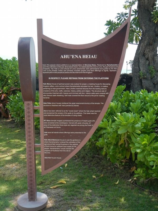
1. Ahu'ena Heiau Marker
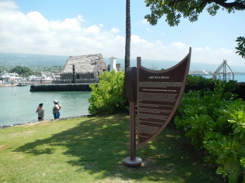
Upon this paepae (stone platform) is a representation of Ahu;ena Heiau. Restored by Kamehameha I upon the unification of the pae'aina (island chain), he rededicated Ahu'ena to Lono, the god of peace and prosperity. The Hale O Lono (House of Lono) ceremonies were administered and guided by the Mo'o Lono (Lono Priestly Order) and primarily included prayers and food offerings to signify, represent, appease and invoke perpetual peace and abundance of the Kingdom.
Hale Mana (house of spiritual power) was a place for prayer, a meeting house of discussing Kingdom affairs, and a school where Kamehameha educated his heir. Liholiho, in maters pertaining to wise government. Here Liholiho received lectures from the leading kahuna (masters) of the arts, crafts, sciences, history, politics and religion. The structure was strong poles thatched with ti leaves and tried with fern. Interior walls were covered with silky banana stalk sheathing. Soft mats covered the floor around a fire pit for roasting bananas.
Hale Pahu (drum house) sheltered the great ceremonial drum(s) of
this page online
Anu'u has been referred to as the "oracle tower" where the high breast received and proclaimed the answer of the gods to his petitions. This tower was the most distinctive feature of the temples of ruling chiefs.
Ki'i Akua (temple images) symbolized the presence of helpful gods who were ancestral to the worshipers. Carved with great virtuosity, ki'i akua of the distinctive Kona style are regarded as among the finest of all Polynesian art forms.
Leie were tall stands where offerings were presented to the gods.
Hale Nānā Mahina'ai (house to see the gardens) is where Kamehameha I ordered the cultivation of the agricultural field named Kuahewa in the uplands of North Kona for sufficient food supply of his people. Kamehameha I would oversee the progress of Kuahewa from this site at Ahu'ena.
Hale Kia'i Guard House.
Topics. This historical marker is listed in these topic lists: Government & Politics • Religion & Religious Structures.
Location. 19° 38.345′ N, 155° 59.862′ W. Marker is in Kailua-Kona,
Photographed by Barry Swackhamer, August 30, 2017
2. Ahu'ena Heiau and Marker

Regionally, this marker is on the Kona Coast and in the Volcanic Hawaii. Globally, it is in North America, in Polynesia, in the Pacific Ocean, in North Pacific, on the Pacific Rim, in the Western Hemisphere, in the Western World, and in the Anglosphere.
Other nearby markers. At least 8 other markers are within walking distance of this marker: Kamakahonu / Kailua Pier (within shouting distance of this marker); Kamakahonu (about 300 feet away, measured in a direct line); Niumalu Beach / Kailua Bay (approx. 0.2 miles away); Ki'ope Pond (approx. ¼ mile away); The First Hawaiian Christian (approx. ¼ mile away); Hulihe‘e Palace / Moku‘aikaua Church (approx. ¼ mile away); Hulihe‘e Palace (approx. ¼ mile away); Mokuaikaua Church (approx. ¼ mile away). Touch for a list and map of all markers in Kailua-Kona.
Credits. This page was last revised on February 22, 2026. It was originally submitted on November 26, 2017, by Barry Swackhamer of Brentwood, California. This page has been viewed 701 times since then and 58 times this year. Photos: 1, 2. submitted on November 26, 2017, by Barry Swackhamer of Brentwood, California.
