
Bandera in Bandera County, Texas — The American South (West South Central)
Bandera County Courthouse
Photographed by Cosmos Mariner, May 28, 2014
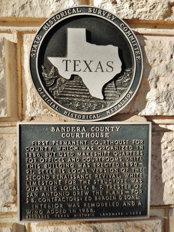
1. Bandera County Courthouse Marker
First permanent courthouse for county, which was organized in 1856, but used makeshift quarters for offices and courtrooms until this building was erected 1890-91. Style is local version of the Second Renaissance Revival. White limestone for the structure was quarried locally. B.F. Trester of San Antonio drew the plans - for $5. Contractors: Ed Braden & Sons. Interior was remodeled and a wing added in 1966.
Erected 1972 by State Historical Survey Committee. (Marker Number 291.)
Topics. This historical marker is listed in this topic list: Notable Buildings. A significant historical year for this entry is 1890.
Location. 29° 43.597′ N, 99° 4.368′ W. Marker is in Bandera, Texas, in Bandera County. It is on Main Street (State Highway 173) north of Hackberry Street, on the right when traveling north. Mounted on subject building just right of the main entrance. Touch for map. Marker is at or near this postal address: 504 Main Street, Bandera TX 78003, United States of America. Touch for directions.

Regionally, this marker is in the Hill Country and in the San Antonio Metropolitan
this page online
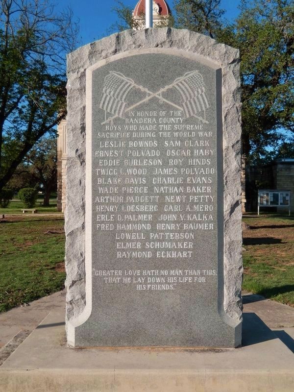
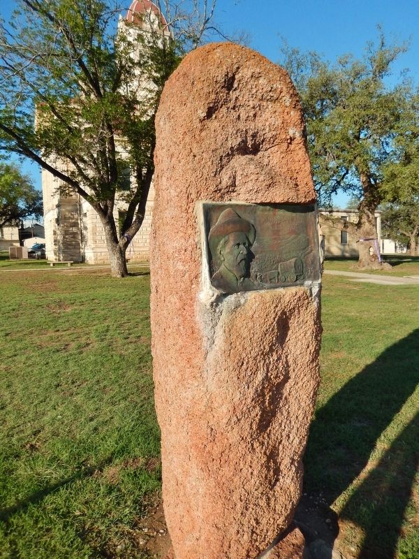
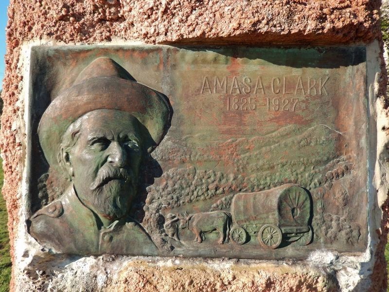
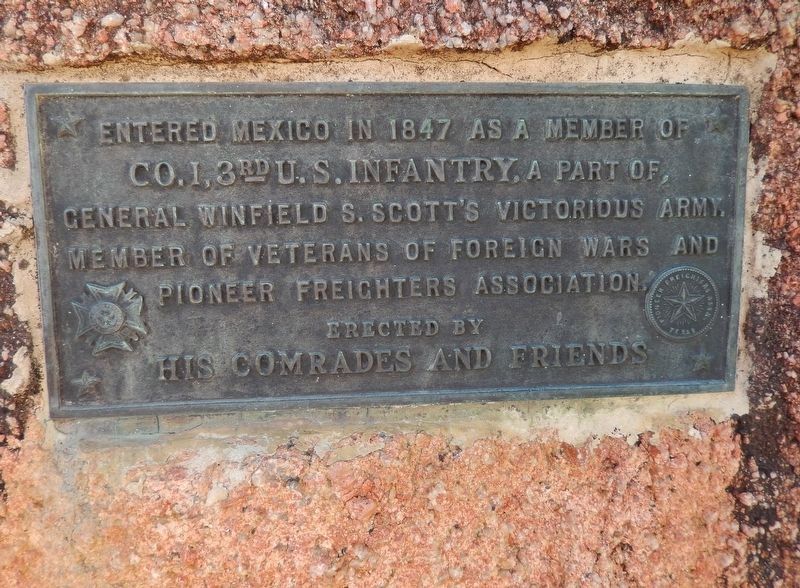
Other nearby markers. At least 8 other markers are within walking distance of this marker: Amasa Clark (a few steps from this marker); Tribute to Valor (a few steps from this marker); Bandera County War Memorial (a few steps from this marker); Mormon Settlers in Bandera County (a few steps from this marker); Camp Montel C.S.A. / Texas Civil War Frontier Defense (within shouting distance of this marker); Old Texas Ranger Trail (within shouting distance of this marker); Captain Jack Phillips (within shouting distance of this marker); Great Western Cattle Trail (about 300 feet away, measured in a direct line). Touch for a list and map of all markers in Bandera.
Also see . . .
1. Bandera County Courthouse and Jail. Wikipedia entry:
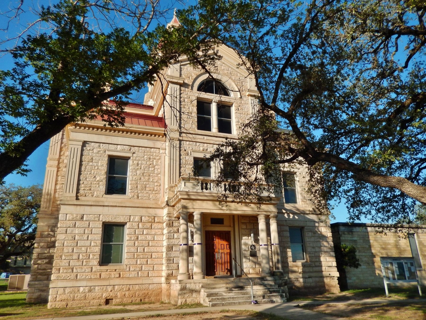
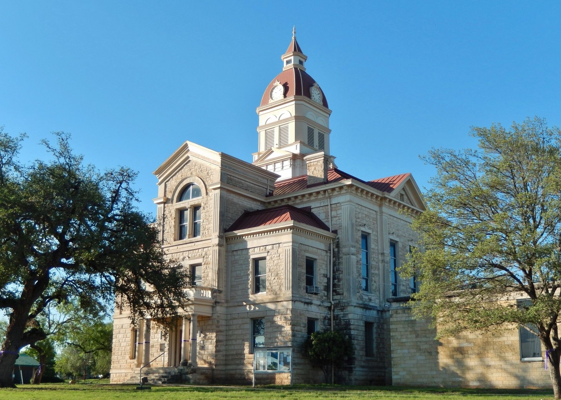
The Bandera County Courthouse, built in 1890 at the corner of Main and Pecan streets, is a Renaissance Revival style building designed
Photographed by Cosmos Mariner, May 28, 2014
2. Bandera County Courthouse (marker visible right of entrance)
2. Bandera County History. Handbook of Texas website entry:
The first Europeans to set foot in what is now Bandera County were the Spanish, who probably explored the region in the early eighteenth century. Bandera is Spanish for "flag," and there are a number of colorful accounts as to how the county was named. One has it that a Spanish general named Bandera led a punitive expedition in the area against the Apaches after the Indians raided San Antonio de Béxar. Another relates that after pursuing the Indians to Bandera Pass the Spanish left a flag or flags to warn them against future raids. And a third legend claims that in 1752 (or 1732) a council was held between Spanish and Indian leaders, during which the Spanish pledged never to go north of the pass if the Indians agreed to cease their
Photographed by Cosmos Mariner, May 28, 2014
3. Bandera County Courthouse (corner view)
3. Cowboy Capital of the World. Bandera County Chamber of Commerce website entry:
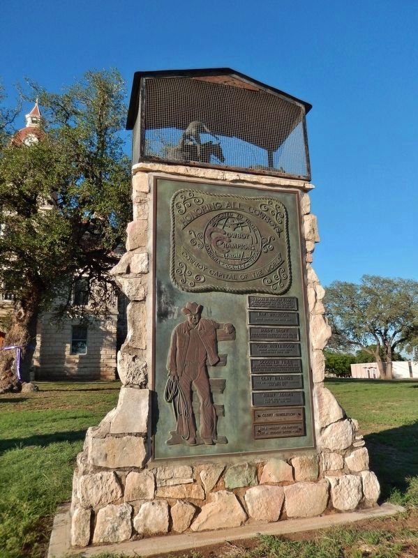
Given that Bandera's early history was carved-literally-from cypress wood, why has Bandera become known as "the Cowboy Capital of the World?" Some claim the large number of dude ranches in the area corralled the name. Some claim it is because Bandera has the largest per capita number of world champion cowboys, as evidenced by the monument on the courthouse lawn designed by the late artist Norma Jean Anderwald. Others point to Bandera's Great Western Trail Heritage Park and the marker commemorating Bandera's role as a starting point for cattle drives from Bandera to Dodge City, Kansas. With the establishment of Camp Verde in 1856 as a fort, Bandera Pass became a popular route to the north, somewhat protected from Indian attack by the U.S. Calvary. (Submitted on December 8, 2017, by Cosmos Mariner of Cape Canaveral, Florida.)
Photographed by Cosmos Mariner, May 28, 2014
4. Bandera "Cowboy Capital of the World" Memorial (in front of courthouse)
Photographed by Cosmos Mariner, May 28, 2014
5. Bandera County World War Memorial (in front of courthouse)
Photographed by Cosmos Mariner, May 28, 2014
6. Amasa Clark Memorial (in front of courthouse)
Photographed by Cosmos Mariner, May 28, 2014
7. Amasa Clark Memorial detail
Photographed by Cosmos Mariner, May 28, 2014
8. Amasa Clark Memorial detail
Credits. This page was last revised on October 10, 2025. It was originally submitted on December 8, 2017, by Cosmos Mariner of Cape Canaveral, Florida. This page has been viewed 837 times since then and 56 times this year. Photos: 1, 2, 3, 4, 5, 6. submitted on December 8, 2017, by Cosmos Mariner of Cape Canaveral, Florida. 7, 8. submitted on December 15, 2017, by Cosmos Mariner of Cape Canaveral, Florida. • Bernard Fisher was the editor who published this page.
