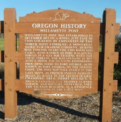
Near St. Paul in Marion County, Oregon — The American West (Northwest)
Willamette Post
Erected by Oregon Department of Transportation.
Topics and series. This historical marker is listed in these topic lists: Industry & Commerce • Settlements & Settlers. In addition, it is included in the Oregon Beaver Boards series list.
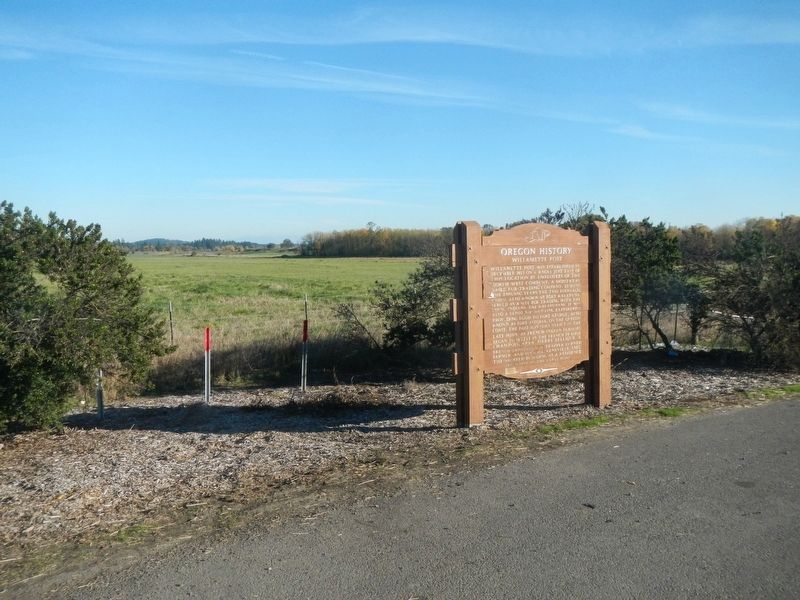
Location. Marker has been reported missing. It was located near 45° 15.811′ N, 122° 56.562′ W. Marker was near St. Paul, Oregon, in Marion County. Marker was on Hillsboro-Silverton Highway NorthEast (Oregon Route 219) near Champoeg Road NorthEast, on the left when traveling south. Touch for map. Marker was in this post office area: Saint Paul OR 97137, United States of America. Touch for directions.
Other nearby markers. At least 8 other markers are within 9 miles of this location, measured as the crow flies. Champoeg (approx. 2 miles away); Hoover - Minthorn House (approx. 2.8 miles away); Courthouse Square Park (approx. 7.1 miles away); Yamhill Blockhouse (approx. 7.1 miles away); Pioneer Park and Blockhouse (approx. 7.1 miles away); Boone's Ferry (approx. 8.2 miles away); Grove of the States (approx. 8.2 miles away); Boone’s Landing (approx. 8.4 miles away).
More about this marker. The marker is located about 1/4 mile south of the Hillsboro-Silverton Highway bridge over the Willamette River.
Also see . . . Oregon Travel Experience - Willamette Post. The official Beaver Board website for Oregon State Historical Markers. (Submitted on February 23, 2018, by Douglass Halvorsen of Klamath Falls, Oregon.)
Credits. This page was last revised on September 6, 2020. It was originally submitted on February 23, 2018, by Barry Swackhamer of Brentwood, California. This page has been viewed 687 times since then and 44 times this year. Photos: 1, 2. submitted on February 23, 2018, by Barry Swackhamer of Brentwood, California.

