Natchez in Adams County, Mississippi — The American South (East South Central)
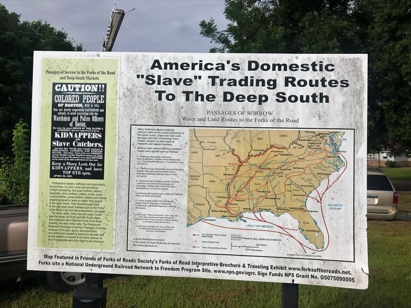
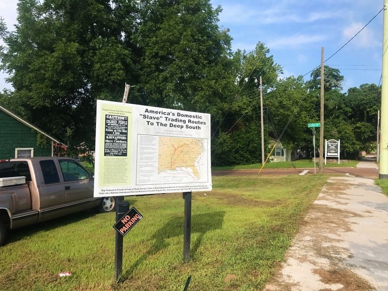
America's Domestic "Slave" Trading Routes To The Deep South
Passage of Sorrows
— Water and Land Routes to the Forks of the Road —
Inscription.
Professional dealers, traffickers and speculators, by purchase, by hook, crook and sometimes outright kidnapping, tore apart mothers, fathers, daughters, sons, brothers, sisters, uncles, aunts, cousins, babies, young children, relations and friends already enslaved or were so-called "free people" in the upper South. They forced-brought them to the new lower south markets such as the Forks of the Road to be sold into enslavement, yet again! The roads, trails, rivers, sea and ocean routes from the upper old South and Mid-South states that eventually led to Natchez Forks of the Road markets, this story writer calls, The Overground Railroad's Passages of Sorrow. Passages of sorrow because of the pain, agony, dehumanization and destruction caused by being torn asunder and forced-walked or shipped in the same manner as their Foreparents were from Africa to the Americas.
Many historians agree enslaved persons were driven south/southwest on the same routes, stage and mail roads, by-ways and inter-connecting rivers, creeks, streams as were used by migrants and regular travelers.
Several main interconnecting overland routes were agreed upon as follows:
A. Baltimore>>Alexandria>>Richmond hubs via Abingdon, Virginia>>Knoxville/Nashville <<>> Tuscaloosa/Montgomery >> to Natchez's Forks and beyond.
B. Richmond hub via Salisbury North Carolina<< >>Juncture of South Carolina-Georgia and Tennessee>>Chattanooga>>Rome Georgia>>. Montgomery>>to Forks and beyond.
C. Kentucky via Lexington hub>>Nashville>>Natchez Trace>>to Forks and beyond.
D. Across coastal stretch from Florida via Jacksonville/St. Augustine>>Tallahassee >>Pensacola>>Mobile/Montgomery>>to Forks and beyond.
See map of probable sea, river, stream and overland trafficking routes of America's Domestic “Slave trade."
Erected by National Park Service, U.S. Department of the Interior.
Topics. This historical marker is listed in these topic lists: African Americans • Industry & Commerce.
Location. 31° 33.365′ N, 91° 23.119′ W. Marker is in Natchez, Mississippi, in Adams County. Marker is on St. Catherine Street east of Junkin Street, on the right when traveling west. Touch for map. Marker is in this post office area: Natchez MS 39120, United States of America. Touch for directions.
Other nearby markers. At least 8 other markers are within walking distance of this marker. History of St. Catherine Street (a few steps from this marker); Forks of the Road (within shouting distance of this marker); a different marker also named Forks of the Road (about 400 feet away, measured in a direct line); Ex-"Slaves" as U.S. Civil War Soldiers in the Mississippi Valley Campaign
(about 500 feet away); Forks of the Road Historical Site (about 500 feet away); Music on St. Catherine Street (approx. 0.2 miles away); Smart-Griffin-Angelety House - 180 St. Catherine Street (approx. 0.2 miles away); Wheaton-McGuire House - 125 St. Catherine Street (approx. 0.2 miles away). Touch for a list and map of all markers in Natchez.
Credits. This page was last revised on June 10, 2022. It was originally submitted on March 1, 2018, by Cajun Scrambler of Assumption, Louisiana. This page has been viewed 699 times since then and 63 times this year. Photos: 1, 2. submitted on March 1, 2018, by Cajun Scrambler of Assumption, Louisiana.

