Southwest Portland in Multnomah County, Oregon — The American West (Northwest)
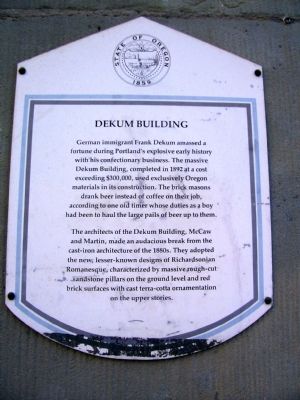
Dekum Building
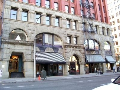
The architects of the Dekum Building, McCaw and Martin, made an audacious break from the cast-iron architecture of the 1880s. They adopted the new, lesser-known designs of Richardsonian Romanesque, characterized by massive rough-cut sandstone pillars on the ground level and red brick surfaces with cast terra-cotta ornamentation on the upper stories.
Erected by the State of Oregon.
Topics. This historical marker is listed in these topic lists: Architecture • Industry & Commerce • Settlements & Settlers. A significant historical year for this entry is 1892.
Location. 45° 31.158′ N, 122° 40.508′ W. Marker is in Portland, Oregon, in Multnomah County. It is in Southwest Portland. Marker is on Southwest 3rd Avenue near S.W. Washington Avenue. Touch for map. Marker is at or near this postal address: 519 SW 3rd Ave, Portland OR 97204, United States of America. Touch for directions.
Other nearby markers. At least 5 other markers are within 4 miles of this marker, measured as the crow flies. In Remembrance of the United States Battleship Oregon (approx. ľ mile away); The Salvation Army (approx. ľ mile away); The Telegram Building, 1922 (approx. 0.4 miles away); The Willamette Stone (approx. 3.3 miles away); a different marker also named The Willamette Stone (approx. 3.3 miles away). Touch for a list and map of all markers in Portland.
More about this marker. $300 thousand back then is about $6.5 million in todayís money.
Credits. This page was last revised on March 17, 2024. It was originally submitted on June 13, 2007, by Elia J. Prats of Columbus, Ohio. This page has been viewed 2,826 times since then and 49 times this year. Photos: 1, 2. submitted on June 13, 2007, by Elia J. Prats of Columbus, Ohio. • J. J. Prats was the editor who published this page.

