Zona 4 in Guatemala City in Guatemala Department, — Central America
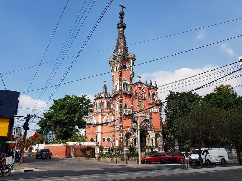
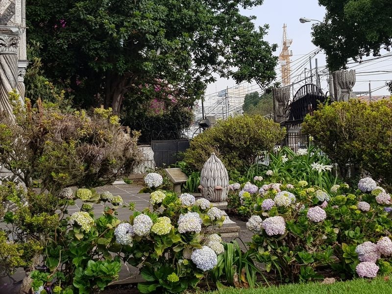
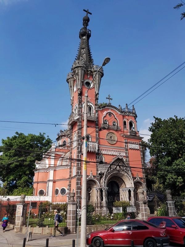
The Chapel of Nuestra Señora de las Angustias
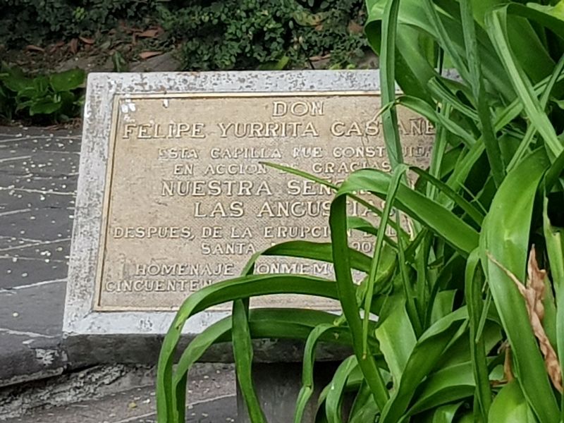
Inscription.
Esta capilla fue construida
en acción de gracias a
Nuestra Señora de las Angustias
después, de la erupción del
Santa María en 1902
Homenaje conmemorativo del cincuenta aniversario
English translation:
This chapel was constructed as a way of giving thanks to
Our Lady of Anguish
after the 1902 eruption of Santa María Volcano
Tribute on the 50th Anniversary
Topics. This historical marker is listed in these topic lists: Churches & Religion • Disasters. A significant historical year for this entry is 1902.
Location. 14° 36.961′ N, 90° 30.895′ W. Marker is in Guatemala City, Guatemala (Guatemala Department). It is in Zona 4. Marker is on Ruta 6 just south of Vía 8, on the right when traveling south. Touch for map. Marker is in this post office area: Guatemala City, Guatemala 01004, Guatemala. Touch for directions.
Other nearby markers. At least 8 other markers are within walking distance of this marker. Monument of the Star (about 120 meters away, measured in a direct line); Founding of the Botanical Garden (about 180 meters away); Assassination of Dr. Alberto Fuentes Mohr (about 210 meters away); Military Academy of Guatemala (approx. 0.3 kilometers away); The Tower of the Reformer (approx. 0.4 kilometers away); Miguel Garcia Granados (approx. 0.4 kilometers away); Israel and Guatemala Monument (approx. 0.8 kilometers away); José María Reina Barrios (approx. 0.8 kilometers away). Touch for a list and map of all markers in Guatemala City.
Regarding The Chapel of Nuestra Señora de las Angustias. This temple was financed and built by the Spanish landowner Felipe Yurrita Castañeda, as a way to give thanks to Nuestra Señora de las Angustias (Our Lady of Anguish) to whom he and his family owed their lives, after the eruption of the Santa María Volcano, in 1902. At that time, the Yurritas lived at the El Ferrol farm, in the western department of San Marcos, Guatemala. The eruption caused a flood of ash, lava and sand that left them stranded at the farm. The family and farm workers set up an impromptu shrine to the Virgin who they believe saved them after the eruption. Yurrita began constructing the temple 25 years after the event, and it was inaugurated on June 15, 1941, five months
before his death. (Translated from Prensa Libre, August 3, 2015)
Also see . . . . "The first eruption of Santa María in recorded history occurred in October 1902. Before 1902 the volcano had been dormant for at least 500 years and possibly several thousand years, but its awakening was clearly indicated by a seismic swarm in the region starting in January 1902, which included a major earthquake in April 1902. The eruption began on October 24, and the largest explosions occurred over the following two days, ejecting an estimated 5.5 cubic kilometers (1.3 cu. miles) of magma. The eruption was one of the largest of the 20th century, only slightly less in magnitude to that of Mount Pinatubo in 1991. The pumice formed in the climactic eruption fell over an area of about 273,000 square kilometers (105,000 sq. mi.), and volcanic ash was seen as far away as San Francisco, some 4,000 kilometers (2,500 mi.) away. The eruption tore away much of the south-western flank of the volcano, leaving a crater about 1 kilometer (0.6 mi.) in diameter and about 300 meters (980 ft) deep, stretching from just below the summit to an elevation of about 2,300 meters (7,500 ft). The first evidence of the eruption was a sprinkling of sand on Quezaltenango. The wind then changed from the south to the east and ashes began to fall at Helvetia, a
coffee plantation six miles to the southwest. Because of the lack of recorded eruptive activity at Santa María, local people did not recognize the preceding seismicity as warning signs of an eruption. At least 5,000 people died as a result of the eruption itself, and a subsequent outbreak of malaria killed many more. (Submitted on April 3, 2018, by J. Makali Bruton of Accra, Ghana.)
Credits. This page was last revised on April 3, 2018. It was originally submitted on April 3, 2018, by J. Makali Bruton of Accra, Ghana. This page has been viewed 477 times since then and 22 times this year. Photos: 1, 2, 3, 4. submitted on April 3, 2018, by J. Makali Bruton of Accra, Ghana.


