York in York County, Maine — The American Northeast (New England)
Historic York Then and Now
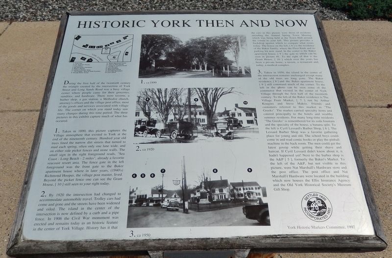
During the first half of the twentieth century the triangle created by the intersection of York Street and Long Sands Road was a busy village center where people came for their groceries, sundries, and hardware. There were taverns, a barber shop, a gas station, a Methodist church, attorney's offices and the village post office, most of the goods and services associated with village life. The corner on which you stand today saw many changes during this time period. The three pictures in this exhibit capture much of what has occurred.
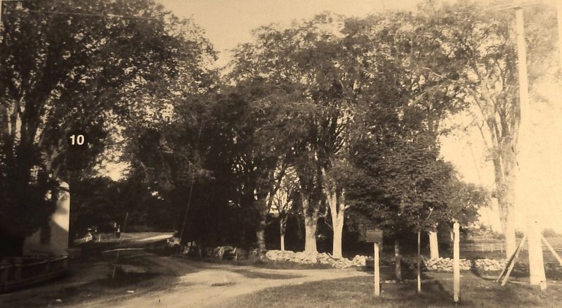
1. Taken in 1890, this picture captures the Village atmosphere that existed in York at the end of the nineteenth century. Hundred year old trees lined the narrow dirt streets that turned to mud each spring, often only one lane wide, and on either side picket fences and stone walls. The small sign in the right foreground reads, "Sea Coast - Long Beach - 2 miles", already a favorite seacoast resort area. The fence gate in the left foreground was the front gate to the Baker apartment house where in later years, (1940's) Richmond Hooper, the village post master, lived. Beyond the picket fence one can see the Grant House, [10] still seen to your right today.
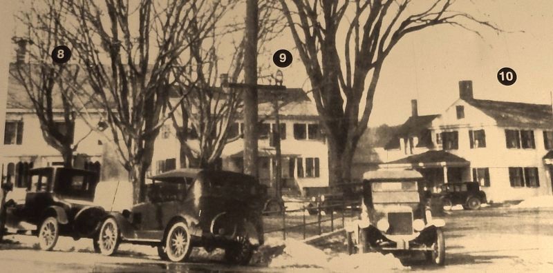
2. By 1920 the intersection had changed to accommodate automobile travel. Trolley cars had come and gone and the streets have been widened and oiled. The island in the center of the intersection is now defined by a curb and a pipe fence. In 1906 the Civil War monument was erected and remains today as an historic feature in the center of York Village. History has it that the cars in this picture were those of residents attending the Annual Spring Town Meeting which was being held at the Town Hall around the corner to your left. This picture provides a backdrop against which to compare what exists today. The house on the left, [8] is the residence of the Baker family, where the Fleet Bank and its parking lot now stand. In the center is the Baker apartment house, [9] the gate to which can be seen in picture #1. To the right of that is the Grant House, [10] which over the years has been a private home, a tavern, a restaurant and, today, a medical complex.
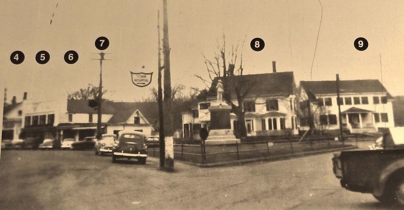
3. Taken in 1950, the island in the center of the intersection remains unchanged except many of the old trees are long gone. The Baker residence, [8] and the Baker apartment house, [9] still command much of the corner. To the left in the photo can be seen some of the commerce that existed in the center of York Village through the first half of the twentieth century. To the left of the Baker residence is The Village Fruit Market, [7] run by Arthur Kougins and Steve Makris. Friends and customers referred to this market as "The Greeks". The market carried specialty items and catered principally to the hotels and wealthy summer residents. For many long-time residents "The Greeks" is remembered for its soda fountain and the specialty of the house, a banana split. To the left is Cyril Lessard's Barber Shop, [6]. The Lessard Barber Shop was a favorite gathering place for young and old. The school boys could come in and read comic books or play the pinball machine in the back room. The men could get the latest gossip while getting their shave and haircut. If Cyril Lessard didn't know about it, it hadn't happened yet! Next to the barber shop is the A&P [5], formerly the Baker's Market. To the left of the A&P, but not visible in this picture, were Nat Marshall's Hardware store and the post office. The post office and Nat Marshall's Hardware were located in the building which now houses the Ellis Insurance Agency and the Old York Historical Society's Museum Gift Shop.
Erected 1997 by York Historic Markers Committee.
Topics. This historical marker is listed in these topic lists: Industry & Commerce • Settlements & Settlers.
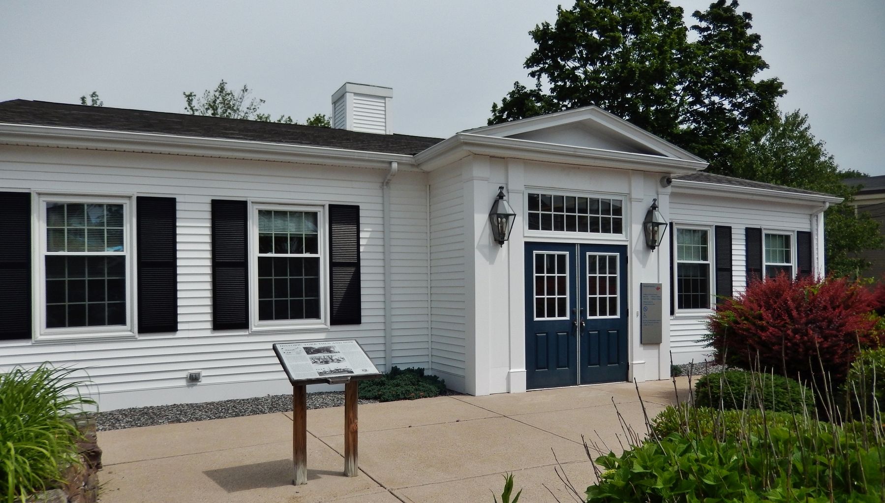
Location. 43° 8.651′ N, 70° 39.04′ W. Marker is in York, Maine, in York County. Marker is at the intersection of York Street (U.S. 1A) and Long Sands Road, on the left when traveling north on York Street. Marker is located in front of the bank building at this address, directly across the highway from the Old York Historical Society. Touch for map. Marker is at or near this postal address: 10 Long Sands Road, York ME 03909, United States of America. Touch for directions.
Other nearby markers. At least 8 other markers are within 6 miles of this marker, measured as the crow flies. Sewall's Bridge (approx. 0.7 miles away); "Beware The Savage Rocks" (approx. 3.2 miles away); "Nubble Light House" (approx. 3.3 miles away); Federal Highway Administration Murrah Building Memorial (approx. 3˝ miles away); Welcome To Fort McClary (approx. 5.2 miles away); Fort McClary (approx. 5.2 miles away); Resisting Naval Firepower (approx. 5.2 miles away); Kittery Maine USS Thresher (SSN 593) Memorial (approx. 5˝ miles away). Touch for a list and map of all markers in York.
More about this marker. Marker is a metal plaque mounted on roughly waist-high posts.
Also see . . .
1. York, Maine. Wikipedia entry:
As provincial capital and site of the Royal Gaol (Jail), York prospered. Numerous wharves and warehouses serviced trade with the West Indies. Agricultural products and lumber were shipped in exchange for sugar, molasses and other commodities. One notable merchant was John Hancock, whose establishment is now a museum. Following the Revolution, however, President Thomas Jefferson's Embargo Act of 1807 crippled trade. (Submitted on April 8, 2018, by Cosmos Mariner of Cape Canaveral, Florida.)
2. History of York County, Maine. With illustrations and biographical sketches of its prominent men and pioneer, by W.W. Clayton (1880)
Internet Archive website entry (Submitted on October 5, 2021, by Larry Gertner of New York, New York.)
Credits. This page was last revised on October 5, 2021. It was originally submitted on April 7, 2018, by Cosmos Mariner of Cape Canaveral, Florida. This page has been viewed 212 times since then and 21 times this year. Photos: 1, 2, 3, 4, 5, 6. submitted on April 8, 2018, by Cosmos Mariner of Cape Canaveral, Florida. • Bill Pfingsten was the editor who published this page.
