Goldfield in Esmeralda County, Nevada — The American Mountains (Southwest)
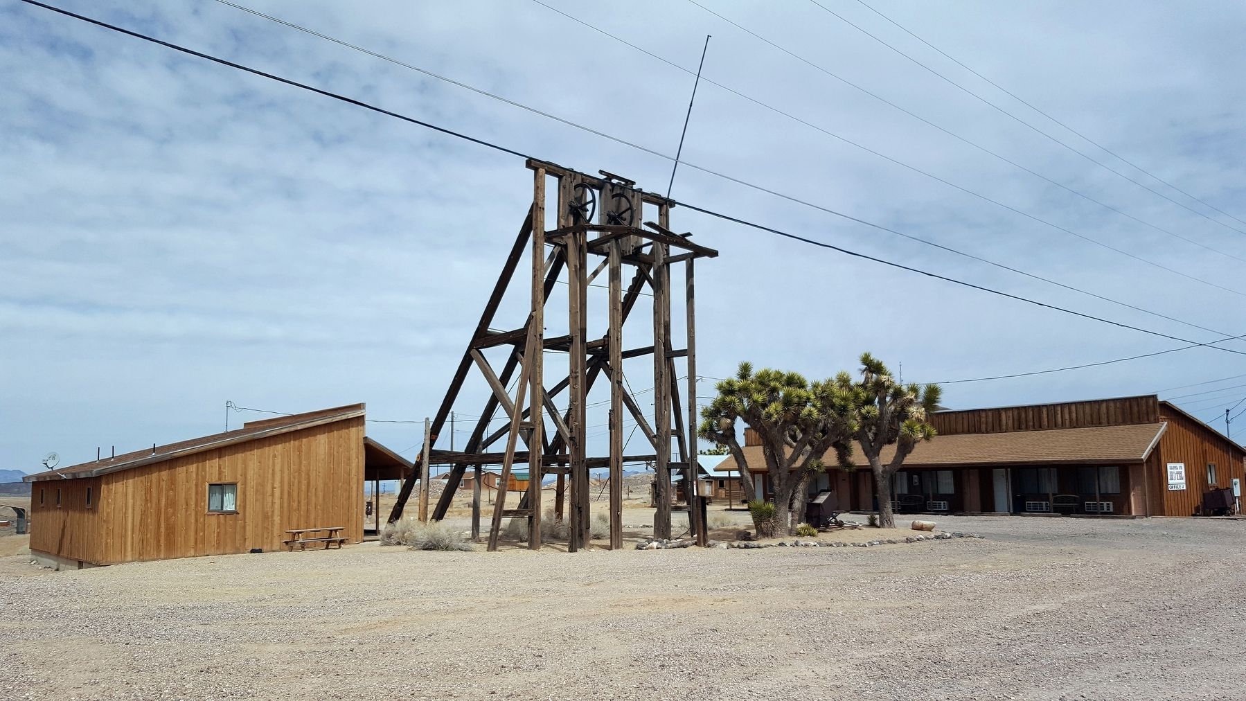
Combination Mine Headframe
Photographed by Douglass Halvorsen, March 31, 2018
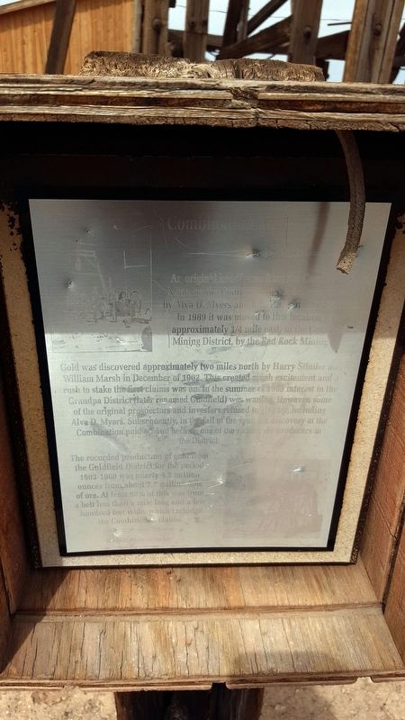
1. Combination Mine Headframe Marker
Gold was discovered approximately two miles north by Harry Stimler and William Marsh in December of 1902. This created much excitement and a rush to stake the first claims was on. In the summer of 1903 interest in the Grandpa District (later renamed Goldfield) was waning. However, some of the original prospectors and investors refused to give up, including Alva D. Myers. Subsequently, in the fall of the year, this discovery at the Combination paid off and became on the the richest ore discoveries in the District.
The recorded production of gold from the Goldfield District for the period 1903–1960 was nearly 4.2 million ounces from about 7.7 million tons of ore. At least 98% of this was from a belt less than a mile long and a few hundred feet wide, which included the Combination claims.
Erected by Goldfield Historical Society.
Topics. This historical marker is listed in this topic list: Industry & Commerce. A significant historical date for this entry is May 26, 1903.
Location. 37° 42.802′ N, 117° 13.856′ W. Marker is in Goldfield, Nevada, in Esmeralda County. It is at the intersection of N 5th Ave and Maple St, on the left when traveling east on N 5th Ave. Touch for map. Marker is in this post office area: Goldfield NV 89013, United States of America. Touch for directions.

Regionally, this marker is in the Sierra Nevada and specifically in Central Nevada. It is also in the American Southwest and in the Mountain West. Globally, it is in North America, the Western Hemisphere, the Western World, and the Anglosphere. Historically,
this page online
Other nearby markers. At least 8 other markers are within walking distance of this marker: The Santa Fe Saloon (within shouting distance of this marker); California Beer Hall Warehouse (approx. ¼ mile away); Consolidated Telephone-Telegraph Company Building (approx. 0.4 miles away); Nixon Wingfield Building (approx. 0.4 miles away); Goldfield Community Center (approx. 0.4 miles away); Goldfield (approx. 0.4 miles away); Gans vs. Nelson (approx. 0.4 miles away); The Gables (approx. half a mile away). Touch for a list and map of all markers in Goldfield.
Another marker is no longer nearby. Southern Nevada Consolidated Telephone-Telegraph Company Building (was approx. 0.4 miles away but has been replaced with another marker now near it).
More about this marker. Marker is extremely, if not impossible to read when the light shines on the metal face.
Photographed by Douglass Halvorsen, March 31, 2018
2. Combination Mine Headframe and Marker
UNLV Digital Collections
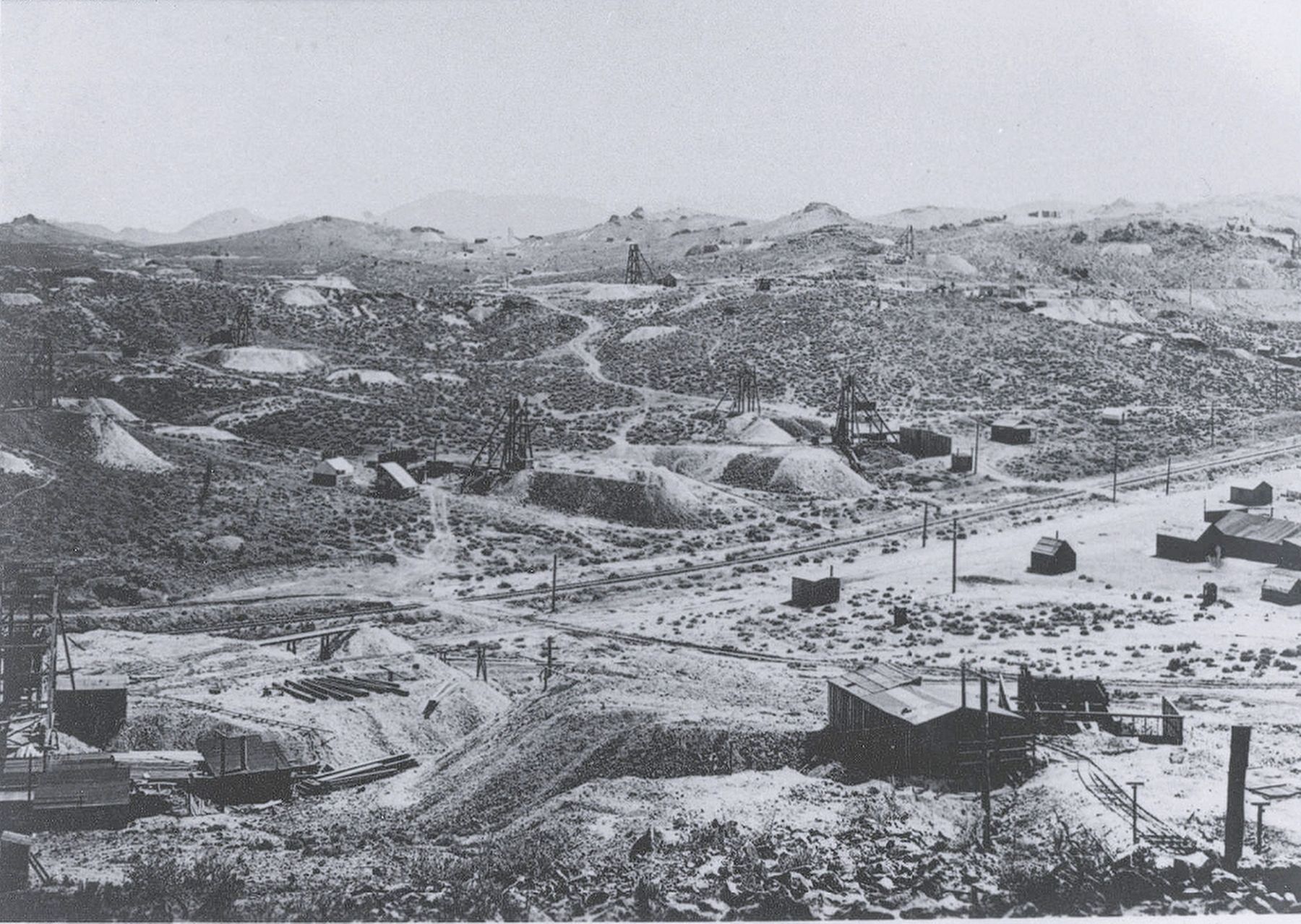
3. Goldfield Mining District, 1907
Looking east from Florence hill. The numerous mines are only a few of the hundreds operating the district at the time. The newly completed tracks of the Bullfrog Goldfield Railroad, one of four serving Goldfield, can be seen in the center of the photo. Milltown, one of Goldfield's four satellite camps, appears on the right.
Credits. This page was last revised on May 8, 2026. It was originally submitted on April 11, 2018, by Douglass Halvorsen of Klamath Falls, Oregon. This page has been viewed 475 times since then and 48 times this year. Photos: 1, 2, 3. submitted on April 11, 2018, by Douglass Halvorsen of Klamath Falls, Oregon. • Andrew Ruppenstein was the editor who published this page.
