St. James's in City of Westminster in Greater London, England, United Kingdom — Northwestern Europe (the British Isles)
Norfolk House
(Operations Torch and Overlord Headquarters)
Photographed by Andrew Ruppenstein, March 15, 2018
1. Norfolk House (Operations Torch and Overlord) Marker
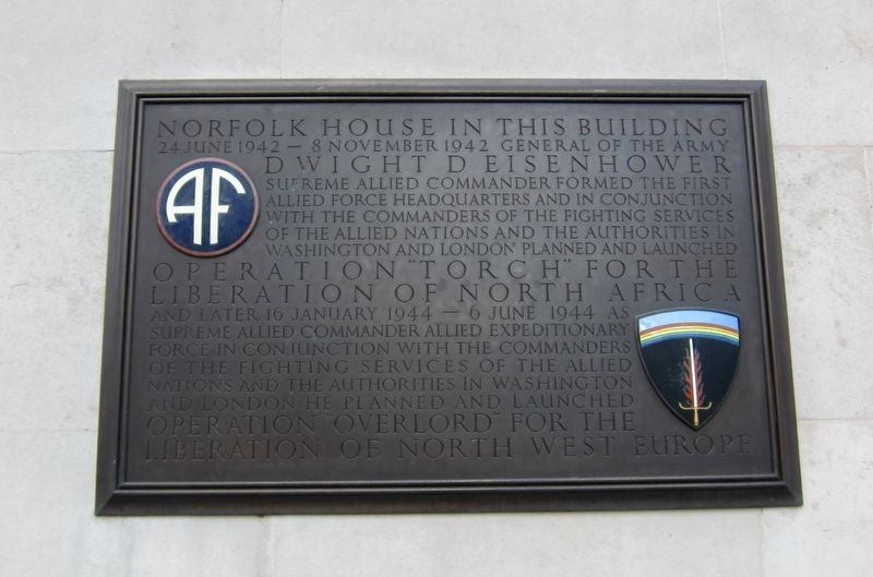
In this buiding 24 June 1942 - 8 November 1942 General of the Army Dwight D Eisenhower Supreme Allied Commander formed the first Allied force headquarters and in conjunction with the commanders of the fighting services of the Allied nations and the authorities in Washington and London planned and launched Operation "Torch" for the Liberation of North Africa and later 16 January 1944 - 6 June 1944 as Supreme Allied Commander Allied Expeditionary Force in conjunction with the commanders of the fighting services of the Allied nations and authorities in Washington and London he planned and launched Operation "Overlord" for the liberation of North West Europe
Topics and series. This historical marker is listed in this topic list: War, World II. In addition, it is included in the Former U.S. Presidents: #34 Dwight D. Eisenhower series list. A significant historical date for this entry is June 24, 1942.
Location. 51° 30.434′ N, 0° 8.048′ W. Marker is in City of Westminster, England, in Greater London. It is in St. James's. It is on St Jame's Square just north of Pall Mall, on the left when traveling south. Touch for map. Marker is at
this page online

Regionally, this marker is in London and in the Greater South East. Globally, it is on the Atlantic Ocean, in the North Atlantic Region, in Europe, in Atlantic Europe, on one of the British Isles, in the Western World, and in the Anglosphere. Historically, it finds itself in what was once the Roman Empire.
Other nearby markers. At least 8 other markers are within walking distance of this marker: Eisenhower's D-Day Headquarters (a few steps from this marker); Yvonne Fletcher (about 90 meters away, measured in a direct line); Frederick Winsor (about 90 meters away); Nancy Astor (about 90 meters away); Brigade of Guards (about 90 meters away); Air Chief Marshal Sir Keith Park (1892 - 1975) (about 120 meters away); Robert Falcon Scott (about 150 meters away); The Waterloo Way (about 150 meters away). Touch for a list and map of all markers in City of Westminster.
Also see . . .
1. Operation Torch (Wikipedia). "Operation Torch (initially called Operation Gymnast) was the Anglo-American
Photographed by Andrew Ruppenstein, March 15, 2018
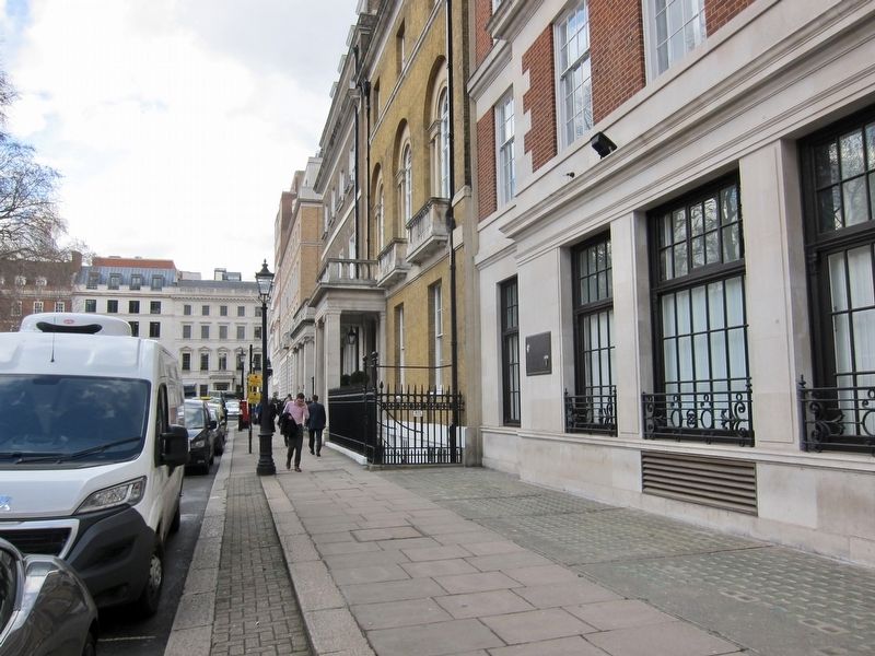
2. Norfolk House Marker - Wide View
2. Operation Overlord (Wikipedia). "Operation Overlord was the codename for the Battle of Normandy, the Allied operation that launched the successful invasion of German-occupied Western Europe during World War II. The operation was launched on 6 June 1944 with the Normandy landings (Operation Neptune, commonly known as D-Day). A 1,200-plane airborne assault preceded an amphibious assault involving more than 5,000 vessels. Nearly 160,000 troops crossed the English Channel on 6 June, and more than two million Allied troops were in France by the end of August." (Submitted on April 26, 2018.)
Additional keywords. St Jame's
Photographed by Andrew Ruppenstein, March 15, 2018
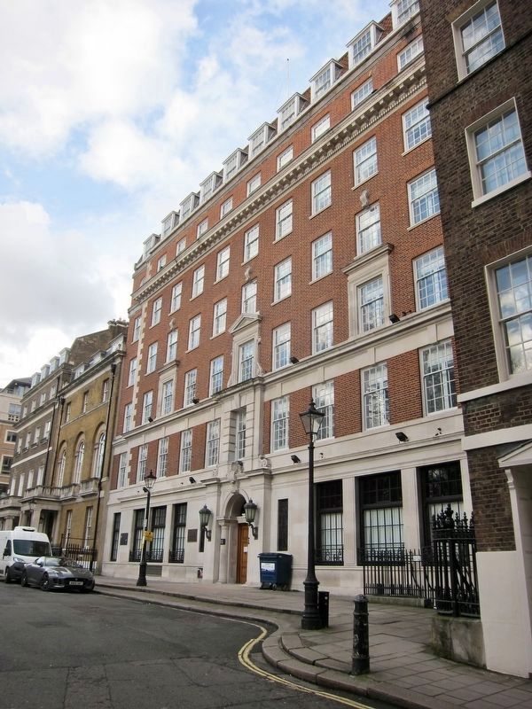
3. Norfolk House and Markers - Wide View
Both the Norfolk House (left) and Eisenhower's Headquarters (right) markers are visible here, both to the left of the building entrance.
Credits. This page was last revised on January 27, 2022. It was originally submitted on April 26, 2018, by Andrew Ruppenstein of Lamorinda, California. This page has been viewed 354 times since then and 25 times this year. Photos: 1, 2, 3. submitted on April 26, 2018, by Andrew Ruppenstein of Lamorinda, California.
