
Liberty in Liberty County, Texas — The American South (West South Central)
Liberty Methodist Church
| — | United Methodist Church Registered Historic Site No. 121 | — |
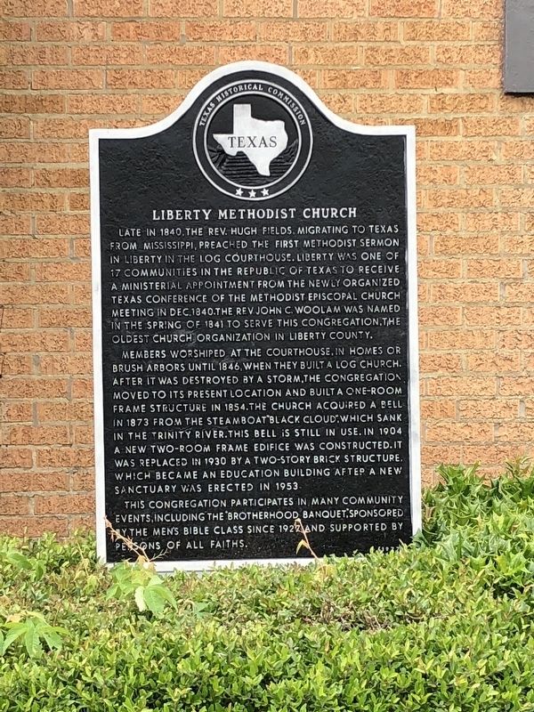
Photographed by Brian Anderson, April 22, 2018
1. Liberty Methodist Church Marker
Members worshiped at the Courthouse, in home or brush arbors until 1846, when they built a log church. After it was destroyed by a storm, the congregation moved to its present location and built a one-room frame structure in 1854. The church acquired a bell in 1873 from the steamboat "Black Cloud", which sank in the Trinity River. This bell is still in use. In 1904 a new two-room frame edifice was constructed. It was replaced in 1930 by a two-story brick structure, which became an education building after a new sanctuary was erected in 1953.
This congregation participates in many community events, including the "Brotherhood Banquet", sponsored by the
this page online
Erected 1977 by Texas Historical Commission. (Marker Number 9673.)
Topics and series. This historical marker is listed in this topic list: Religion & Religious Structures. In addition, it is included in the United Methodist Church Historic Sites series list.
Location. 30° 3.643′ N, 94° 47.763′ W. Marker is in Liberty, Texas, in Liberty County. It is on Main Street, on the right when traveling south. Touch for map. Marker is at or near this postal address: 539 Main Street, Liberty TX 77575, United States of America. Touch for directions.

Regionally, this marker is in the Houston Metropolitan Area. It is also in the American South and on the Gulf Coast. Globally, it is in North America, a Gulf of Mexico state, the Western Hemisphere, the Western World, and the Anglosphere. Historically, it finds itself in what was once New Spain, the Republic of Texas, and one of the Confederate States of America.
Other nearby markers. At least 8 other markers are within walking distance of this marker: Liberty County Bank
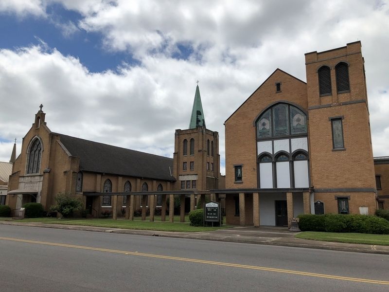
Photographed by Brian Anderson, April 22, 2018
2. Liberty Methodist Church
Credits. This page was last revised on August 20, 2023. It was originally submitted on April 26, 2018, by Brian Anderson of New Albany, Ohio. This page has been viewed 540 times since then and 63 times this year. Photos: 1, 2. submitted on April 26, 2018, by Brian Anderson of New Albany, Ohio. • Andrew Ruppenstein was the editor who published this page.
