Twentynine Palms in San Bernardino County, California — The American West (Pacific Coastal)
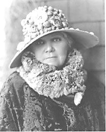
Minerva Hamilton Hoyt
Apostle of the Cacti
Photographed by Michael Kindig, June 5, 2010
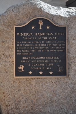
1. Minerva Hamilton Hoyt Marker
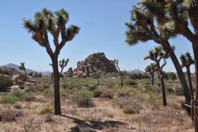
Her tireless efforts to establish Joshua Tree National Monument contributed to a heightened appreciation, not only of the Joshua Tree, but of the total desert environment.
Erected 1980 by Billy Holcomb Chapter No. 1069 E Clampus Vitus. (Marker Number 23.)
Topics and series. This historical marker is listed in these topic lists: Charity & Public Work • Education • Horticulture & Forestry. In addition, it is included in the E Clampus Vitus series list.
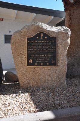
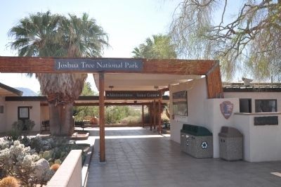
Location. 34° 7.716′ N, 116° 2.259′ W. Marker is in Twentynine Palms, California, in San Bernardino County. It is at the intersection of Utah Trail and National Park Drive, on the right when traveling south on Utah Trail. Marker is located in the courtyard of the Joshua Tree National Park Headquarters and Visitor Center. Touch for map. Marker is at or near this postal address: 74485 National Park Drive, Twentynine Palms CA 92277, United States of America. Touch for directions.

Regionally, this marker is in Greater Los Angeles, in the Coachella Valley, in the Peninsular Ranges, and specifically in the Transverse Ranges. It is also in the American Southwest. Globally, it is in North America, on the Ring of Fire, on the Pacific Rim, in the Western Hemisphere, in the Western World, and in the Anglosphere. Historically, it finds itself in what was once New Spain and also Mexico’s Alta California.
Other nearby markers. At least 8 other markers are within 2 miles of this marker, measured as the crow flies: Champion of the Desert (within shouting distance of this marker); Oasis of Mara (approx. one mile away); The Desert Trail (approx. 1.2 miles away); Keys' Desert Queen Ranch (approx. 1.2 miles away); Jack Cones (approx. 1.2 miles away); Cattle Days in Hidden Valley (approx. 1.2 miles
this page online
More about this marker. See nearby marker Champion of the Desert.
Regarding Minerva Hamilton Hoyt. Mrs. Hoyt became aware of the "mining" of the desert vegetation which was being used for landscaping in the Los Angeles area. Her efforts were too late to prevent the stripping of an area just north of the modern I-10 and SR-62 junction, known as "Devils Garden." The Devil's Garden area received this name as its variety of cacti and other desert plants made it a very forbidding habitat.
Source: Billy Holcomb Chapter 1069 35th Anniversary Plaque Book by Phillip Holdaway
Additional commentary.
1. Joshua Trees
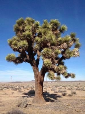
The Joshua Tree is a yucca native to the Southwest. It's distinctive shape was noted by Mormon Pioneers who named them after a line from the Book of Joshua: "Thou shall follow the way pointed to thee by trees"
— Submitted December 30, 2011.
Photographed by Michael Kindig, June 5, 2010
2. Minerva Hamilton Hoyt Marker
Photographed by Michael Kindig, June 5, 2010
3. Joshua Tree National Park Visitor Center
Photographed by Michael Kindig, June 5, 2010
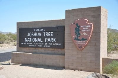
4. Joshua Tree National Park
Photographed by National Park Service
5. Minerva Hamilton Hoyt
Photographed by Michael Kindig, June 5, 2010
6. Joshua Tree Forest (Yucca brevifolia)
Photographed by Dean Whittle, December 31, 2011
7. Joshua Tree
Credits. This page was last revised on October 16, 2024. It was originally submitted on December 18, 2011, by Michael Kindig of Elk Grove, California. This page has been viewed 1,203 times since then and 25 times this year. Last updated on April 27, 2018, by Cosmos Mariner of Cape Canaveral, Florida. Photos: 1. submitted on December 18, 2011, by Michael Kindig of Elk Grove, California. 2, 3, 4. submitted on December 23, 2011, by Michael Kindig of Elk Grove, California. 5. submitted on December 20, 2011, by Michael Kindig of Elk Grove, California. 6. submitted on December 31, 2011, by Michael Kindig of Elk Grove, California. 7. submitted on December 31, 2011, by Dean Whittle of San Diego, California. • Syd Whittle was the editor who published this page.
