
Sweetwater in Monroe County, Tennessee — The American South (East South Central)
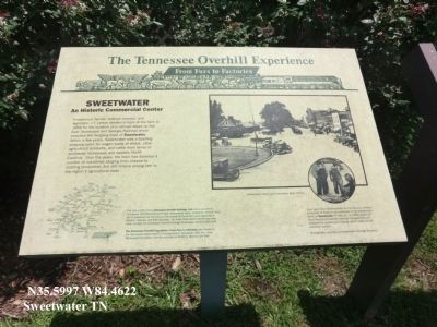
The Tennessee Overhill Experience
From Furs to Factories
| — | Sweetwater-An Historic Commercial Center | — |
Photographed by Don Morfe, July 28, 2013
1. The Tennessee Overhill Experience Marker
(Inscription under the photo in the upper right)
Sweetwater Depot and downtown, circa 1910s.
(Inscription under the photo in the lower right)
Each year, from mid-November to mid-January, millions of pounds of tobacco are auctioned in the warehouses north of Sweetwater on Hwy 11. In 1985, export of local tobacco to national markets changed from rail transport to commercial trucking, which relies on the interstate system. Photographs courtesy of Sweetwater Heritage Museum.
Erected by Tennessee Department of Transportation and others.
Topics and series.
this page online
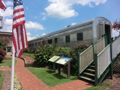
Location. 35° 35.979′ N, 84° 27.728′ W. Marker is in Sweetwater, Tennessee, in Monroe County. It is on North Main Street (U.S. 11) north of East Walnut Street, on the right when traveling north. The marker is located on the grounds of the Sweetwater Depot. Touch for map. Marker is in this post office area: Sweetwater TN 37874, United States of America. Touch for directions.

Regionally, this marker is in East Tennessee. It is also in the American South, specifically in the Upper South, in Appalachia, and specifically in Southern Appalachia. Globally, it is in North America, the Western Hemisphere, the Western World, and the Anglosphere. Historically, it finds itself in what was once the original Cherokee Nation, the territory of the Mississippian Culture, one of the Confederate States of America, and the Antebellum South.
Other nearby markers. At least 8 other markers are within 5 miles of this marker,
Photographed by Don Morfe, July 28, 2013
2. The Tennessee Overhill Experience Marker
Related markers. Click here for a list of markers that are related to this marker. The Tennessee Overhill Experience
Photographed by Tom Bosse, May 16, 2026
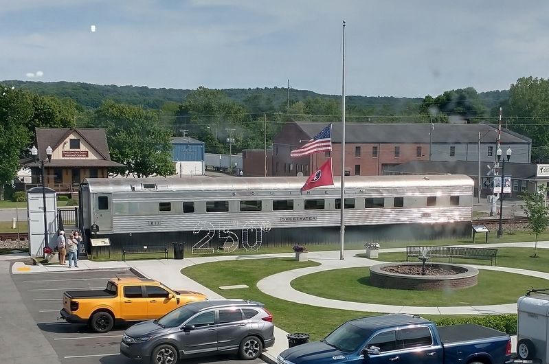
3. The Tennessee Overhill Experience Marker
This marker has been moved. It is now at the left-hand side of the rail car.

Photographed by Tom Bosse, May 16, 2026
4. The Tennessee Overhill Experience Marker
This marker has been moved. It is now at the left-hand side of the rail car.
Credits. This page was last revised on May 20, 2026. It was originally submitted on October 15, 2013, by Don Morfe of Baltimore, Maryland. This page has been viewed 971 times since then and 44 times this year. Last updated on May 5, 2018, by Byron Hooks of Sandy Springs, Georgia. Photos: 1, 2. submitted on October 15, 2013, by Don Morfe of Baltimore, Maryland. 3, 4. submitted on May 17, 2026, by Tom Bosse of Jefferson City, Tennessee. • Bill Pfingsten was the editor who published this page.
