
Harper in Gillespie County, Texas — The American South (West South Central)
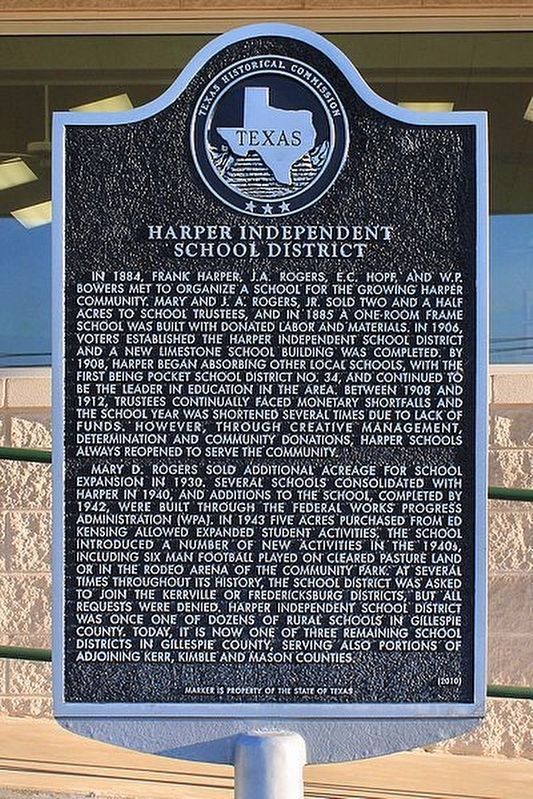
Harper Independent School District
Photographed by Larry D. Moore, March 14, 2017
1. Harper Independent School District Marker
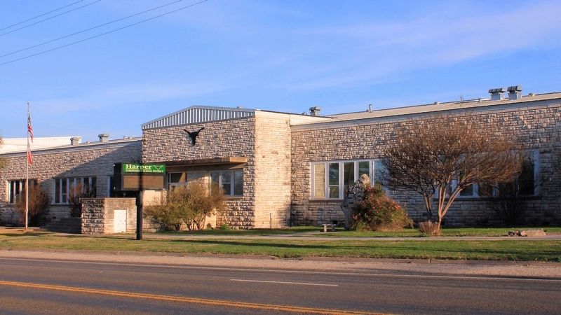
Mary D. Rogers sold additional acreage for school expansion in 1930. Several schools consolidated with Harper in 1940, and additions to the school, completed by 1942, were built through the federal Works Progress Administration (WPA). In 1943 five acres purchased from Ed Kensing allowed expanded student activities. The school introduced a number of new activities in the 1940s, including six man football played on cleared pasture land or in the rodeo arena of the community park. At several times throughout its history, the school district was asked to join the Kerrville or Fredericksburg districts, but all requests were denied. Harper Independent School District was once one of dozens of rural schools in Gillespie County. Today, it is now one of three remaining school districts in Gillespie County, serving also portions of adjoining Kerr, Kimble and Mason Counties.
Erected 2010 by Texas Historical Commission. (Marker Number 16502.)
Topics. This historical marker is listed in this topic
this page online
Location. 30° 18.011′ N, 99° 14.558′ W. Marker is in Harper, Texas, in Gillespie County. It is at the intersection of U.S. 290 and Ranch to Market Road 783, on the right when traveling west on U.S. 290. Touch for map. Marker is at or near this postal address: 23122 US-290, Harper TX 78631, United States of America. Touch for directions.

Regionally, this marker is in the Hill Country. Globally, it is in North America, a Gulf of Mexico state, the Western Hemisphere, the Western World, and the Anglosphere. Historically, it finds itself in what was once New Spain, the Republic of Texas, and one of the Confederate States of America.
Other nearby markers. At least 8 other markers are within 13 miles of this marker, measured as the crow flies: Site of the McDonald Massacre (approx. 0.3 miles away); Harper Community Park (approx. 0.3 miles away); St. James Lutheran Church (approx. 0.8 miles away); The Dowdy Tragedy of 1878 (approx. 11.7 miles away); Sunset Cemetery (approx. 11.9 miles away); Doss School (approx. 12 miles away); St. Peter Lutheran Church (approx. 12 miles
Photographed by Larry D. Moore, March 14, 2017
2. Harper School Addition
Credits. This page was last revised on May 28, 2018. It was originally submitted on May 26, 2018, by Larry D. Moore of Del Valle, Texas. This page has been viewed 559 times since then and 56 times this year. Photos: 1, 2. submitted on May 26, 2018, by Larry D. Moore of Del Valle, Texas. • Bernard Fisher was the editor who published this page.
