
Port Lavaca in Calhoun County, Texas — The American South (West South Central)
Calhoun County Hurricanes

Photographed by Mansfieldphoto.com, November 15, 2025
1. Calhoun County Hurricanes Marker
Erected 2001 by Texas Historical Commission. (Marker Number 12452.)
Topics. This historical marker is listed in this topic list: Disasters.
Location. 28° 36.788′ N, 96° 37.568′ W. Marker is in Port Lavaca, Texas, in Calhoun County. It is at the intersection of South Ann Street and West Live Oak Street, on the right when traveling south on South Ann Street. Marker is located on the courthouse grounds. Touch for map. Marker is at or near this postal address: 211 South Ann Street, Port Lavaca TX 77979, United States of America. Touch for directions.

Regionally, this marker is in the American South and on the Gulf Coast. Globally, it is in North America, a Gulf of Mexico state, the Western Hemisphere, the Western World, and the Anglosphere. Historically, it finds itself in what was once New Spain, the Republic of Texas, and one of the Confederate States of America.
Other nearby markers. At least 8 other markers are within walking distance of this marker: Calhoun County Participation During World War II (here, next to this marker); Howard G. Hartzog, Sr. (here, next to this marker); San Antonio & Mexican Gulf Railroad (approx. 0.2 miles away); Wood Barrels of Cement (approx. 0.2
this page online
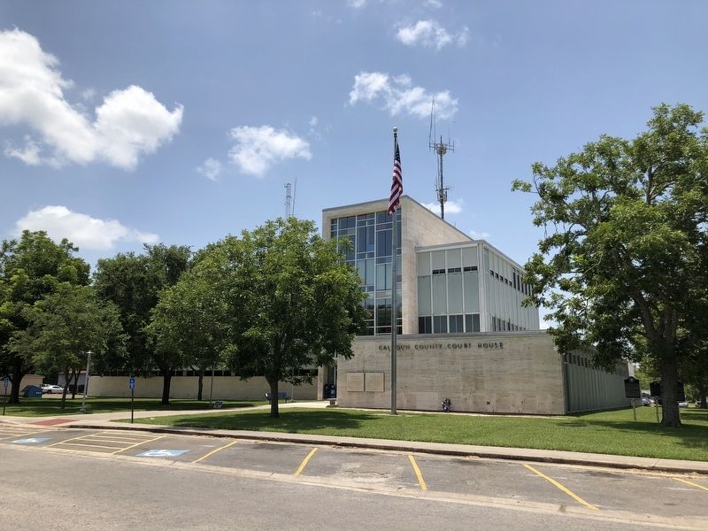
Photographed by Brian Anderson, July 21, 2018
2. Calhoun County Hurricanes Marker
Marker can be seen under the tree to the right of the photo. Visible markers from left to right are: Howard Gallemore Hartzog, Sr., Calhoun County Hurricanes, and Calhoun County Participation During World War II.

Photographed by Brian Anderson, July 21, 2018
3. Calhoun County Hurricanes Marker
Credits. This page was last revised on November 20, 2025. It was originally submitted on July 23, 2018, by Brian Anderson of New Albany, Ohio. This page has been viewed 546 times since then and 37 times this year. Photos: 1. submitted on November 20, 2025, by James Hulse of Medina, Texas. 2, 3. submitted on July 23, 2018, by Brian Anderson of New Albany, Ohio. • Andrew Ruppenstein was the editor who published this page.
