
Myrtle Beach in Horry County, South Carolina — The American South (South Atlantic)
Base Operations
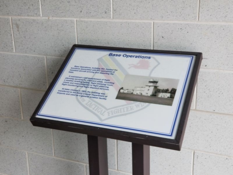
Photographed by Charles Keller, July 24, 2018
1. Base Operations Marker
It maintained a full complement of flight planning services for transient pilots, including a weather briefing facility, flight planning room, charts and maps essential to flight planning, flight monitoring and flight dispatch services.
At base closure in 1993, the building was transferred to the Horry County Department of Airports and used as a general aviation facility.
Topics. This historical marker is listed in this topic list: Military.
Location. 33° 40.419′ N, 78° 56.062′ W. Marker is in Myrtle Beach, South Carolina, in Horry County. It can be reached from the intersection of Airdrome Avenue and Huger Street, on the left when traveling south. In doorway to General Aviation Building. Touch for map. Marker is at or near this postal address: 1250 Airdrome Ave #362, Myrtle Beach SC 29577, United States of America. Touch for directions.

Regionally, this marker is on South Carolina’s Grand Strand and in the Pee Dee. It
this page online
Other nearby markers. At least 8 other markers are within walking distance of this marker: Dental Clinic (approx. 0.2 miles away); 355th Tactical Fighter Squadron (approx. 0.2 miles away); 355th Tactical Fighter Squadron Operations (approx. 0.2 miles away); 356th Tactical Fighter Squadron (approx. ¼ mile away); Base Supply (approx. ¼ mile away); Auto Craft Center (approx. ¼ mile away); Audio Visual Facility (approx. ¼ mile away); 356th Tactical Fighter Squadron Operations (approx. 0.3 miles away). Touch for a list and map of all markers in Myrtle Beach.
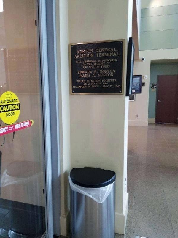
Photographed by Charles Keller, July 24, 2018
2. Norton General Aviation Terminal
to the memory of
the Norton twins
Edward R. Norton
James A. Norton
Killed in action together
in a Martin B26
Marauder in WWII - May 17, 1943
Credits. This page was last revised on July 25, 2018. It was originally submitted on July 25, 2018, by Charles Keller of Myrtle Beach, South Carolina. This page has been viewed 274 times since then and 10 times this year. Photos: 1, 2. submitted on July 25, 2018, by Charles Keller of Myrtle Beach, South Carolina. • Bernard Fisher was the editor who published this page.
Editor’s want-list for this marker. A wide shot of the marker and its surroundings. • Can you help?
