Castle Rock in Douglas County, Colorado — The American Mountains (Southwest)
Founders Village
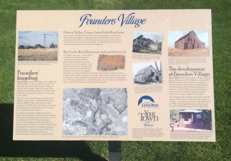
Frank X. Flierl and Frank Hagg were neighboring homesteaders on the southern portion of the land that would become Founders Village in the late 20th century. They, like many other residents of the Ridge Road-Lower Lake Gulch Road area, emigrated from Bavaria, Germany, in the 1880s.
Flierl, his wife, Anna Ehmann, and their five children "proved up" on 160 Homestead Act acres by 1899 to add to the 120 acres they purchased in 1892. They raised dairy cattle and worked hard to farm the thin layer of topsoil that overlaid the rocky terrain.
In addition to farming, Flierl joined stone mason John Ehmann to build the first Catholic church in Douglas County. St. Francis of Assisi was dedicated in 1889. Flierl also worked for $1 a day, building Castlewood Dam on Cherry Creek. His eldest son, John Frank Flierl, continued the tradition of farming, ranching and working as a part-time mason, helping to build Charlford Castle, now known as Cherokee Castle and Ranch, outside Sedalia.
In contrast to the West Plum Creek section of Douglas County, which was settled by Protestant emigrants from the British Isles, this area was predominantly Catholic, with marriages, funerals and church services conducted in both German and English. The Methodist preachers who rode circuit through the area also were bilingual.
5.5 million years ago, a subtropical rainforest covered the land now occupied by Founders Village. One of the most common fossils left from this time is petrified wood. Petrified wood forms underground, when wood becomes buried under sediment. Over time, the organic materials are replaced with minerals while retaining the original structure of the wood in detail. Features such as tree rings and the various tissues often are observed. Today, fragments of petrified wood can be found in the Founders area. This stone remains as a colorful reminder of the Castle Rock Rainforest and its 100-foot-tall trees that were 4 feet in diameter.
John Frank Flierl, Hagg and Guy Anderson sold their properties to Albert Mikelson about 1945. Mikelson and his four children continued to farm until they sold the land to Park Funding for development. Park Funding defaulted on payment, and the Mikelson family developed a small part of Founders Village themselves before the company regained ownership.
The early Founders Village consisted of only 85 houses. There were no public services, parks or schools or even snow removal - the first winter of 1985. Rock Ridge Elementary School and Founders Park both opened in the late 1980s.
Photo captions:
Top left: The former Hagg homestead in what today is Founders Village. Note the decorative fish scale detailing on the house.
Middle bottom: An aerial photo of the area of Castle Rock that now is Founders Village as it looked in 1975.
Middle top: Nothing remains today of the 1½ story stone house, milk house and barn the Flierl family built in the 1880s and 1890s.
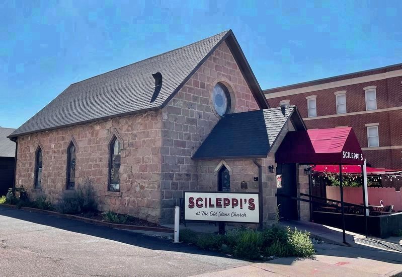
Middle right: Frank X. Flierl, who once owned the land that became Founders Village, helped build the old St. Francis of Assisi Church, which today is The Old Stone Church restaurant.
Top right: By 2000, little was left to commemorate the hard work of Founders' founders. Local historians Clyde Jones and Kent Brandebery photographed what was left of the homesteads just before they were bulldozed.
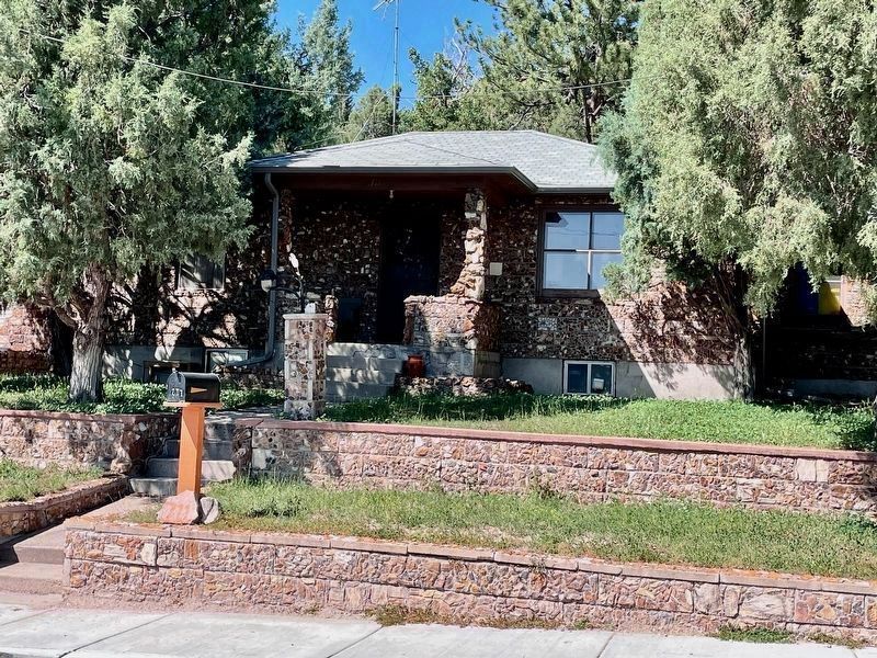
Bottom right: After John Frank Flierl sold his ranch, he and his wife, Henrietta, moved into Town and built their house at 711 Sixth St. of petrified wood they'd collected over the years in Douglas County.
Erected by the Town of Castle Rock.
Topics. This historical marker is listed in these topic lists: Churches & Religion • Settlements & Settlers. A significant historical year for this entry is 1899.
Location.
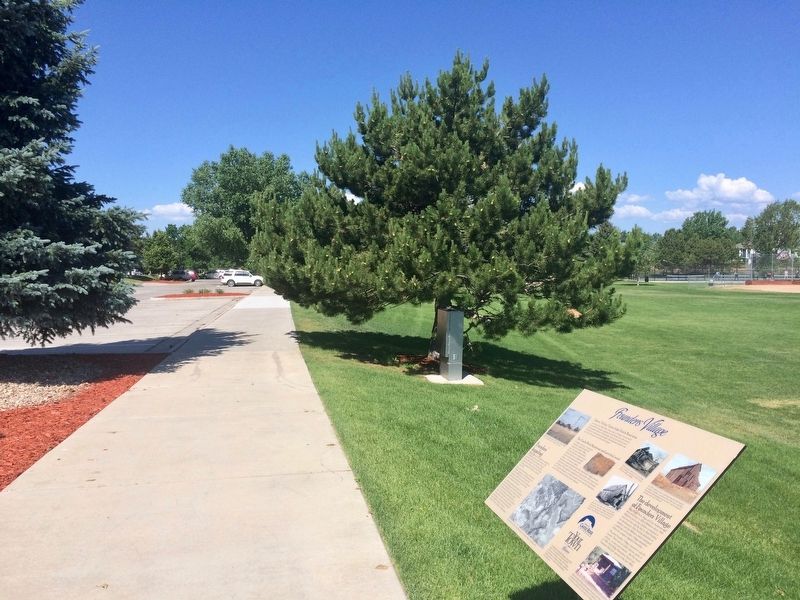
39° 22.189′ N, 104° 48.775′ W. Marker is in Castle Rock, Colorado, in Douglas County. Marker can be reached from Enderud Boulevard, on the right when traveling west. Located next to the Founders Park parking lot. Touch for map. Marker is in this post office area: Castle Rock CO 80104, United States of America. Touch for directions.
Other nearby markers. At least 8 other markers are within 4 miles of this marker, measured as the crow flies. City Hotel (approx. 2½ miles away); Rock Park (approx. 2½ miles away); Good Roads in Colorado / The Great North-South Highway (approx. 2½ miles away); The Rock / Gray Gold (approx. 2½ miles away); Keystone Hotel (approx. 2½ miles away); Victoria’s House (approx. 2.6 miles away); Denver & Rio Grande Railroad Depot (approx. 2.7 miles away); Franktown (approx. 3½ miles away). Touch for a list and map of all markers in Castle Rock.
Additional commentary.
1. Frank Flierl and Frank Hagg
Frank Flierl and Frank Hagg were brothers in law. Flierl was Married to Anna Ehmann and Hagg was married to Margaret Ehmann. Both were Simon and Anna Meir Ehmann’s daughters. Note To Editor only visible by Contributor and editor
— Submitted December 5, 2023, by Daniel Mikelson of Castle Rock, Colorado.

Photographed By Mark Hilton, September 6, 2023
4. The Old Stone Church
(Now Scileppi's restaurant at 210 3rd Street)
(Now Scileppi's restaurant at 210 3rd Street)
Built in 1888, the former St Francis of Assisi Catholic Church was the first one built in Castle Rock. In 1966, the parish built a larger church east of town and abandoned the building. It sat dormant until 1975 when it was converted into this restaurant.
Credits. This page was last revised on December 22, 2023. It was originally submitted on July 25, 2018, by Mark Hilton of Montgomery, Alabama. This page has been viewed 761 times since then and 83 times this year. Photos: 1, 2. submitted on July 25, 2018, by Mark Hilton of Montgomery, Alabama. 3, 4. submitted on September 7, 2023, by Mark Hilton of Montgomery, Alabama.


