Near Brookneal in Campbell County, Virginia — The American South (Mid-Atlantic)
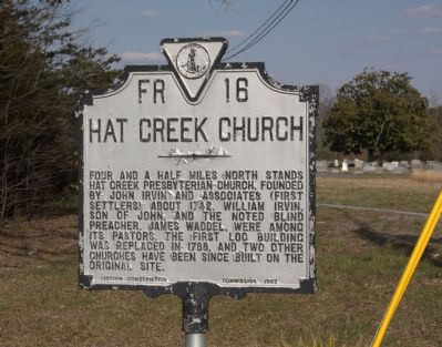
Hat Creek Church
American Presbyterian and Reformed Historical Site
Erected 1947 by Virginia Conservation Commission. (Marker Number FR-16/210.)
Topics and series. This historical marker is listed in this topic list: Churches & Religion. In addition, it is included in the American Presbyterian and Reformed Historic Sites, and the Virginia Department of Historic Resources (DHR) series lists. A significant historical year for this entry is 1742.
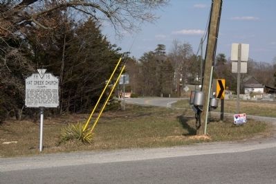
Location. 37° 4.68′ N, 78° 55.026′ W. Marker is near Brookneal, Virginia, in Campbell County. Marker is at the intersection of Swinging Bridge Road (County Route 605) and Wickliffe Road (Virginia Route 40), on the right when traveling west on Swinging Bridge Road. Touch for map. Marker is in this post office area: Brookneal VA 24528, United States of America. Touch for directions.
Other nearby markers. At least 8 other markers are within 4 miles of this marker, measured as the crow flies. Patrick Henry’s Grave (approx. one mile away); Birthplace of General Pick (approx. 2.4 miles away); Red Hill (approx. 2.6 miles away); a different marker also named Patrick Henry’s Grave (approx. 2.6 miles away); a different marker also named Patrick Henry’s Grave (approx. 2.6 miles away); Slave and African American Cemetery (approx. 3.2 miles away); Quarter Place Trailhead (approx. 3.2 miles away); a different marker also named Red Hill (approx. 3.3 miles away). Touch for a list and map of all markers in Brookneal.
Regarding Hat Creek Church. Hat Creek Church is one of 445 American Presbyterian and Reformed Historical Sites registered between 1973 and 2003 by the Presbyterian Historical Society (PHS), headquartered in Philadelphia. Approved sites received a metal plaque featuring John Calvin’s seal and the site’s registry number (PHS marker location unknown).
The following text is taken from the Presbyterian Historical Society website:
There were less than a half dozen Presbyterian church buildings in all of Virginia when the Scotch-Irish pioneers in the frontier settlement of Hat Creek built their first log meeting house. Under the leadership of John Irvin, who had come to Virginia from Pennsylvania in pursuit of free land, a house of
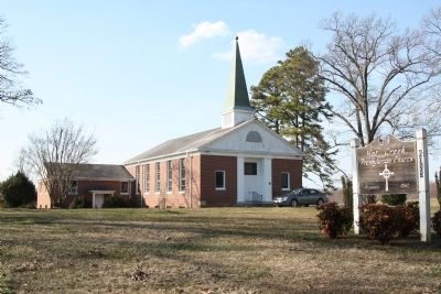
worship was completed in 1742. Rev. Gilbert Tennant of Pennsylvania served as the Hat Creek Church's first pastor. The hill upon which the first meeting house was built has remained the site of all subsequent church edifices. New buildings constructed in 1785, 1810, and 1846 were all frame structures. The present church was completed in 1961.
Also see . . . Campbell Chronicles and Family Sketches, Chapter II. Transcript of 1927 book by R. H. Early. “John Irvine, pioneer of these settlers, came alone into the virgin forest and blazed the way for others who were to follow him. In a wilderness of thirty-five or forty miles extent, he only found one very old white resident. Patenting there a large tract of land he prepared for the settlement of his family upon it, returning to Pennsylvania for them.
“His report of the likelihood of a living being obtainable in this new country induced others to follow, and people then flocked to the neighborhood, for land was cheap and wood for building and for fuel was abundant.
“As soon as they had established themselves in their new homes, Irvine persuaded the settlers to unite with him in building a place of worship, and the first church was given the name Hat Creek from that of the nearby stream. Community interests centered around this church and as its membership became extended through the adjoining country, its influence increased
and it
eventually became the mother of other county churches.” (Submitted on April 13, 2013, by J. J. Prats of Powell, Ohio.)
Credits. This page was last revised on September 7, 2018. It was originally submitted on April 13, 2013, by J. J. Prats of Powell, Ohio. This page has been viewed 791 times since then and 73 times this year. Last updated on August 19, 2018, by Douglass Halvorsen of Klamath Falls, Oregon. Photos: 1, 2, 3. submitted on April 13, 2013, by J. J. Prats of Powell, Ohio. • Bill Pfingsten was the editor who published this page.


