D'Iberville in Harrison County, Mississippi — The American South (East South Central)
Fort Maurepas and Old Biloxi
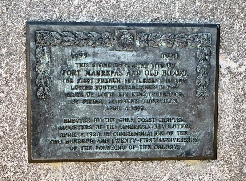
1699 1920
Fort Maurepas and Old Biloxi,
the first French settlement in the
lower south, established in the
name of Louis XIV King of France,
by Pierre Le Moyne D'Iberville
April 8, 1699.
Erected by the Gulf Coast Chapter,
Daughters of the American Revolution,
April 8, 1920, in commemoration of the
Two-Hundred and Twenty-First Anniversary
of the founding of the colony.
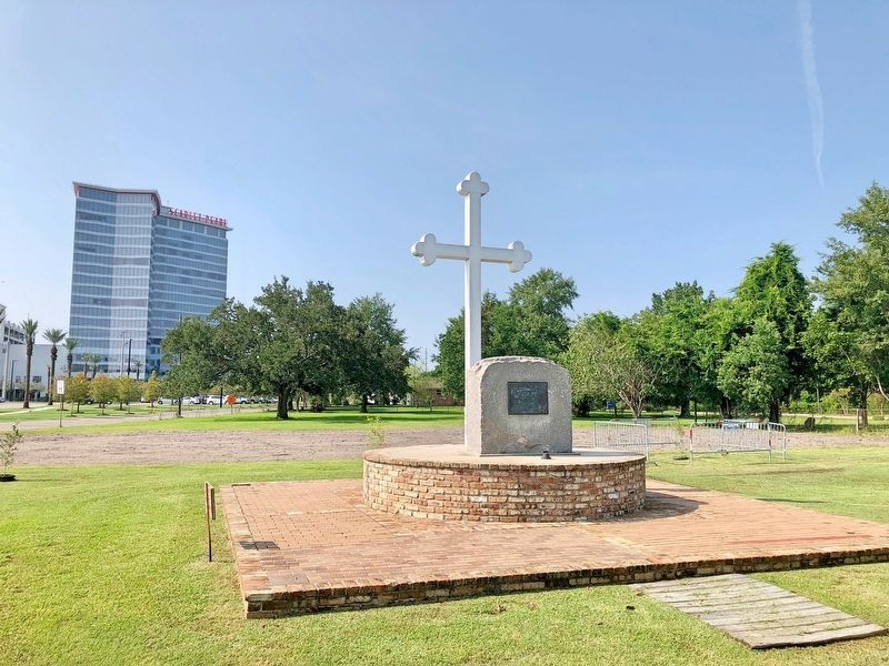
Erected 1920 by the Gulf Coast Chapter, Daughters of the American Revolution.
Topics and series. This historical marker is listed in these topic lists: Forts and Castles • Settlements & Settlers. In addition, it is included in the Daughters of the American Revolution series list. A significant historical date for this entry is April 8, 1699.
Location. 30° 25.682′ N, 88° 53.425′ W. Marker is in D'Iberville, Mississippi, in Harrison County. Marker can be reached from the intersection of Church Avenue and Gorenflo Road, on the right when traveling south. Touch for map. Marker is at or near this postal address: 9600 Church Avenue, Diberville MS 39540, United States of America. Touch for directions.
Other nearby markers. At least 8 other markers are within walking distance of this marker. D'Iberville High School Original Site (within shouting distance of this marker); The Five Trails (about 600 feet away, measured in a direct line); The Quave Commercial Strip (about 600 feet away); The Land and Legend of the Cross (approx. 0.3 miles away); The Crossing (approx. 0.3 miles away); Harvey's Hill (approx. 0.4 miles away); Santa Cruz Landing (approx. half a mile away); The Old Brickyard (approx. 0.6 miles away). Touch for a list and map of all markers in D'Iberville.
Also see . . . Wikipedia article on Fort Maurepas. (Submitted on August 25, 2018, by Mark Hilton of Montgomery, Alabama.)
Credits. This page was last revised on April 30, 2019. It was originally submitted on August 25, 2018, by Mark Hilton of Montgomery, Alabama. This page has been viewed 446 times since then and 46 times this year. Photos: 1, 2. submitted on August 25, 2018, by Mark Hilton of Montgomery, Alabama. 3. submitted on April 30, 2019, by Allen C. Browne of Silver Spring, Maryland. 4. submitted on August 25, 2018, by Mark Hilton of Montgomery, Alabama.


