Coloma in El Dorado County, California — The American West (Pacific Coastal)
Coloma
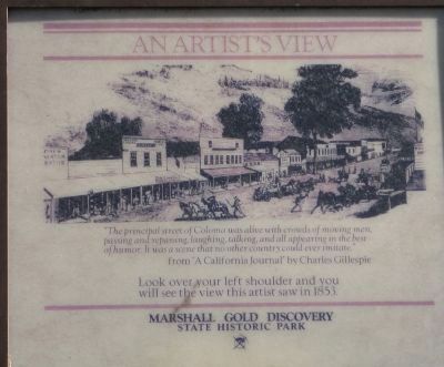
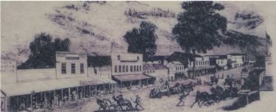
An Artists View
from “A California Journal” by Charles Gillespie
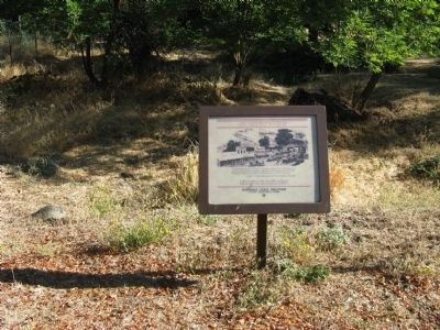
Look over your left shoulder and you will see the view this artist saw in 1853
Erected by Marshall Gold Discovery State Historic Park.
Topics and series. This historical marker is listed in these topic lists: Industry & Commerce • Settlements & Settlers. In addition, it is included in the National Historic Landmarks series list. A significant historical year for this entry is 1853.
Location. 38° 47.978′ N, 120° 53.376′ W. Marker is in Coloma, California, in El Dorado County. Marker is on State Highway 49, on the left when traveling south. Marker is located within the boundaries of the Marshall Gold Discovery State Historic Park. Touch for map. Marker is in this post office area: Coloma CA 95613, United States of America. Touch for directions.
Other nearby markers. At least 8 other markers are within walking distance of this marker. Robert Bell's Store (here, next to this marker); Site of Virginia Saloon (a few steps from this marker); County Courthouse (within shouting distance of this marker); Kane House (within shouting distance of this marker); El Dorado Bath House and Shaving Saloon (within shouting distance of this marker); Papini House (within shouting distance of this marker); Site of the Sierra Nevada House (within shouting distance of this marker); Odd Fellows Hall (within shouting distance of this marker). Touch for a list and map of all markers in Coloma.
Regarding Coloma. Also see: Sutter's Mill Site, James W. Marshall Monument and all nearby Coloma markers for additional information.
Additional commentary.
1. Coloma has been designated as a National Historic Landmark
Statement of Significance (as of designation - July 4, 1961):
The discovery of placer gold at Coloma on January 24, 1848, resulted in the greatest series of gold strikes on the North American continent. The initial strike occurred at a sawmill constructed by land baron John A. Sutter on the South Fork of the American River. Coloma grew up around Sutter's Mill, and became the distributing center from which other mining camps were founded to the north, east, and south. The town died as the deposits were exhausted in the late 1850's.
2004, a Save America's Treasures matching grant in the amount of $200,000 was made to Coloma to stabilize the severely deteriorated Thomas Hansford Williams House, a contributing element in the historic district, in order to prepare for its restoration and opening to the public.
— Submitted October 9, 2008, by Syd Whittle of Mesa, Arizona.
2. National Register of Historic Places
Coloma was placed on the National Register of Historic Places on October 15, 1966.
— Submitted November 3, 2008, by Syd Whittle of Mesa, Arizona.

Photographed By Syd Whittle, October 7, 2008
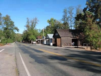
4. Coloma Main Street Today
Photo is taken across the street from marker. Artwork on marker shows west side of road, this photo shows east side of road. First building is the blacksmith shop, third building (with flagpole) is the current Coloma Post Office.
Credits. This page was last revised on July 7, 2019. It was originally submitted on October 9, 2008, by Syd Whittle of Mesa, Arizona. This page has been viewed 2,054 times since then and 27 times this year. Photos: 1, 2, 3, 4. submitted on October 9, 2008, by Syd Whittle of Mesa, Arizona.


