Cap-Saint-Ignace in Chaudière-Appalaches, Québec — Central Canada (French-Canadian)
Les Églises / The Churches
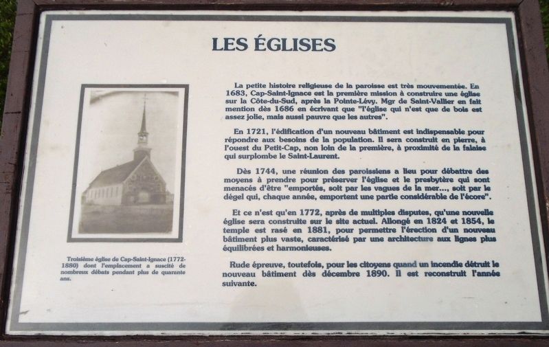
En 1721, l'édification d'un nouveau bâtiment est indispensable pour répondre aux besoins de la population. Il sera construit en pierre, à l'ouest du Petit-Cap, non loin de la première, à proximité de la falaise qui surplombe le Saint-Laurent.
Dès 1744, une réunion des paroissiens a lieu pour débattre des moyens à prendre pour préserver l'église et le presbytère qui sont menacés d'être "emportés, soit par les vagues de la mer..., soit par le dégel qui, chaque année, emportent une partie considérable de l'écore".
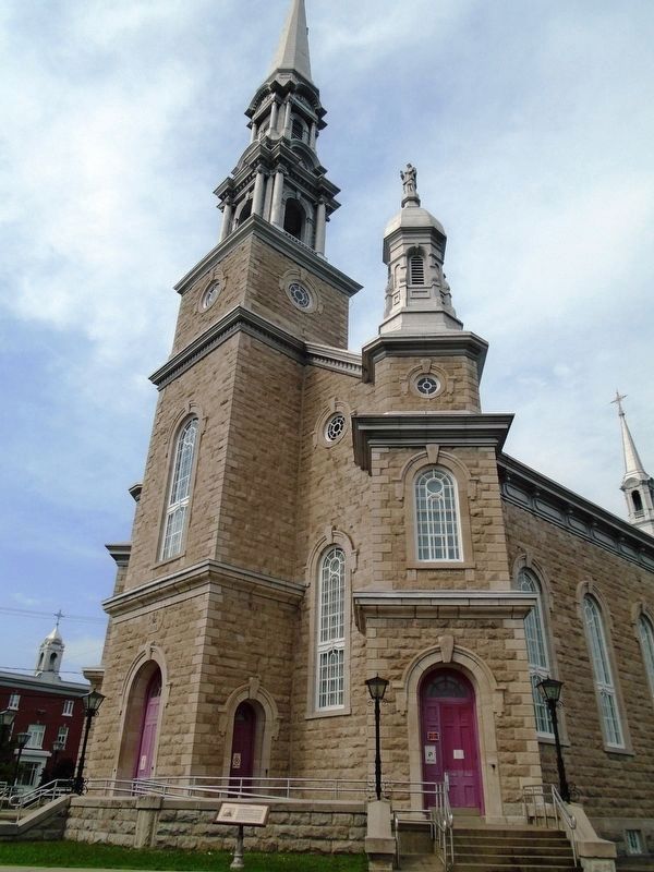
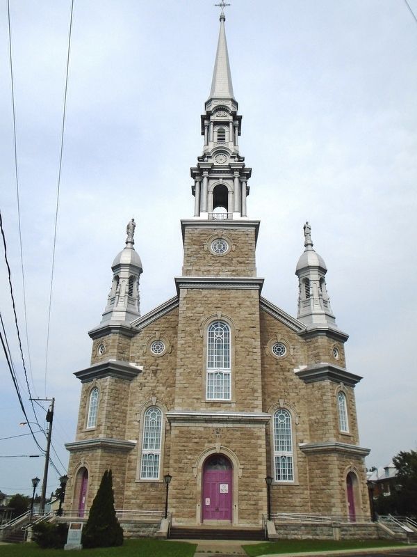
Et ce n'est qu'en 1772, après de multiples disputes, qu'une nouvelle église sera construite sur le site actuel. Allongé en 1824 et 1854, le temple est rasé en 1881, pour permettre l'érection d'un nouveau bâtiment plus vaste, caractérisé par une architecture aux lignes plus équilibrées et harmonieuses.
Rude épreuve, toutefois, pour les citoyens quand un incendie détruit le nouveau bâtiment dès décembre 1890. Il est reconstruit l'année suivante.
[Légende photo lit] Troisième église de Cap-Saint-Ignace (1772-1880) dont l'emplacement a suscité de nombreux débats pendant plus de quarante ans.
[English translation]
The religious history of the parish is quite eventful. In 1683, Cap-Saint-Ignace was the first mission to build a church on the Côte-du-Sud, after Pointe-Lévy. Bishop de Saint-Vallier mentioned this in 1686 when he wrote that "the church, which is only of wood, is pretty but as poor as the others".
In 1721, the construction of a new building was essential to meet the needs of the population. It was built of stone, not far from the first, west of Petit-Cap near the cliff overlooking the St. Lawrence.
About 1744, a meeting of parishioners was held to discuss ways to preserve the church and the presbytery that were threatened with being "washed away by the waves of the sea ..., or by the thaw that, each year, takes away a considerable part of the shoreline".
But it was only in 1772, after many disputes, that a new church was built on the current site. Enlarged in 1824 and 1854, the temple was demolished in 1881, to allow the erection of a new larger building, characterized by an architecture with more balanced and harmonious lines.
It was a tough test, however, for the citizens when a fire destroyed the new building in December 1890. It was rebuilt the following year.
[Photo
caption reads] Third Cap-Saint-Ignace church (1772-1880) whose location has sparked many debates for more than forty years.
Topics. This historical marker is listed in this topic list: Churches & Religion. A significant historical year for this entry is 1683.
Location. 47° 2.273′ N, 70° 27.391′ W. Marker is in Cap-Saint-Ignace, Québec, in Chaudière-Appalaches. Marker is on Place de l'Église just east of rue du Manoir Est, on the left when traveling east. Marker is on the Église Cap-Saint-Ignace grounds. Touch for map. Marker is at or near this postal address: 90-148 rue du Manoir Est, Cap-Saint-Ignace QC G0R 1H0, Canada. Touch for directions.
Other nearby markers. At least 8 other markers are within 21 kilometers of this marker, measured as the crow flies. Pierre Richard (a few steps from this marker); Académie St-Ignace Academy (within shouting distance of this marker); Sir Étienne Paschal Taché (approx. 9.8 kilometers away); War Memorial (approx. 11.8 kilometers away); Joseph-Elzear Bernier (approx. 12 kilometers away); Beaumont-la-Ronce et Anse de Nouzilly (approx. 19.6 kilometers away); Historique du phare du Pilier de Pierre (approx. 19.6 kilometers away); Historique du phare de La Roche à Veillon (approx. 19.6 kilometers away). Touch for a list and map of all markers in Cap-Saint-Ignace.
Also see . . .
1. Église Saint-Ignace-de-Loyola's organ: Casavant, Opus 757, 1918. Organs in Quebec website entry (Submitted on September 24, 2018, by William Fischer, Jr. of Scranton, Pennsylvania.)
2. Église de Cap-Saint-Ignace. Grand Quebec website entry (Submitted on September 24, 2018, by William Fischer, Jr. of Scranton, Pennsylvania.)
Credits. This page was last revised on January 23, 2022. It was originally submitted on September 24, 2018, by William Fischer, Jr. of Scranton, Pennsylvania. This page has been viewed 168 times since then and 15 times this year. Photos: 1, 2, 3. submitted on September 24, 2018, by William Fischer, Jr. of Scranton, Pennsylvania.


