The Key Section of the Fortifications: The Main Wall
Haithabu und Danewerk
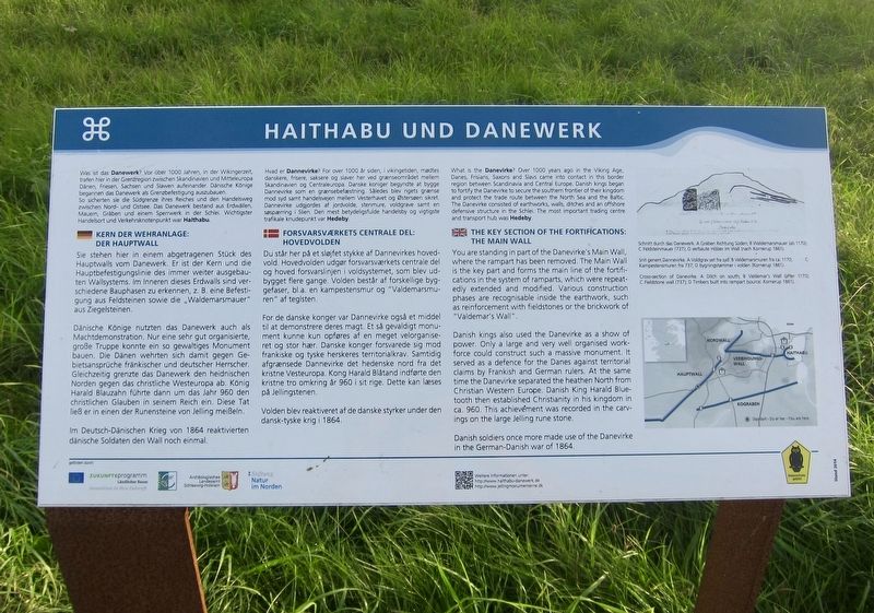
What is the Danevirke? Over 1000 years ago in the Viking Age, Danes, Frisians, Saxons and Slavs came into contact in this border region between Scandinavia and Central Europe. Danish kings began to fortify the Danevirke to secure the southern frontier of their kingdom and protect the trade route between the North Sea and the Baltic. The Danevirke consisted of earthworks, walls, ditches and an offshore defensive structure in the Schlei. The most important trading centre and transport hub was Hedeby.
THE KEY SECTION OF THE FORTIFICATIONS: THE MAIN WALL
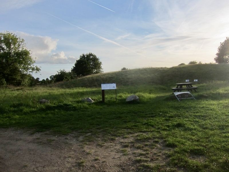
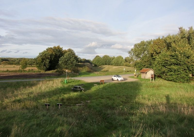
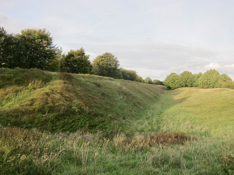
You are standing in part of the Danevirke's Main Wall, where the rampart has been removed. The Main Wall is the key part and forms the main line of the fortifications in the system of ramparts, which were repeatedly extended and modified. Various construction phases are recognisable inside the earthwork, such as reinforcement with fieldstones or the brickwork of "Valdemar's Wall".
Danish kings also used the Danevirke as a show of power. Only a large and very well organised workforce could construct such a massive monument. It served as a defence for
the Danes against territorial claims by Frankish and German rulers. At the same time the Danevirke separated the heathen North from Christian Western Europe. Danish King Harald Bluetooth then established Christianity in his kingdom in ca. 960. This achievement was recorded in the carvings on the large Jelling rune stone.Danish soldiers once more made use of the Danevirke in the German-Danish war of 1864.
-
(Danish:)
FORSVARSVÆRKETS CENTRALE DEL: HOVEDVOLDEN
Du står her på et sløjfet stykke af Dannevirkes hovedvold. Hovedvolden udgør forsvarsværkets centrale del og hoved forsvarslinjen i voldsystemet, som blev udbygget flere gange. Volden består af forskellige byggefaser, bl.a. en kampestensmur og "Valdemarsmuren" af teglsten.
For de danske konger var Dannevirke også et middel til at demonstrere deres magt. Et så gevaldigt monument kunne
Volden blev reaktiveret af de danske styrker under den dansk-tyske krig i 1864.
-
(German:)
KERN DER WEHRANLAGE: DER HAUPTWALL
Sie stehen hier in einem abgetragenen Stück des Hauptwalls vom Danewerk. Er ist der Kern und die Hauptbefestigungslinie des immer weiter ausgebauten Wallsystems. Im Inneren dieses Erdwalls sind verschiedene Bauphasen zu erkennen, z. B. eine Befestigung aus Feldsteinen sowie die „Waldemarsmauer" aus Ziegelsteinen.
Dänische Könige nutzten das Danewerk auch als Machtdemonstration. Nur eine sehr gut organisierte,
Im Deutsch-Dänischen Krieg von 1864 reaktivierten dänische Soldaten den Wall noch einmal.
Topics. This historical marker is listed in this topic list: Forts and Castles.
Location. 54° 28.31′ N, 9° 28.593′ E. Marker is in Dannewerk, Schleswig-Holstein (Sleswick-Holstein), in Schleswig-Flensburg. Marker is at the intersection of Margarethenwall and Schaepersweg, on the left when traveling west on Margarethenwall. Touch for map. Marker is in this post office area: Dannewerk SH 24867, Germany. Touch for directions.
Other nearby markers. At least 2 other markers are within walking distance of this marker. The "Kovirke" - New Defences for Hedeby? (approx. 1.1 kilometers away); Bastion 14 and the 1864 War (approx. 1.4 kilometers away).
Also see . . .
1. Danevirke (Wikipedia). "The Danevirke...is a system of Danish fortifications in Schleswig-Holstein, Germany. This historically important linear defensive earthwork across the neck of the Cimbrian peninsula was initiated by the Danes in the Nordic Iron Age at some point before 500 AD. It was later expanded multiple times during Denmark's Viking Age. The Danevirke was last used for military purposes in 1864 during the Second War of Schleswig....The Danevirke consists of several walls, trenches and the Schlei Barrier. The walls stretch for 30 km, from the former Viking trade centre of Hedeby near Schleswig on the Baltic Sea coast in the east to the extensive marshlands in the west of the peninsula. One of the walls (named Østervolden), between the Schlei and Eckernförde inlets, defended the Schwansen peninsula." (Submitted on October 3, 2018.)
2. From the Vikings to WWII, the Danevirke Wall Has Seen it All. Ancient Origins website entry (Submitted on May 27, 2021, by Larry Gertner of New York, New York.)
Credits. This page was last revised on January 28, 2022. It was originally submitted on October 3, 2018, by Andrew Ruppenstein of Lamorinda, California. This page has been viewed 152 times since then and 6 times this year. Photos: 1, 2, 3, 4. submitted on October 3, 2018, by Andrew Ruppenstein of Lamorinda, California.


