Near Sterling City in Sterling County, Texas — The American South (West South Central)
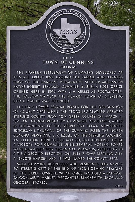
Town of Cummins
Site of
| — | (100 yds. SW) | — |
Photographed by Larry D. Moore, October 19, 2018
1. Town of Cummins Marker
The two towns became rivals for the designation of county seat when the Texas Legislature created Sterling County from Tom Green County on March 4, 1891. An intense publicity campaign developed, aided by the writings of the respective town newspaper editors: W. L. Thurman of the Cummins paper, the "North Concho News," and S. R. Ezzell of the "Sterling Courier". An election, conducted May 20, 1891, appeared to be a victory for Cummins until several voting boxes were dismissed for technical reasons, resulting in a tie. A second election on July 7 gave Sterling City a 13-vote margin and it was named the county seat.
Most Cummins businesses and residents had moved to Sterling City by the end of 1891. Nothing remains of the early townsite, which once included a school, saloon, meat market, mercantile, blacksmith shop, and grocery stores.
Erected 1981 by Texas Historical Commission. (Marker Number 5525.)
Topics. This historical marker is listed in this topic list: Settlements & Settlers. A significant historical date for this entry is March 4, 1891.
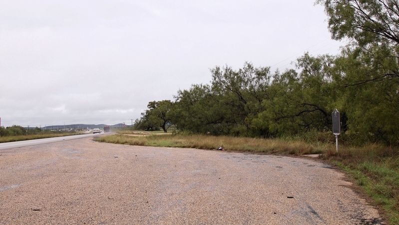
Location. 31° 50.446′ N, 101° 1.144′ W. Marker is near Sterling City, Texas, in Sterling County. It is at the intersection of U.S. 87 and Hunt Rd, on the right when traveling south on U.S. 87. Touch for map. Marker is in this post office area: Sterling City TX 76951, United States of America. Touch for directions.

Regionally, this marker is in Big Country. Globally, it is in North America, a Gulf of Mexico state, the Western Hemisphere,
this page online
Other nearby markers. At least 8 other markers are within 6 miles of this marker, measured as the crow flies: State Hotel – First State Bank (approx. 1.8 miles away); Sterling County Jail (approx. 1.8 miles away); Sterling County (approx. 1.9 miles away); Concho, San Saba & Llano Valley Railroad Station (approx. 2 miles away); Foster Cemetery (approx. 4.8 miles away); Montvale (approx. 5.1 miles away); Robert West Foster (approx. 5.3 miles away); William Lenard Foster (approx. 5.3 miles away). Touch for a list and map of all markers in Sterling City.
Photographed by Larry D. Moore, October 19, 2018
2. Town of Cummins Marker Area
Credits. This page was last revised on October 21, 2018. It was originally submitted on October 21, 2018, by Larry D. Moore of Del Valle, Texas. This page has been viewed 2,870 times since then and 212 times this year. Photos: 1, 2. submitted on October 21, 2018, by Larry D. Moore of Del Valle, Texas. • Andrew Ruppenstein was the editor who published this page.
