Hexham in Northumberland, England, United Kingdom — Northwestern Europe (the British Isles)
The Fort and its Design
The Fort and its Design
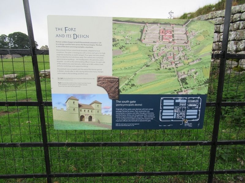
Roman soldiers began to build Housesteads around AD 124 to a design used for forts across the Roman Empire. This fort is one of the best surviving examples, anywhere.
Housesteads follows a text-book template, adapted to local conditions. The plan is rectangular, with a stone wall up to 5m high originally backed by an earth rampart. Four gates led onto streets that divided the fort into three areas. The central area contained administrative buildings - the headquarters, the granaries and a hospital - as well as the commanding officer's house. On each side of the central area were barracks, where up to 800 soldiers lived, and also workshops and support buildings.
Housesteads was occupied until the end of the Roman period in Britain, shortly after AD 400, during which time many changes were made to the buildings and their uses.
The south gate
(porta principalis dextra)
Originally, all four gates were identical, with twin arched passages flanked by towers. Their construction was monumental, to impress and reflect the glory of the army and the Empire. Niches over the gateways often contained statues of gods associated with the army – Mars and Victory – or an inscribed stone tablet recording the emperor and important officials who had built or restored the gate. ( photo captions )
Far right: Housesteads fort as it may have looked around AD 200. Reconstruction by Peter Urmston
Right: Several decorated window heads have been found at Housesteads, including this incomplete example. These may have adorned the gateways.
Left: The south gate as it may have appeared when first built shortly after AD 124.
Topics. This historical marker is listed in these topic lists: Forts and Castles • Settlements & Settlers.
Location. 55° 0.773′ N, 2° 19.777′ W. Marker is in Hexham, England, in Northumberland. Marker can be reached from England Route B6319, 4.7 kilometers west of North Road, on the right when traveling west. Located at Housesteads Roman Fort. Touch for map. Marker is in this post office area: Hexham, England NE47 6NW, United Kingdom. Touch for directions.
Other nearby markers. At least 8 other markers are within walking distance of this marker. 16th Century Bastle House (here, next to this marker); The Vicus (within shouting distance of this marker); Mediterranean Style in Northern Climes (within shouting distance of this marker); The Comanding Officer and his House (within shouting distance of this marker); The Heart of the Fort (within shouting distance of this marker); A Changing Fort (within shouting distance of this marker); Where the Soldiers Lived (about 90 meters away, measured in a direct line); Barracks: the Last Hundred Years at Housesteads (about 90 meters away). Touch for a list and map of all markers in Hexham.
Also see . . .
1. English Heritage - Housesteads Roman Fort. (Submitted on November 16, 2018, by Michael Herrick of Southbury, Connecticut.)
2. Housesteads Roman Fort on Wikipedia. (Submitted on November 16, 2018, by Michael Herrick of Southbury, Connecticut.)
Credits. This page was last revised on January 27, 2022. It was originally submitted on November 16, 2018, by Michael Herrick of Southbury, Connecticut. This page has been viewed 71 times since then and 8 times this year. Photos: 1, 2. submitted on November 16, 2018, by Michael Herrick of Southbury, Connecticut.

