Newcastle upon Tyne in Tyne and Wear, England, United Kingdom — Northwestern Europe (the British Isles)
Castle Keep & Castle Garth
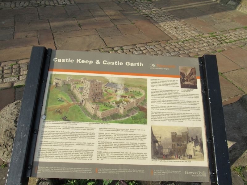
Castle Keep & Castle Garth
The area surrounding you is a naturally defensible site with steeps sides overlooking and running down to the River Tyne and has been occupied for nearly 2000 years.
From the mid second century the Roman fort of Pons Aelius stood here guarding the river crossing below until the beginning of the fifth century when Roman rule collapsed. The name Pons Aelius refers to the Roman name for bridge (pons) and the Emperor Hadrian whose family name was Aelius. Parts of Hadrian's Wall are still visible today from Wallsend in the east to Carlisle on the west coast.
From the late seventh century until the construction of the Castle in 1080, the site was used as an extensive Saxon cemetery. Even after the Castle had been built, burials continued within the area enclosed by its defences.
The ‘New Castle’, which gave the town its name, is now a Scheduled Ancient Monument and Grade I Listed Building. It was founded in 1080 by the eldest son of William the Conqueror, Robert Curthose, and built using earth and timber. There is evidence to argue that the Castle could have been of either motte and bailey or ringwork design. A motte and bailey castle consists of a mound on which a timber keep would stand, commonly known as the motte, and the land around and in front of it known as the bailey, which was defended by a protective fence. A ringwork castle had no mound, but had an enclosing bank, with a ditch outside it.
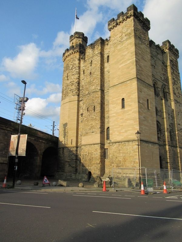
Between 1168 and 1178 the castle was rebuilt in stone by Maurice the Engineer at a cost of just over £1,144, equivalent now to well over £600,000. Building work was interrupted in 1173 when the castle was besieged by the Scots and again in 1174. This rebuilding produced the Keep that we can see today.
The Castle's keep had two main functions - it was the principal strongpoint of the Castle and the living space for the commander of the garrison. It displays many important features, including the late Norman chapel, and the well, which is nearly 100 feet deep, allowing fresh water to be provided to the Castle, even during a siege.
Notable additions to the castle were made in the 13th century during the reign of King John (1207 – 1216) including the Great Hall which was built within the garth, the area enclosed by the castle walls. The last improvement to the defences was the addition of a barbican, now known as the Black Gate, between 1247 and 1250.
By the early 14th century the town and Castle were enclosed by the completion of the Town Wall, a fortified wall with six main gates, two postern gates, 19 towers and later medieval turrets, therefore reducing the Castle's role to little more than a Royal supply base.
In 1400 Newcastle became a county in its own right but the Castle Garth remained part of the County of Northumberland. The Keep became a prison for the county. The 13th century Great Hall, known as the Moot Hall (on the current site of the Vermont Hotel and the courtyard of the present Moot Hall), was used by the assizes courts (courts which sat at regular intervals in each county of England and Wales).
In 1619 the Castle, with the exception of The Keep, Moot Hall and gaoler's house, was leased by James I to Alexander Stephenson, one of the King's courtiers. Stephenson allowed houses to be built, which doubled as workplaces, within the Castle walls.
When civil war broke out in 1642 the Castle was briefly refortified and became the last stronghold of the town's Royalist defenders before it fell to a lowland Scottish Covenanter army, that was allied to the Parliamentarians, on 19th October 1644.
After the Civil War, houses were rebuilt and new ones were added until, by the end of the 18th century, the medieval Castle was almost completely concealed by dwellings. Clearance began in 1810, with construction of the new Moot Hall (to replace the medieval Moot Hall as the County Court) and was almost complete in 1847 when the first railway viaduct was built across the Castle Garth making it difficult to see the Keep and Black Gate as part of a single defensive structure.
Before there was a castle here there was a Roman fort that guarded the river crossing and is part of Hadrian's Wall. Soldiers from all over the Roman Empire would have come to Britain to guard Hadrian's Wall which stretches all the way from the east coast to the west coast.
After the Romans left there was a Saxon cemetery. Even after the castle was built on top of it people were still buried within its grounds. It is most likely they were important people like knights.
In medieval times the Castle Keep was turned into a prison. What do you think it was like to be put in prison here?
( photo captions )
- Reconstruction of the Castle Keep and Castle Garth as it was believed to be around 1250, after completion of the Black Gate. Courtesy of the Society of Antiquaries of Newcastle upon Tyne.
- Castle Garth, Black Gate and St. Nicholas Cathedral from Dog Leap Stairs, 1894.
- The Castle Keep from the old County Court (now the Moot Hall), 1834.
Topics. This historical marker is listed in this topic list: Forts and Castles. A significant historical date for this entry is October 19, 1644.
Location. 54° 58.125′ N, 1° 36.638′ W. Marker is in Newcastle upon Tyne, England, in Tyne and Wear. Marker is at the intersection of St Nicholas Street and Castle Garth, on the right when traveling north on St Nicholas Street. Located at Newcastle Castle. Touch for map. Marker is in this post office area: Newcastle upon Tyne, England NE1 1RQ, United Kingdom. Touch for directions.
Other nearby markers. At least 8 other markers are within walking distance of this marker. Anglo-Saxon Church (within shouting distance of this marker); The Heron Pit (within shouting distance of this marker); The Black Gate (within shouting distance of this marker); William Heron (within shouting distance of this marker); The Barbican (within shouting distance of this marker); a different marker also named The Black Gate (within shouting distance of this marker); Turning Bridge (within shouting distance of this marker); Medieval Castle (within shouting distance of this marker). Touch for a list and map of all markers in Newcastle upon Tyne.
Also see . . . Newcastle Castle. (Submitted on November 28, 2018, by Michael Herrick of Southbury, Connecticut.)
Credits. This page was last revised on January 27, 2022. It was originally submitted on November 28, 2018, by Michael Herrick of Southbury, Connecticut. This page has been viewed 355 times since then and 44 times this year. Photos: 1, 2. submitted on November 28, 2018, by Michael Herrick of Southbury, Connecticut.

