Downtown in Trenton in Mercer County, New Jersey — The American Northeast (Mid-Atlantic)
The Second Battle of Trenton
History
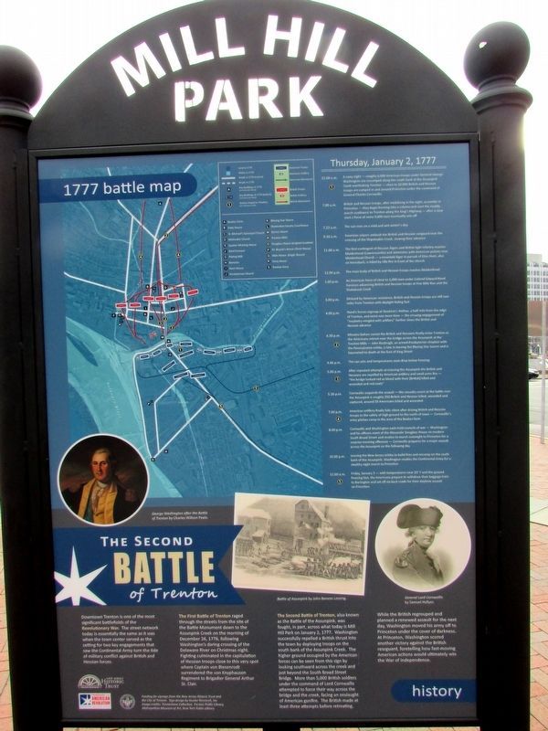
Downtown Trenton is one of the most significant battlefields of the Revolutionary War. The street network today is essentially the same as it was when the town center served as the setting for two key engagements that saw the Continental Army turn the tide of military conflict against British and Hessian forces.
The First Battle of Trenton raged through the streets from the site of the Battle Monument down to the Assunpink Creek on the morning of December 26, 1776, following Washington’s daring crossing of the Delaware River on Christmas night. Fighting culminated in the capitulation of Hessian troops close to this very spot where Captain von Biesenrodt surrendered the von Knyphausen Regiment to Brigadier General Arthur St. Clair.
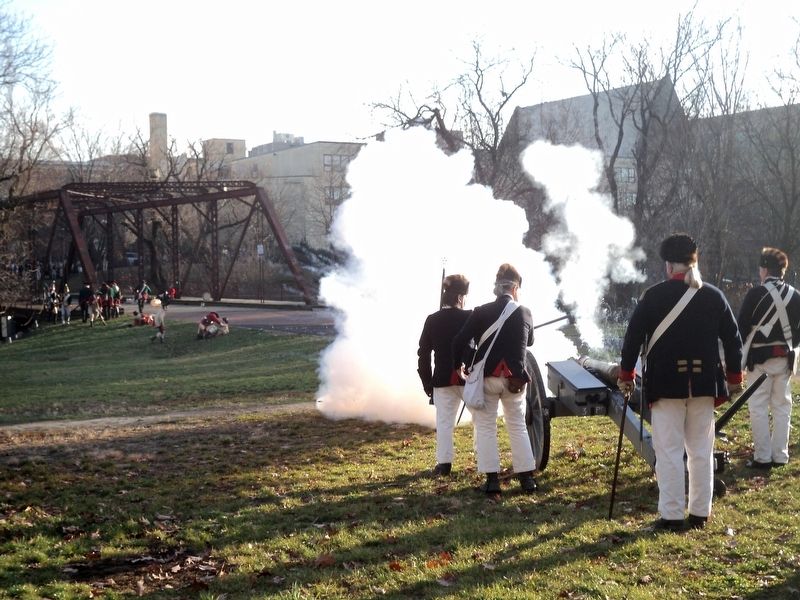
The Second Battle of Trenton, also known as the Battle of the Assunpink, was fought, in part, across what today is Mill Hill Park on January 2, 1777. Washington successfully repelled a British thrust into the town by deploying troops on the south bank of the Assunpink Creek. The higher ground occupied by the American forces can be seen from this sign by looking southward across the creek and just beyond South Broad Street Bridge. More than 5,000 British soldiers under the command of Lord Cornwallis attempted to force their way across the bridge and the creek, facing an onslaught of American gunfire. The British made at least three attempts before retreating.
While the British regrouped and planned a renewed assault for the next day, Washington moved his army off to Princeton under the cover of darkness. At Princeton, Washington scored another victory against the British rearguard, foretelling how fast-moving American actions would ultimately win the War of Independence.
Thursday, January 2, 1777
1)
12:00 a.m. A rainy night – roughly 6,000 American troops under General George Washington are encamped along the south bank of the Assunpink Creek overlooking Trenton – close to 10,000 British and Hessian troops are camped in and around Princeton under the command of General Charles Cornwallis.
7:00 a.m. British and Hessian troops, after mobilizing in the night, assemble in Princeton – they begin forming into a column and start the muddy march southwest to Trenton along the King’s Highway – after a slow start a force of some 9,000 men eventually sets off.
7:22 a.m. The sun rises on a mild and wet winter’s day.
9:30 a.m. American snipers ambush the British and Hessian vanguard near the crossing of the Shipetaukin Creek, slowing their advance.
11:00 a.m. The first contingent of Hessian Jägers and British light infantry reaches Maidenhead (Lawrenceville) and skirmishes with American pickets near Maidenhead Church – a mounted Jäger in pursuit of Elias Hunt, also on horseback, is killed by rifle fire in front of the church.
12:00 p.m. The main body of British and Hessian troops reached Maidenhead.
1:00 p.m. An American force of close to 1,000 men under Colonel Edward Hand harasses advancing British and Hessian troops at Five Mile Run and the Shabakunk Creek.
3:00 p.m. Delayed by American resistance, British and Hessian troops are still two miles from Trenton with daylight fading fast.
4:00 p.m. Hand’s forces regroup at Stockton’s Hollow, a half mile from the edge of Trenton, and resist one more time – the ensuing engagement of “musketry mingled with artillery” further slows the British and Hessian advance.
2)
4:30 p.m. Minutes before sunset the British and Hessians finally enter Trenton as the Americans retreat over the bridge across the Assunpink at the Trenton Mills – John Rosbrugh, an armed Presbyterian chaplain with the Pennsylvania militia, is late in leaving the Blazing Star tavern and is bayoneted to death at the foot of King Street.
4:46 p.m. The sun sets and temperatures drop below freezing.
3)
5:00 p.m. After repeated attempts at crossing the Assunpink the British and Hessians are repelled by American artillery and small arms fire – “the bridge looked red as blood with their [British] killed and wounded and red coats.”
5:30 p.m. Cornwallis suspends the assault – the casualty at the battle over the Assunpink is roughly 350 British and Hessian killed, wounded and captured, around 50 Americans killed or wounded.
4)
7:00 p.m. American artillery finally falls silent after driving British and Hessian troops to the safety of high ground to the north of town – Cornwallis’s army pitches camp in the area of the Beakes farm.
8:00 p.m. Cornwallis and Washington each hold councils of war – Washington and his officers meet at the Alexander Douglass House on modern South Broad Street and resolve to march overnight to Princeton for a surprise morning offensive – Cornwallis prepares for a major assault across the Assunpink on the following day.
10:00 p.m. Leaving New Jersey militia to build fires and encamp on the south bank of the Assunpink, Washington readies the Continental Army for a stealthy night march to Princeton.
5)
12:00 a.m. Friday, January 3 – with temperatures near 20° F and the ground freezing fast, the Americans prepare to withdraw their baggage train to Burlington and set off via back roads for their daytime assault on Princeton.
Erected 2018.
Topics. This historical
marker is listed in this topic list: War, US Revolutionary. A significant historical date for this entry is January 2, 1777.
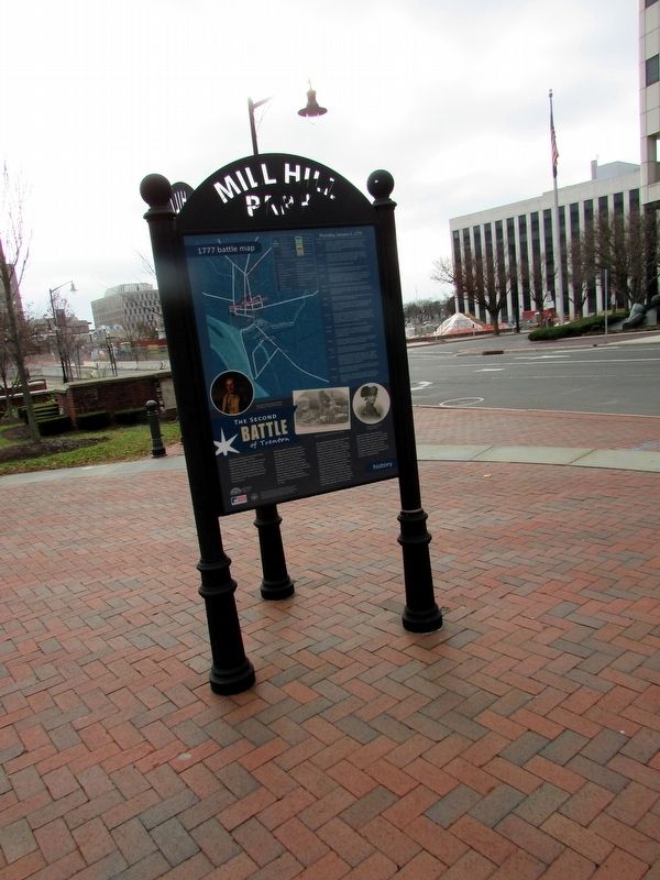
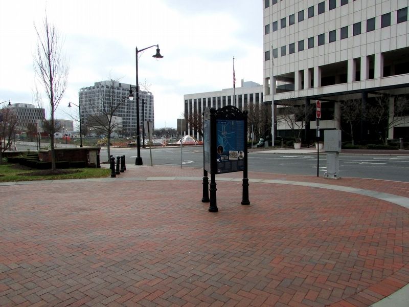
Location. 40° 13.129′ N, 74° 45.84′ W. Marker is in Trenton, New Jersey, in Mercer County. It is in Downtown. Marker is at the intersection of S Broad Street and E Front Street, on the right when traveling north on S Broad Street. The marker is at Mill Hill Park. Touch for map. Marker is in this post office area: Trenton NJ 08608, United States of America. Touch for directions.
Other nearby markers. At least 8 other markers are within walking distance of this marker. Mill Hill Park (here, next to this marker); Historic Downtown Trenton (here, next to this marker); Revolutionary War Patriots (a few steps from this marker); Washington’s Triumphal Arch (within shouting distance of this marker); Assunpink Creek (within shouting distance of this marker); a different marker also named Assunpink Creek (within shouting distance of this marker); a different marker also named Assunpink Creek (within shouting distance of this marker); a different marker also named Assunpink Creek (within shouting distance of this marker). Touch for a list and map of all markers in Trenton.
More about this marker. A 1777 battle map at the upper left of the marker shows troop movements and various landmarks of the Second Battle of Trenton.
A portion of the painting “George Washington after the Battle of Trenton” by Charles Willson Peale, a drawing of the “Battle of Assunpink” by John Benson Lossing, and an image of “General Lord Cornwallis by Samuel Hollyer” appear at the bottom of the marker.
Credits. This page was last revised on February 16, 2023. It was originally submitted on December 3, 2018, by Bill Coughlin of Woodland Park, New Jersey. This page has been viewed 653 times since then and 63 times this year. Last updated on January 3, 2022, by Carl Gordon Moore Jr. of North East, Maryland. Photos: 1, 2, 3, 4. submitted on December 3, 2018, by Bill Coughlin of Woodland Park, New Jersey. • Michael Herrick was the editor who published this page.


