Near Grantsville in Tooele County, Utah — The American Mountains (Southwest)
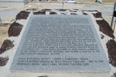
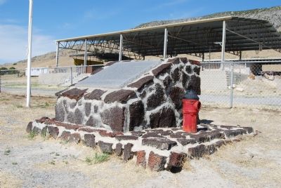
This Lonely Fire Hydrant
The public square consisted of 169 acres, with four center streets 132 ft. wide. On four sides of the town park a row of trees were planted in the center of each street. All the other streets were 66 ft. wide and the blocks were divided into 4 lots each containing ¾ acres. All the streets had Hawaiian names. The original purchase consisted of 1,920 acres, of which 200 were under cultivation, the next two years accumulated to 5,273 acres. The water came from five streams, collected in an open ditch, put into a concrete conduit that furnished culinary water to each home. A fire hydrant and irrigation ditch went with each lot. The cemetery, about ½ acre is located a mile northeast of the settlement. Iosepa won the State prize in 1911 for the best kept town and the most progressive city in the State of Utah. Only the Hoopiiana family and J. Palikapeg Nawahine remained in Utah, the rest returned home to Hawaii to settle and help built the Laie Temple (1917–1919). Iosepa returned to dust, leaving a heritage of the faithful Polynesian Pioneers and closed the chapter in the great western American History.
Erected 1989 by Iosepa Historical Society, Edwin L. Kamaiioila ’Ohana. Plaque & marker donated by Rex & Phyllis Grosland, Hoopiiaina Ohana, Malu Cuma Wilford, Clifford Cory.
Topics. This historical marker is listed in this topic list: Settlements & Settlers. A significant historical year for this entry is 1889.
Location. 40° 32.322′ N, 112° 44.862′ W. Marker is near Grantsville, Utah, in Tooele County. Marker is on Utah Route 196 at milepost 23,, 15 miles south of Interstate 80, on the left when traveling south. Touch for map. Marker is in this post office area: Dugway UT 84022, United States of America. Touch for directions.
Other nearby markers. At least 2 other markers are within walking distance of this marker. Iosepa Settlement Cemetery (within shouting distance of this marker); Iosepa Historical Memorial (within shouting distance of this marker).
Credits. This page was last revised on June 16, 2016. It was originally submitted on June 24, 2007, by Dawn Bowen of Fredericksburg, Virginia. This page has been viewed 2,468 times since then and 40 times this year. It was the Marker of the Week November 11, 2012. Photos: 1, 2. submitted on June 24, 2007, by Dawn Bowen of Fredericksburg, Virginia. • J. J. Prats was the editor who published this page.

