Clarkston in Oakland County, Michigan — The American Midwest (Great Lakes)
Becoming Clarkston
It Started with the Mill
The brothers came from New York State.
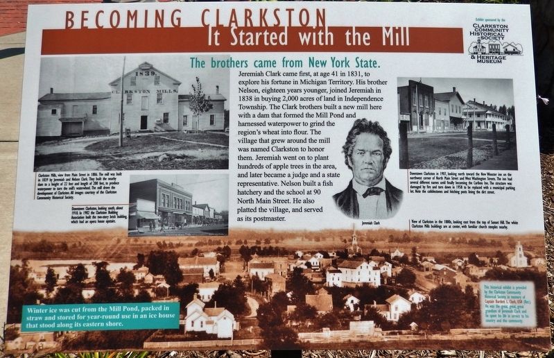
Jeremiah Clark came first, at age 41 in 1831, to explore his fortune in Michigan Territory. His brother Nelson, eighteen years younger, joined Jeremiah in 1838 in buying 2,000 acres of land in Independence Township. The Clark brothers built a new mill here with a dam that formed the Mill Pond and harnessed waterpower to grind the region’s wheat into flour. The village that grew around the mill was named Clarkston to honor them. Jeremiah went on to plant hundreds of apple trees in the area, and later became a judge and a state representative. Nelson built a fish hatchery and the school at 90 North Main Street. He also platted the village, and served as its postmaster.
captions for background photograph at bottom of marker:
• View of Clarkston in the 1880s, looking east from the top of Sunset Hill. The white Clarkston Mills buildings are at center, with familiar church steeples nearby.
• Winter ice was cut from the Mill Pond, packed in straw and stored for year-round use in an ice house that stood along its eastern shore.
This historical exhibit is provided by the Clarkston Community Historical Society in memory of Captain Bartlett L. Clark, USN (Ret.), grandson of Jeremiah Clark and he spent his life in service to his country and this community
Erected by Clarkston Community Historical Society & Heritage Museum.
Topics. This historical marker is listed in these topic lists: Industry & Commerce • Settlements & Settlers.
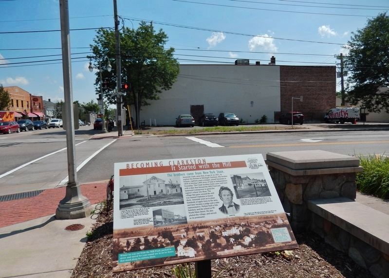
Location. 42° 44.163′ N, 83° 25.159′ W. Marker is in Clarkston, Michigan, in Oakland County. Marker is at the intersection of North Main Street (State Highway 15) and West Washington Street, on the right when traveling south on North Main Street. Marker is located along the sidewalk, at the northwest corner of the intersection. Touch for map. Marker is in this post office area: Clarkston MI 48346, United States of America. Touch for directions.
Other nearby markers. At least 8 other markers are within 6 miles of this marker, measured as the crow flies. The Nelson Clark Home (about 800 feet away, measured in a direct line); Building Clarkston History (approx. 0.2 miles away); Getting Here (approx. 0.9 miles away); Sashabaw Cemetery (approx. 3.1 miles away); Sashabaw United Presbyterian Church (approx. 3.1 miles away); Seymour Lake Methodist Episcopal Church (approx. 5˝ miles away); Howarth School (approx. 5.9 miles away); Kelley-Fisk Farm (approx. 6 miles away). Touch for a list and map of all markers in Clarkston.
More about this marker. Marker is a large rectangular composite interpretive panel, mounted horizontally on a waist-high
Courtesy of the Clarkston Community Historical Society
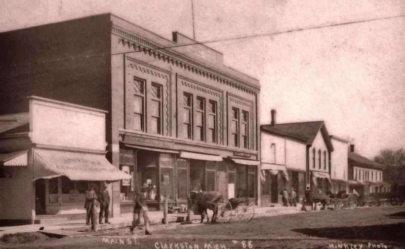
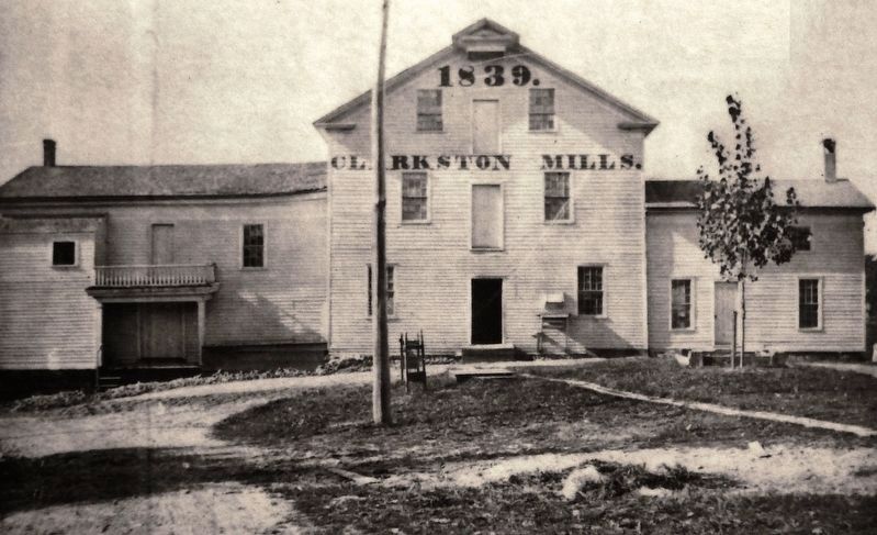
2. Marker detail: Clarkston Mills, view from Main Street in 1886
The mill was built in 1839 by Jeremiah and Nelson Clark. They built the nearby dam to a height of 22 feet and length of 200 feet, to produce waterpower to turn the mill's waterwheel. The mill drove the development of Clarkston.
Related markers. Click here for a list of markers that are related to this marker. Clarkston Village Historic District
Also see . . . A Brief History of Clarkston. City website entry (Submitted on March 30, 2023, by Larry Gertner of New York, New York.)
Courtesy of the Clarkston Community Historical Society
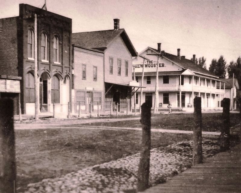
4. Marker detail: Downtwn Clarkston in 1901
Downtown Clarkston in 1901, looking north toward the New Wooster inn on the northwest corner of North Main Street and West Washington Streets. The inn had several different names until finally becoming the Caribou Inn. The structure was damaged by fire and torn down in 1958 to be replaced with a municipal parking lot Note the cobblestones and hitching posts lining the dirt street.
Credits. This page was last revised on March 30, 2023. It was originally submitted on January 4, 2019, by Cosmos Mariner of Cape Canaveral, Florida. This page has been viewed 796 times since then and 105 times this year. Photos: 1, 2, 3, 4, 5, 6. submitted on January 4, 2019, by Cosmos Mariner of Cape Canaveral, Florida. • Bill Pfingsten was the editor who published this page.
