Dover in Kent, England, United Kingdom — Northwestern Europe (the British Isles)
The Signal Platform
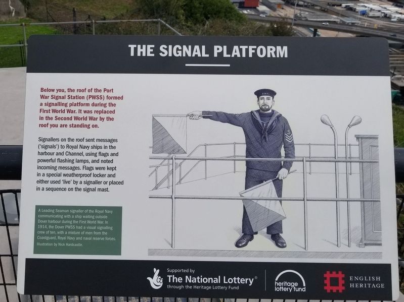
Signallers on the roof sent messages ('signals') to Royal Navy ships in the harbour and Channel, using flags and powerful flashing lamps, and noted incoming messages. Flags were kept in a special weatherproof locker and either used 'live' by a signaller or placed in a sequence on the signal mast.
( photo caption )
- A Leading Seaman signaller of the Royal Navy communicating with a ship waiting outside Dover harbour during the First World War. In 1914, the Dover PWSS had a visual signalling crew of ten, with a mixture of men from the Coastguard, Royal Navy and naval reserve forces.
Topics. This historical marker is listed in these topic lists: War, World I • War, World II. A significant historical year for this entry is 1914.
Location. 51° 7.602′ N, 1° 19.505′ E. Marker is in Dover, England, in Kent. Marker can be reached from the intersection of Castle Hill Road and Canons Gate Road, on the left when traveling south. Located at the Hospital Battery at the cliff’s edge next to Dover Castle. Touch for map. Marker is in this post office area: Dover, England CT16 1HU, United Kingdom. Touch for directions.
Other nearby markers. At least 8 other markers are within walking distance of this marker. A View to the East (here, next to this marker); A View of the Harbour (here, next to this marker); A View to the West (a few steps from this marker); Finding the Enemy (a few steps from this marker); Command, Control and Communication (within shouting distance of this marker); Fighting the Enemy in the Sky (within shouting distance of this marker); Operation Dynamo (within shouting distance of this marker); Ramsay: retreat and return (within shouting distance of this marker). Touch for a list and map of all markers in Dover.
Also see . . .
1. English Heritage - Dover Castle. (Submitted on January 11, 2019, by Michael Herrick of Southbury, Connecticut.)
2. Dover Castle on Wikipedia. (Submitted on January 11, 2019, by Michael Herrick of Southbury, Connecticut.)
Credits. This page was last revised on January 27, 2022. It was originally submitted on January 11, 2019, by Michael Herrick of Southbury, Connecticut. This page has been viewed 157 times since then and 14 times this year. Photos: 1, 2. submitted on January 11, 2019, by Michael Herrick of Southbury, Connecticut.

