Eagle Bridge in Washington County, New York — The American Northeast (Mid-Atlantic)
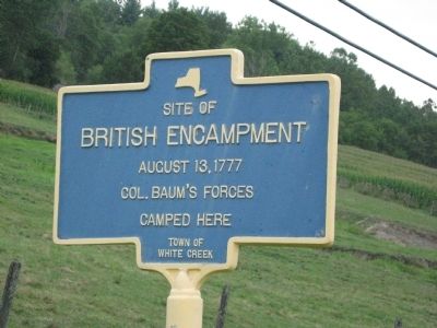
Site of British Encampment
August 13, 1777
Col. Baum's forces camped here
Erected by Town of White Creek.
Topics. This historical marker is listed in this topic list: War, US Revolutionary. A significant historical year for this entry is 1777.
Location. 42° 57.646′ N, 73° 22.531′ W. Marker is in Eagle Bridge, New York, in Washington County. Marker is on New York State Route 22, 0.2 miles North Old State Road, on the left when traveling north. Touch for map. Marker is in this post office area: Eagle Bridge NY 12057, United States of America. Touch for directions.
Other nearby markers. At least 8 other markers are within 3 miles of this marker, measured as the crow flies. Site of Skirmish (approx. 0.7 miles away); Homestead of Grandma Moses (approx. 0.9 miles away); Eagle Bridge Buskirk Veterans Memorial (approx. 1.3 miles away); St. Croix Church (approx. 2.2 miles away); Checkered House (approx. 2.3 miles away); Battle of Bennington (approx. 2˝ miles away); Lakes to Locks Passage (approx. 2.8 miles away); A Log Church (approx. 2.9 miles away). Touch for a list and map of all markers in Eagle Bridge.
Additional keywords. Burgoyne's campaign 1777
Credits. This page was last revised on February 3, 2019. It was originally submitted on August 15, 2012, by Tom McGreevy of Averill Park, New York. This page has been viewed 595 times since then and 32 times this year. Last updated on February 1, 2019, by Steve Stoessel of Niskayuna, New York. Photo 1. submitted on August 15, 2012, by Tom McGreevy of Averill Park, New York. • Andrew Ruppenstein was the editor who published this page.
